Area Overview for B79 7WA
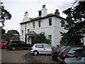
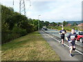
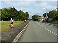
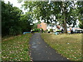
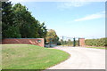
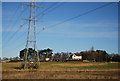
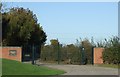
Photos of B79 7WA

Area Information
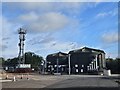
Living in B79 7WA means being part of a small, tightly knit residential cluster within Tamworth Borough, Staffordshire. With a population of 1,187, the area is compact yet historically rich, situated in a region once central to the Anglo-Saxon Kingdom of Mercia. The rivers Tame and Anker define its geography, while its modern status as a Staffordshire borough reflects centuries of settlement and industrial legacy, including the former Reliant Motor Company site. Daily life here balances historical roots with practical modernity. The area’s proximity to Tamworth, a town with royal Mercian heritage, offers a blend of heritage sites and contemporary amenities. Residents benefit from a low population density, which means a quieter, more intimate community feel. While the area is small, it is well-connected to nearby transport networks, making it accessible for commuters. For those seeking a place with a distinct character, B79 7WA combines rural tranquillity with the convenience of nearby urban services. Its compact size ensures that essential amenities are within walking or short driving distance, fostering a sense of self-contained living.
- Area Type
- Postcode
- Area Size
- Not available
- Population
- 1187
- Population Density
- 1395 people/km²
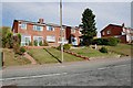
The property market in B79 7WA is dominated by owner-occupied homes, with 87% of residents living in properties they own. This high rate of home ownership suggests a community focused on long-term investment rather than rental turnover. The accommodation type is exclusively houses, which is uncommon in more densely populated areas but typical of smaller, suburban or rural clusters. This housing stock likely includes a mix of detached and semi-detached properties, offering spacious living environments. For buyers, this means the area is not a rental hotspot but a place where properties are likely to be held for years. The small size of the postcode area means that the housing market is limited in scope, and buyers should consider nearby towns like Tamworth for broader options. The emphasis on owner-occupation may also indicate strong local ties, with residents less likely to move frequently.
House Prices in B79 7WA
No properties found in this postcode.
Energy Efficiency in B79 7WA
The lifestyle in B79 7WA is shaped by its proximity to essential amenities within practical reach. The area has five retail outlets, including Co-op Leyfields and Spar, providing daily shopping convenience. The Victoria Road Bus Interchange serves as a hub for local transport, linking residents to nearby services and employment centres. Nearby railway stations, such as Tamworth High Level and Lichfield Trent Valley, offer connections to major cities like Birmingham and Manchester, making commuting feasible. While the area’s small size means fewer large-scale leisure facilities, its integration with Tamworth ensures access to cultural and recreational opportunities. The presence of multiple retail and transport options supports a self-sufficient lifestyle, with minimal need to travel far for essentials. This balance of convenience and connectivity makes daily life in B79 7WA practical and efficient.
Amenities
Schools
| Rank | School | Type | Entry gender | Ages |
|---|
Explore more schools in this area
Go to Schools tabDemographics
The community in B79 7WA is predominantly composed of adults aged 30–64, with a median age of 47. This suggests a mature, stable population, likely with established careers and families. Home ownership is high at 87%, indicating a strong preference for long-term residency over rental properties. The area is characterised by houses rather than flats, reflecting a suburban or semi-rural housing stock. The predominant ethnic group is White, which aligns with broader demographic trends in the region. While no specific data on deprivation is provided, the high home ownership rate and age profile imply a relatively affluent and settled community. The absence of significant diversity data means the area’s social composition is largely homogeneous. For buyers, this profile suggests a neighbourhood where property values may be resilient, and the demographic stability could contribute to a consistent local economy.
Household Size
Accommodation Type
Tenure
Ethnic Group
Religion
Household Composition
Age
Household Deprivation
NS-SEC
Explore more demographic insights in this area
Go to Demographics tabPlanning
Planning Constraints
- Flood RiskPremium
- Ramsar Wetland SitesPremium
- Area of Outstanding Natural BeautyPremium
- Protected Nature ReservePremium
- Protected WoodlandPremium