Area Overview for B79 7US
Photos of B79 7US
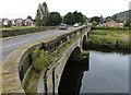
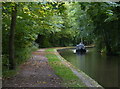
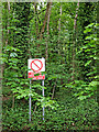
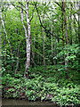


30 photos from this area
Area Information
Key information about the B79 7US including its size, population, and administrative classification.
- Area Type
- Postcode
- Area Size
- 2.2 hectares
- Population
- 1187
- Population Density
- 1395 people/km²
House Prices in B79 7US
27
Properties
£248,016
Average Sold Price
£108,000
Lowest Price
£450,000
Highest Price
Showing 27 properties
| Address | Type | Beds | Baths | Last Sale Price | Last Sale Date | |
|---|---|---|---|---|---|---|
| 24 Longleat, Tamworth, B79 7US | Detached | 4 | 2 | £447,500 | Nov 2023 | |
| 6 Longleat, Tamworth, B79 7US | Detached | 4 | 3 | £450,000 | Sep 2021 | |
| 26 Longleat, Tamworth, B79 7US | Detached | 4 | 1 | £359,000 | Jul 2020 | |
| 9 Longleat, Tamworth, B79 7US | Detached | 4 | - | £290,000 | Mar 2017 | |
| 23 Longleat, Tamworth, B79 7US | Bungalow | 3 | - | £232,000 | Mar 2013 | |
| 27 Longleat, Tamworth, B79 7US | Detached | 4 | - | £217,500 | Aug 2012 | |
| 16 Longleat, Tamworth, B79 7US | house | - | - | £270,000 | Jun 2010 | |
| 15 Longleat, Tamworth, B79 7US | Detached | - | - | £230,000 | Jun 2009 | |
| 20 Longleat, Tamworth, B79 7US | Detached | - | - | £240,000 | Mar 2009 | |
| 10 Longleat, Tamworth, B79 7US | Detached | 4 | - | £236,000 | Mar 2008 |
Page 1 of 3
Energy Efficiency in B79 7US
Amenities
Schools
| Rank | School | Type | Entry gender | Ages |
|---|
Explore more schools in this area
Go to Schools tabDemographics
Household Size
Two person
most common
Accommodation Type
Houses
most common
Tenure
87
majority
Ethnic Group
White
most common
Religion
N/A
most common
Household Composition
N/A
most common
Age
47
median
Adults (30-64 years)
most common
Household Deprivation
N/A
with no deprivation
NS-SEC
33
in Lower managerial occupations
Explore more demographic insights in this area
Go to Demographics tabPlanning
Planning Constraints
- Flood RiskPremium
- Ramsar Wetland SitesPremium
- Area of Outstanding Natural BeautyPremium
- Protected Nature ReservePremium
- Protected WoodlandPremium