Area Overview for B79 7RN
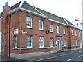
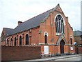
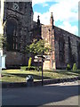
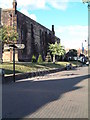
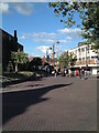
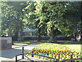
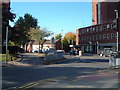
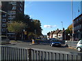
Photos of B79 7RN


Area Information
Living in B79 7RN means being part of a small, tightly knit residential cluster within the Borough of Tamworth, Staffordshire. With a population of 2,159, this area is characterised by its compact size and proximity to historical landmarks, such as a Grade II listed milestone near the postcode boundary. The community here is predominantly composed of adults aged 30–64, with a median age of 47, suggesting a mature, stable demographic. Daily life is shaped by the mix of owner-occupied and rental properties, with 55% of homes owned by residents. The area’s small footprint means amenities and services are within practical reach, while its location in the West Midlands offers access to regional transport networks. Families and professionals alike benefit from the balance of quiet residential living and nearby urban connectivity. The presence of primary and sixth-form schools, combined with good broadband and rail links, makes this postcode an appealing choice for those seeking a blend of convenience and tradition.
- Area Type
- Postcode
- Area Size
- Not available
- Population
- 2159
- Population Density
- 3797 people/km²
The property market in B79 7RN is dominated by houses, with 55% of homes owned by residents. This suggests a predominantly owner-occupied area, though the small population size means the market is limited in scale. The presence of houses rather than flats or apartments indicates a focus on family-friendly or long-term residential properties. For buyers, this means the housing stock is likely to be older, with potential for character features or historical significance, given the nearby Grade II listed milestone. However, the small area size means opportunities for new developments or property choices are constrained. Those considering the area should evaluate the practicality of proximity to transport links, such as nearby rail stations, and the availability of local amenities. The mix of home ownership and rental properties also implies a moderate level of turnover, which could affect property values and investment potential.
House Prices in B79 7RN
No properties found in this postcode.
Energy Efficiency in B79 7RN
The lifestyle in B79 7RN is supported by a range of nearby amenities, including five retail outlets such as Tamworth Co-operative Society, Spar, and Farmfoods Leyfields. These shops provide access to essential goods, groceries, and services within walking distance. The area’s proximity to Victoria Road Bus Interchange and multiple railway stations ensures easy travel to surrounding regions, whether for work, leisure, or shopping. While specific details on parks or leisure facilities are not provided, the small residential cluster suggests a focus on community-centric living, where local services and transport links form the backbone of daily life. The presence of schools, shops, and transport options creates a self-contained environment, ideal for those prioritising convenience and accessibility over expansive recreational spaces.
Amenities
Schools
Residents of B79 7RN have access to a range of educational institutions, including primary and sixth-form colleges. Moorgate Community Primary School and Marmion Junior School cater to younger children, while Tamworth and Lichfield College and Landau Forte Academy Tamworth Sixth Form provide post-16 education. Moorgate Primary Academy, also a primary school, holds an Ofsted rating of ‘good’, indicating a reliable standard of teaching. The combination of primary and sixth-form options ensures families can access education at multiple stages without relocating. This diversity supports both local and commuting students, with institutions likely serving a broader area beyond B79 7RN. The presence of multiple schools suggests a focus on educational provision, which may be a key factor for families considering the area for long-term residency.
| Rank | School | Type | Entry gender | Ages |
|---|
Explore more schools in this area
Go to Schools tabDemographics
The community in B79 7RN is largely composed of adults aged 30–64, with a median age of 47, reflecting a mature population. Home ownership stands at 55%, indicating a mix of owner-occupied and rental properties. The predominant accommodation type is houses, which aligns with the area’s residential character. The predominant ethnic group is White, though specific data on diversity is not provided. The population size of 2,159 suggests a close-knit community, where local interactions and familiarity are likely common. For quality of life, the age profile implies a stable population with established needs, such as access to schools and healthcare. The absence of detailed deprivation data means broader socioeconomic factors remain unexplored, but the demographic stability suggests a consistent demand for local services and amenities.
Household Size
Accommodation Type
Tenure
Ethnic Group
Religion
Household Composition
Age
Household Deprivation
NS-SEC
Explore more demographic insights in this area
Go to Demographics tabPlanning
Planning Constraints
- Flood RiskPremium
- Ramsar Wetland SitesPremium
- Area of Outstanding Natural BeautyPremium
- Protected Nature ReservePremium
- Protected WoodlandPremium