Area Overview for B79 7QG
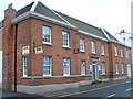
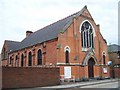
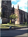
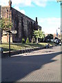
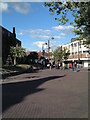
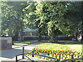
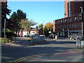
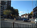
Photos of B79 7QG


Area Information
Living in B79 7QG means inhabiting a compact residential cluster in England, where 1,701 people reside across a densely populated area of 875 people per square kilometre. This postcode is defined by its small-scale character, with homes predominantly occupied by owners rather than renters. The community skews towards adults aged 30–64, with a median age of 47, suggesting a stable, mature demographic. Daily life here is shaped by proximity to essential services and transport links, though the area’s size means it is best suited for those prioritising convenience over sprawling landscapes. The presence of a primary school and multiple rail stations within reach indicates a focus on practical living, with families and commuters finding the balance between local amenities and broader connectivity. While the area lacks natural or historical landmarks, its straightforward infrastructure and moderate population density make it a viable choice for those seeking a settled, low-maintenance environment.
- Area Type
- Postcode
- Area Size
- Not available
- Population
- 1701
- Population Density
- 875 people/km²
The property market in B79 7QG is characterised by a high rate of home ownership, with 61% of residents in private houses. This suggests a market skewed towards owner-occupation rather than rental, which may indicate long-term residency and a stable demand for family homes. The predominance of houses over flats or apartments implies a focus on spacious, private living, which aligns with the area’s mature demographic. However, the small size of the postcode means the housing stock is limited, and buyers should consider proximity to nearby areas for more options. The lack of data on property prices or recent trends means the market’s competitiveness is unclear, but the strong home ownership rate suggests a low turnover of properties. For those seeking a home in this area, the emphasis on private housing may appeal to families or professionals prioritising space and privacy.
House Prices in B79 7QG
No properties found in this postcode.
Energy Efficiency in B79 7QG
Daily life in B79 7QG is supported by a range of nearby amenities, including five retail outlets such as Farmfoods Leyfields and Iceland Tamworth, which cater to everyday shopping needs. The Victoria Road Bus Interchange provides access to local bus routes, while five rail stations offer connections to broader destinations. Though the area lacks parks or leisure facilities, its proximity to retail and transport hubs ensures a practical lifestyle. The mix of shops and transport options means residents can manage errands and commuting efficiently without needing to travel far. For those prioritising convenience over expansive recreational spaces, this area offers a straightforward, functional environment.
Amenities
Schools
The nearest school to B79 7QG is Dunstall Park Primary School, which serves the local community with primary education. No other schools are listed in the data, meaning families relying on secondary or specialist education may need to look further afield. The presence of a primary school within practical reach is a key consideration for parents, though the absence of secondary schools nearby could affect long-term planning. For those prioritising a walkable school environment, Dunstall Park Primary offers a local option, but buyers should assess the need for additional educational facilities beyond this single institution.
| Rank | School | Type | Entry gender | Ages |
|---|
Explore more schools in this area
Go to Schools tabDemographics
B79 7QG’s population is dominated by adults aged 30–64, reflecting a community that is neither young nor elderly. With a median age of 47, the area is home to a mature demographic, likely comprising professionals, retirees, and families. Home ownership is strong, with 61% of residents owning their homes, a figure that suggests a stable housing market and long-term residency. The predominant accommodation type is houses, indicating a preference for private, standalone properties over flats. The ethnic composition is largely White, though no specific breakdown of diversity is provided. The absence of detailed deprivation data means the area’s quality of life is inferred from its infrastructure and services. For buyers, this profile suggests a community focused on comfort and security, with limited turnover in property ownership.
Household Size
Accommodation Type
Tenure
Ethnic Group
Religion
Household Composition
Age
Household Deprivation
NS-SEC
Explore more demographic insights in this area
Go to Demographics tabPlanning
Planning Constraints
- Flood RiskPremium
- Ramsar Wetland SitesPremium
- Area of Outstanding Natural BeautyPremium
- Protected Nature ReservePremium
- Protected WoodlandPremium