Area Overview for B79 7PE
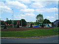
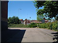
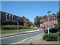
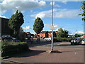
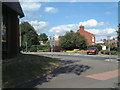
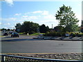
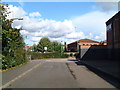
Photos of B79 7PE


Area Information
Living in B79 7PE means being part of a small, tightly knit residential cluster in England, home to 1,539 people. The area’s compact nature fosters a sense of familiarity, with residents likely knowing their neighbours. The community is predominantly middle-aged, with a median age of 47 and most residents falling within the 30–64 age range. This suggests a stable, family-oriented demographic, with 61% of homes owned by occupants rather than rented. The housing stock is largely composed of houses, reflecting a traditional, low-density layout. While the area lacks major landmarks, its proximity to retail hubs like Lidl Leyfields and Aldi Leyfields, plus rail connections to Tamworth and surrounding towns, ensures practical access to daily essentials. For those prioritising safety, the flood risk is negligible, but crime rates are above average, requiring vigilance. B79 7PE is not a place for the seeking the extraordinary, but for those who value simplicity, routine, and a quiet life within reach of regional amenities.
- Area Type
- Postcode
- Area Size
- Not available
- Population
- 1539
- Population Density
- 2453 people/km²
B79 7PE is an owner-occupied area, with 61% of homes owned by residents rather than rented. The housing stock is predominantly houses, which contrasts with areas where flats or apartments dominate. This suggests a focus on family homes, likely with gardens or outdoor space, catering to the area’s middle-aged population. The small size of the postcode means the property market is limited to a handful of listings, but the high home ownership rate indicates a stable, low-turnover environment. Buyers should expect a modest selection of properties, all of which are likely to be traditional houses. For those seeking a quiet, settled lifestyle, this market offers predictable value and minimal competition. However, the lack of rental properties means the area is less suited to those requiring flexibility or investment in a rental portfolio.
House Prices in B79 7PE
No properties found in this postcode.
Energy Efficiency in B79 7PE
Residents of B79 7PE have access to a modest range of amenities within walking or short driving distance. The retail sector includes Lidl Leyfields, Aldi Leyfields, and Iceland Tamworth, offering everyday shopping needs. The Victoria Road Bus Interchange provides connections to nearby areas, while four railway stations—Tamworth High Level, Wilnecote, and Polesworth—offer regional travel options. Though the area lacks large supermarkets or entertainment venues, the presence of multiple retail outlets and transport hubs ensures practical convenience. The small scale of B79 7PE means amenities are not sprawling, but they are sufficient for daily life. For those who prioritise simplicity over luxury, this lifestyle offers a balance of accessibility and quietude, with no excess to distract from the essentials.
Amenities
Schools
Residents of B79 7PE have access to two schools within practical reach: Kettlebrook Infant School, a primary school, and Kettlebrook Short Stay School, which serves a different educational need. The presence of a primary school is a key consideration for families with young children, though the absence of secondary schools nearby may require commuting. The Short Stay School likely caters to students with specific learning requirements or temporary placements, adding diversity to the local educational landscape. However, the data does not provide Ofsted ratings or academic performance metrics, so prospective families should conduct further research. For those prioritising proximity to schools, the area offers a basic foundation, but additional resources may be necessary for comprehensive education planning.
| Rank | School | Type | Entry gender | Ages |
|---|
Explore more schools in this area
Go to Schools tabDemographics
The population of B79 7PE is 1,539, with a median age of 47. Most residents fall into the 30–64 age range, indicating a mature, established community. Home ownership is high at 61%, suggesting a preference for long-term residency over rental properties. The area is predominantly composed of houses, which aligns with the demographic’s likely focus on family living. The predominant ethnic group is White, reflecting a homogenous population. This composition shapes a community where generational stability is key, with fewer transient residents. The absence of detailed diversity data means the area’s cultural dynamics remain unexplored, but the high home ownership rate and age profile suggest a low turnover of residents. For those considering relocation, this demographic profile offers a snapshot of a place where routine and familiarity are prioritised over novelty.
Household Size
Accommodation Type
Tenure
Ethnic Group
Religion
Household Composition
Age
Household Deprivation
NS-SEC
Explore more demographic insights in this area
Go to Demographics tabPlanning
Planning Constraints
- Flood RiskPremium
- Ramsar Wetland SitesPremium
- Area of Outstanding Natural BeautyPremium
- Protected Nature ReservePremium
- Protected WoodlandPremium