Area Overview for B79 7LF
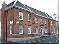
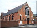
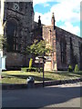
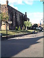
Photos of B79 7LF


Area Information
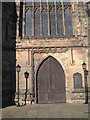
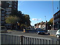
Living in B79 7LF means being part of a small, tightly knit residential cluster in the Borough of Tamworth, Staffordshire. The postcode covers a population of 2,159 people, with a median age of 47 and a majority of residents aged 30–64. This suggests a community of established adults, many of whom are likely to be homeowners, given that 55% of properties are owner-occupied. The area is characterised by its modest scale, with homes primarily in the form of houses rather than flats. Notably, B79 7LF includes a Grade II listed milestone near Tamworth, hinting at historical significance. Situated in the West Midlands, the area is close to major transport routes and services, making it accessible for commuters. Daily life here balances quiet residential living with proximity to local amenities, schools, and rail links. The postcode’s small size means it is likely to feel cohesive, with residents sharing common needs and resources. For those seeking a settled, low-maintenance lifestyle with practical access to services, B79 7LF offers a straightforward, unpretentious alternative to larger urban centres.
- Area Type
- Postcode
- Area Size
- Not available
- Population
- 2159
- Population Density
- 3797 people/km²
The property market in B79 7LF reflects a balance between owner-occupied homes and rental properties, with 55% of residents owning their homes. The predominant accommodation type is houses, which may indicate a preference for single-family dwellings over flats or apartments. This suggests the area is likely to appeal to buyers seeking traditional, spacious homes rather than modern developments. Given the small population and compact postcode, the housing stock is unlikely to be extensive, meaning properties may be in limited supply. For buyers, this could mean competition for available homes, particularly if the area is growing in popularity. The focus on houses may also mean higher land values or larger plots, which could affect affordability. However, the lack of specific data on property prices or recent sales means the market’s dynamics remain unclear, though the owner-occupation rate suggests a degree of stability and long-term residency.
House Prices in B79 7LF
No properties found in this postcode.
Energy Efficiency in B79 7LF
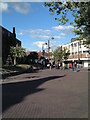
The lifestyle in B79 7LF is shaped by its proximity to essential amenities and modest retail options. Residents can access five nearby shops, including the Tamworth Co-operative Society and Spar, providing convenience for daily essentials. The area’s rail connectivity, with five stations within reach, offers easy access to Tamworth and surrounding towns, supporting both commuting and leisure travel. While there is no mention of parks or leisure facilities in the data, the presence of multiple rail and bus links suggests opportunities for outdoor activities in nearby areas. The retail mix includes supermarkets and local stores, catering to practical needs without requiring long trips. The small-scale nature of the postcode means amenities are likely to be tightly clustered, fostering a sense of community. However, the lack of detailed information on leisure or green spaces means the area’s recreational offerings remain undefined, relying on nearby towns for more extensive facilities.
Amenities
Schools
Residents of B79 7LF have access to a range of educational institutions, including primary schools and sixth-form colleges. Nearby schools include Moorgate Community Primary School, Marmion Junior School, and Moorgate Primary Academy, which holds an Ofsted rating of ‘good’. These primary schools provide options for younger children, while Tamworth and Lichfield College and Landau Forte Academy Tamworth Sixth Form cater to older students. The presence of both primary and post-16 education institutions suggests a comprehensive educational ecosystem, supporting families with children at different stages. The ‘good’ rating at Moorgate Primary Academy indicates a school performing above average, which could be a draw for prospective buyers. However, the absence of secondary schools in the immediate area means students may need to travel to nearby towns for secondary education. Overall, the school mix offers practical support for families but may require additional planning for older children.
| Rank | School | Type | Entry gender | Ages |
|---|
Explore more schools in this area
Go to Schools tabDemographics
The community in B79 7LF is predominantly composed of adults aged 30–64, with a median age of 47. This suggests a mature population, likely with established careers and families. Home ownership stands at 55%, indicating a mix of owner-occupied properties and rental homes. The accommodation type is primarily houses, which may appeal to those seeking more space or privacy. The predominant ethnic group is White, though no specific data on diversity or deprivation is provided. The age profile implies a stable demographic, with fewer young families or elderly residents compared to other areas. This could influence local services, such as schools and healthcare, which may cater more to working-age adults. The absence of detailed diversity statistics means the community’s cultural composition remains less defined, but the age and ownership data suggest a practical, settled population focused on long-term stability.
Household Size
Accommodation Type
Tenure
Ethnic Group
Religion
Household Composition
Age
Household Deprivation
NS-SEC
Explore more demographic insights in this area
Go to Demographics tabPlanning
Planning Constraints
- Flood RiskPremium
- Ramsar Wetland SitesPremium
- Area of Outstanding Natural BeautyPremium
- Protected Nature ReservePremium
- Protected WoodlandPremium