Area Overview for B79 7HW
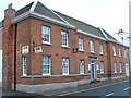
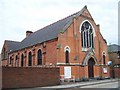
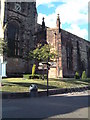
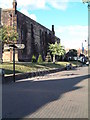
Photos of B79 7HW


Area Information
Living in B79 7HW means being part of a small, tightly knit residential cluster in England, home to 1,539 people. This area is defined by its compact size and proximity to essential services, making it a practical choice for those seeking a balance between suburban comfort and accessibility. The community is predominantly composed of adults aged 30-64, reflecting a mature demographic with established households. With 61% of homes owner-occupied, the area leans towards long-term residency rather than transient rental markets. Daily life here is shaped by its quiet residential character, complemented by nearby retail and transport links. While the population is small, the area’s connectivity to rail and bus networks ensures residents can easily access larger towns and cities. The absence of major environmental constraints, such as protected woodlands or AONB designations, means development is not restricted, though the high crime risk score of 15/100 warrants caution. For buyers, B79 7HW offers a snapshot of a traditional English village setting, albeit with modern amenities within reach.
- Area Type
- Postcode
- Area Size
- Not available
- Population
- 1539
- Population Density
- 2453 people/km²
The property market in B79 7HW is characterised by a strong emphasis on owner-occupation, with 61% of homes owned by residents. This suggests a community of long-term residents rather than a transient rental market. The predominant accommodation type is houses, which aligns with the area’s small, residential nature. Given the low population and limited land area, the housing stock is likely to be tightly clustered, with little scope for expansion. For buyers, this means a limited selection of properties, often requiring proximity to the area’s core. The absence of major planning constraints, such as protected woodlands or AONB designations, may allow for future development, though the high crime risk score of 15/100 could influence investment decisions. Those seeking homes here should consider the area’s compact size and the need to balance proximity to amenities with potential safety concerns.
House Prices in B79 7HW
No properties found in this postcode.
Energy Efficiency in B79 7HW
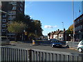
The lifestyle in B79 7HW is shaped by its proximity to essential amenities. Residents have access to five retail outlets, including Iceland Tamworth, Farmfoods Leyfields, and Aldi Leyfields, providing everyday shopping convenience. The area’s transport links to four railway stations and a bus interchange at Victoria Road enhance mobility, enabling easy access to larger towns for leisure, dining, or professional opportunities. While the data does not specify parks or recreational spaces, the absence of protected natural areas suggests a focus on residential comfort over expansive green spaces. The compact nature of the area means amenities are concentrated, reducing the need for long commutes. This balance of retail, transport, and connectivity creates a functional lifestyle, though the lack of detailed information on leisure facilities leaves room for further exploration. The community’s character is likely defined by its practicality and reliance on nearby hubs for broader experiences.
Amenities
Schools
Residents of B79 7HW have access to two named schools within practical reach: Kettlebrook Infant School, a primary school, and Kettlebrook Short Stay School, which is categorised as ‘other’. While no Ofsted ratings are provided, the presence of a primary school suggests the area supports young families, though the secondary education options are not explicitly listed. The mix of school types indicates a focus on early education and specialist provisions, but the absence of comprehensive data on academic performance or capacity limits understanding of the full educational landscape. For families, the availability of a primary school is a key draw, but the lack of information on secondary schooling or nursery provision may require further research. The schools’ proximity to the area underscores the importance of education in shaping the community’s character.
| Rank | School | Type | Entry gender | Ages |
|---|
Explore more schools in this area
Go to Schools tabDemographics
The population of B79 7HW is 1,539, with a median age of 47, indicating a community dominated by middle-aged adults. Over 60% of residents are homeowners, a figure that suggests stability and long-term investment in the area. The majority of properties are houses, reflecting a preference for family homes over flats. The predominant ethnic group is White, aligning with broader trends in rural England. The age range of 30-64 years is the most common, implying a population that is largely in their prime working and family-raising years. This demographic profile suggests a community focused on established living rather than transient populations. However, the lack of specific data on deprivation or income levels means the quality of life for residents remains unquantified. The absence of diversity metrics also limits understanding of cultural or social dynamics, though the area’s small size likely fosters a cohesive, familiar environment.
Household Size
Accommodation Type
Tenure
Ethnic Group
Religion
Household Composition
Age
Household Deprivation
NS-SEC
Explore more demographic insights in this area
Go to Demographics tabPlanning
Planning Constraints
- Flood RiskPremium
- Ramsar Wetland SitesPremium
- Area of Outstanding Natural BeautyPremium
- Protected Nature ReservePremium
- Protected WoodlandPremium