Area Overview for B79 7HT
Photos of B79 7HT
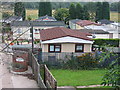


100 photos from this area
Area Information
Key information about the B79 7HT including its size, population, and administrative classification.
- Area Type
- Postcode
- Area Size
- 1.4 hectares
- Population
- 1698
- Population Density
- 2051 people/km²
House Prices in B79 7HT
78
Properties
£122,895
Average Sold Price
£43,500
Lowest Price
£254,037
Highest Price
Showing 78 properties
| Address | Type | Beds | Baths | Last Sale Price | Last Sale Date | |
|---|---|---|---|---|---|---|
| 64 Alexandra Mews, Tamworth, B79 7HT | Flat | 2 | 1 | £129,950 | Nov 2025 | |
| 69 Alexandra Mews, Tamworth, B79 7HT | Semi-detached | 3 | 1 | £240,000 | Aug 2024 | |
| 70 Alexandra Mews, Tamworth, B79 7HT | Flat | 2 | - | £128,500 | May 2024 | |
| 85 Alexandra Mews, Tamworth, B79 7HT | Terraced | 2 | 1 | £210,000 | Dec 2023 | |
| 52 Alexandra Mews, Tamworth, B79 7HT | Flat | - | - | £150,000 | Jul 2023 | |
| 14 Alexandra Mews, Tamworth, B79 7HT | Semi-detached | 4 | 1 | £254,037 | Jul 2023 | |
| 72 Alexandra Mews, Tamworth, B79 7HT | Flat | 2 | 1 | £155,000 | Apr 2023 | |
| 41 Alexandra Mews, Tamworth, B79 7HT | Flat | - | - | £143,000 | Apr 2023 | |
| 51 Alexandra Mews, Tamworth, B79 7HT | Flat | 2 | 1 | £147,500 | Oct 2022 | |
| 81 Alexandra Mews, Tamworth, B79 7HT | Terraced | 3 | 1 | £175,000 | Oct 2022 |
Page 1 of 8
Energy Efficiency in B79 7HT
Amenities
Schools
| Rank | School | Type | Entry gender | Ages |
|---|
Explore more schools in this area
Go to Schools tabDemographics
Household Size
One person
most common
Accommodation Type
Flats
most common
Tenure
24
majority
Ethnic Group
White
most common
Religion
N/A
most common
Household Composition
N/A
most common
Age
47
median
Adults (30-64 years)
most common
Household Deprivation
N/A
with no deprivation
NS-SEC
16
in Lower managerial occupations
Explore more demographic insights in this area
Go to Demographics tabPlanning
Planning Constraints
- Flood RiskPremium
- Ramsar Wetland SitesPremium
- Area of Outstanding Natural BeautyPremium
- Protected Nature ReservePremium
- Protected WoodlandPremium