Area Overview for B79 7HN
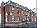
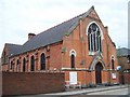
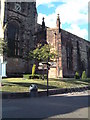
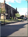
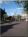
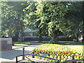
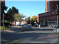
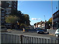
Photos of B79 7HN


Area Information
Living in B79 7HN means being part of a small, residential cluster within Tamworth, a town in Staffordshire’s West Midlands region. With a population of 2,159, the area is compact but well-served by local amenities and transport links. The postcode sits within Spital Ward, an electoral division known for its historic features, including a Grade II listed milestone near the junction of local roads. Daily life here balances proximity to urban services with a quieter, community-oriented feel. The area’s mix of schools, from primary academies to sixth-form colleges, supports families at different life stages. Residents benefit from strong digital connectivity, with broadband rated at 100 (the highest possible score), and mobile coverage rated 85, ensuring reliable internet for both work and leisure. While the population is relatively small, the area’s infrastructure—such as nearby railway stations and retail outlets—offers practical convenience. B79 7HN is ideal for those seeking a stable, family-friendly environment with access to essential services without the pressures of larger urban centres.
- Area Type
- Postcode
- Area Size
- Not available
- Population
- 2159
- Population Density
- 3797 people/km²
The property market in B79 7HN is characterised by a 55% home ownership rate, with houses forming the majority of accommodation types. This indicates a market skewed towards owner-occupied properties, rather than rental or leasehold units. The presence of family homes aligns with the area’s demographic profile of adults aged 30–64, suggesting a focus on long-term stability rather than speculative investment. Given the small population and compact nature of the postcode, the housing stock is likely limited in scale, with properties serving local residents and nearby commuters. Buyers should consider that the area’s size may restrict availability, though the emphasis on homeownership could mean a strong sense of community and established property values. The absence of high-rise or multi-unit developments implies a quieter, more residential character. For those seeking a family home with a balance of privacy and access to local services, B79 7HN offers a niche but practical option within Tamworth’s broader housing landscape.
House Prices in B79 7HN
No properties found in this postcode.
Energy Efficiency in B79 7HN
The lifestyle in B79 7HN is shaped by its proximity to essential amenities and community-focused services. Retail options include the Tamworth Co-operative Society, Spar, and Farmfoods Leyfields, offering everyday shopping needs within walking distance. The Victoria Road Bus Interchange provides easy access to local and regional routes, while five nearby railway stations—such as Tamworth High Level and Polesworth—connect residents to broader transport networks. Though the area is small, these amenities create a practical, self-contained environment. The presence of schools, shops, and transport links supports a convenient, low-stress lifestyle. Residents can enjoy the benefits of urban services without the congestion of larger cities. The mix of retail and transport options ensures daily tasks are manageable, reinforcing the area’s appeal to those prioritising accessibility and community convenience.
Amenities
Schools
Residents of B79 7HN have access to a range of educational institutions, including primary schools and sixth-form colleges. Moorgate Community Primary School and Marmion Junior School cater to younger children, while Tamworth and Lichfield College and Landau Forte Academy Tamworth Sixth Form provide post-16 education. Moorgate Primary Academy, a primary school with an Ofsted rating of ‘good’, highlights the area’s commitment to quality education. The mix of school types ensures families can access both early years education and advanced studies without long commutes. For parents, this diversity reduces the need to rely on distant schools, supporting a more self-contained lifestyle. The presence of sixth-form colleges also benefits students seeking further education or vocational training, reinforcing the area’s appeal to families at various stages of education. These institutions contribute to the area’s reputation as a place where educational needs are met across the lifespan.
| Rank | School | Type | Entry gender | Ages |
|---|
Explore more schools in this area
Go to Schools tabDemographics
The community in B79 7HN is predominantly composed of adults aged 30–64, with a median age of 47. This suggests a mature, established population, likely with strong ties to local institutions and employment. Home ownership stands at 55%, indicating a mix of owner-occupied properties and rental units. The area’s accommodation is primarily houses, reflecting a preference for private, family-oriented living spaces. The predominant ethnic group is White, though no specific data on diversity or deprivation levels is provided. The age profile implies a stable demographic, with fewer young families or retirees compared to other areas. This balance may contribute to a low-key, low-traffic environment. For buyers, the focus on homeownership and family homes suggests a market oriented towards long-term residency rather than short-term investment. The absence of detailed diversity metrics means the community’s social composition remains less defined in the data, but the age range and ownership figures paint a picture of a settled, middle-aged population.
Household Size
Accommodation Type
Tenure
Ethnic Group
Religion
Household Composition
Age
Household Deprivation
NS-SEC
Explore more demographic insights in this area
Go to Demographics tabPlanning
Planning Constraints
- Flood RiskPremium
- Ramsar Wetland SitesPremium
- Area of Outstanding Natural BeautyPremium
- Protected Nature ReservePremium
- Protected WoodlandPremium