Area Overview for B79 7HD
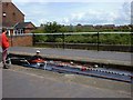
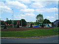
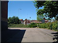
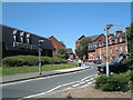
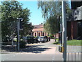
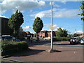
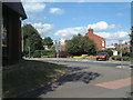
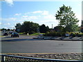
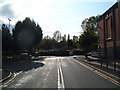
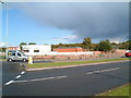
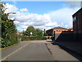
Photos of B79 7HD

Area Information
B79 7HD represents a small residential cluster defined by its specific postcode identity rather than a broad neighbourhood name. This tiny area covers just 1.1 hectares, creating a tightly packed environment for a population of 1,539 people. The high population density means residents live in close proximity to their neighbours, fostering a compact community feel within a very limited geographical footprint. It is a distinct postcode area where daily life revolves around a shared, concentrated space. When you consider living in B79 7HD, you are entering a secluded pocket of homes that prioritises closeness over sprawl. The area is entirely residential, offering a focused living experience away from the larger complications of mixed-use zones. You should expect a neighbourhood where every street corner is known by your next-door neighbour. This small scale ensures that the area retains its character regardless of wider regional changes. Prospective buyers looking for a distinct, micro-community will find this postcode delivers exactly that. The definition of the area relies on its precise boundaries, making it a unique choice for those seeking a specific, contained lifestyle within England. The community within B79 7HD reflects a mature demographic with a significant focus on established households. The median age stands at 47, indicating that the population skews towards adults rather than younger families or elderly retirees. Most residents fall into the 30 to 64 years age range, suggesting a workforce that is active and settled. Home ownership is remarkably high at 61%, meaning the majority of people living in this postcode own their own properties rather than renting. This statistic points to a stable community where long-term residents have invested in their homes. Almost all accommodation consists of houses, creating a uniform environment that differs from areas dominated by flats or terraced rows. The ethnic composition is predominantly White, aligning with the broader demographic trends of the surrounding region. With a population density that reaches 137,796 people per square kilometre, the area feels unexpectedly crowded for its small size of 1.1 hectares. This concentration of adults in houses with high ownership rates creates a distinct social fabric. You should anticipate a neighbourhood of permanent residents who have put down roots for the long term. The data confirms this is a quiet, owner-occupied enclave rather than a transient rental market. The housing stock in B79 7HD is characterised by a specific type of residential tenure and structure. With 61% of residents being owners, this postcode is firmly an owner-occupied area. The dominant accommodation type is houses, which means you will not find a concentration of apartments or multi-unit residential buildings within this cluster. This high level of ownership suggests a market where families and individuals purchase homes for stability rather than short-term rentals. When you look at homes in B79 7HD, you are viewing properties that have likely remained in the same hands for many years. The small physical size of the area at 1.1 hectares limits the total number of properties, reinforcing the idea of a specialised, contained housing market. Buyers searching for this location will find a homogeneous stock of houses that cater to established families. The lack of rental dominance indicates that the local economy supports residents in buying property rather than sustaining a large private landlord sector. There are no large estate blocks or high-density developments here. Instead, the landscape is defined by individual family homes. If you are buying in this area, you join a community where the norm is to own one's house and build equity over time. The density of nearly 138,000 people per square kilometre further suggests that every square metre of land is utilised for residential purposes. Families seeking education options for children in B79 7HD have two specific institutions immediately available to them. Kettlebrook Infant School serves as a primary school for young children, providing early education within a short walking distance. For families with children who require alternative care or early years support, Kettlebrook Short Stay School offers other specialised services. The presence of these named schools indicates that the neighbourhood is integrated with the local education network. While data regarding Ofsted ratings is not included in this summary, the existence of these facilities confirms that formal education is accessible to residents. The mix includes an infant school, suggesting a focus on younger age groups for immediate access. Homeowners in this postcode know that they live near designated educational establishments without needing to commute far for primary education. You can rely on these specific names when planning your children's school run or discussing local provisions. The proximity of Kettlebrook Infant School and Kettlebrook Short Stay School means that daily routines for school-aged children involve familiar, nearby landmarks. This concentration of educational facilities supports the community's role as a family-oriented residence. Connectivity for residents of B79 7HD relies heavily on digital infrastructure and proximity to major transport hubs. Fixed broadband quality is excellent, with a score of 100 out of 100, ensuring you have reliable high-speed internet for working from home or streaming. Mobile network coverage is also very strong at 85 out of 100, providing robust connectivity for phones and smart devices. This digital foundation means you do not suffer from poor signal or slow internet speeds while living in this small area. For physical travel, bus services are accessible, with one interchange available at Victoria Road Bus Interchange. Rail connectivity extends further afield, with four stations serving the region including Tamworth High Level Railway Station, Wilnecote Railway Station, and Polesworth Railway Station. These five stations in total mean you have multiple options for commuting beyond the immediate neighbourhood. The excellent broadband scores are particularly important given the tight geography of B79 7HD, which covers only 1.1 hectares. You can expect seamless video calls and fast downloads regardless of your position within the postcode. Mobile coverage is sufficient for safe navigation and communication during daily activities. The combination of top-tier fixed lines and strong mobile signals makes this a practical location for modern remote workers and tech-dependent households. Daily life in B79 7HD is supported by a selection of amenities within practical reach. For shopping and groceries, residents have access to five retail outlets in the immediate vicinity. Notable venues include Lidl Leyfields and Aldi Leyfields, which provide essential household supplies without requiring a long journey. Iceland Tamworth is also within reach, offering further food and home options. Transport links support a mobile lifestyle with the Victoria Road Bus Interchange serving as a key bus hub. For longer commutes or regional travel, four railway stations are nearby, including Tamworth High Level Railway Station, Wilnecote Railway Station, and Polesworth Railway Station. This network ensures you can visit larger towns for leisure or work without being isolated. The area appeals to those who value convenience in retail and regular public transport access. While the postcode itself is tiny, its connection to wider infrastructure like Leyfields and Tamworth expands your lifestyle opportunities. You can purchase essentials locally at Aldi or travel to independent shops in nearby towns using the rail connections. The presence of multiple bus and train options reduces the necessity for a private car for daily trips. Your lifestyle balance depends on these specific, named amenities and their proximity to the 1.1 hectare residential cluster. Safety and environmental factors in B79 7HD require careful consideration of the local risks. The crime risk assessment is critical, with a score of 15 out of 100, indicating crime rates are above average and enhanced security measures are recommended. This critical level suggests you should be vigilant about property security and personal safety. Conversely, the flood risk assessment is also rated critical at a score of 66.45, showing high flood risk coverage in the area. Residents must account for potential water damage to their homes and prepare accordingly. Planning constraints regarding nature are less restrictive as the area passes with a score of zero for Ramsar wetland sites, protected nature reserves, and protected woodland. There is no Area of Outstanding Natural Beauty coverage, which removes certain construction limitations on properties. While the crime and flood risks demand attention, the environmental planning status is clear and non-constrained. These critical safety assessments define the conditions for living in B79 7HD more than the quiet residential nature might suggest. You should budget for security systems and review flood insurance carefully. The intersection of high crime probability and flood vulnerability creates unique challenges for homeowners in this small postcode. Understanding these scores is essential before committing to a property here. What is the community like in B79 7HD?The community consists of 1,539 residents living in a dense cluster of houses. The median age is 47, meaning the area is dominated by adults between 30 and 64. With 61% home ownership, it is a stable, owner-occupied neighbourhood. Are there good local schools for families?Kettlebrook Infant School and Kettlebrook Short Stay School are located near B79 7HD. These facilities provide primary and specialist support close to your home within the 1.1 hectare postcode area. How reliable is the internet and transport?Fixed broadband scores 100/100 for excellent quality, while mobile coverage is 85/100. Transport options include the Victoria Road Bus Interchange and four nearby railway stations, including Tamworth High Level. Should I be concerned about safety and flooding?Yes. The area has a critical crime risk score of 15 and a critical flood risk score of 66.45. Both figures indicate higher-than-average risks that require enhanced security and flood preparations. What shopping and amenities are within reach?Residents can shop at Lidl Leyfields, Aldi Leyfields, and Iceland Tamworld. Several railway stations are nearby, offering excellent connections for daily commutes and leisure trips outside the immediate locality.
- Area Type
- Postcode
- Area Size
- 1.1 hectares
- Population
- 1539
- Population Density
- 2453 people/km²
The housing stock in B79 7HD is characterised by a specific type of residential tenure and structure. With 61% of residents being owners, this postcode is firmly an owner-occupied area. The dominant accommodation type is houses, which means you will not find a concentration of apartments or multi-unit residential buildings within this cluster. This high level of ownership suggests a market where families and individuals purchase homes for stability rather than short-term rentals. When you look at homes in B79 7HD, you are viewing properties that have likely remained in the same hands for many years. The small physical size of the area at 1.1 hectares limits the total number of properties, reinforcing the idea of a specialised, contained housing market. Buyers searching for this location will find a homogeneous stock of houses that cater to established families. The lack of rental dominance indicates that the local economy supports residents in buying property rather than sustaining a large private landlord sector. There are no large estate blocks or high-density developments here. Instead, the landscape is defined by individual family homes. If you are buying in this area, you join a community where the norm is to own one's house and build equity over time. The density of nearly 138,000 people per square kilometre further suggests that every square metre of land is utilised for residential purposes. Families seeking education options for children in B79 7HD have two specific institutions immediately available to them. Kettlebrook Infant School serves as a primary school for young children, providing early education within a short walking distance. For families with children who require alternative care or early years support, Kettlebrook Short Stay School offers other specialised services. The presence of these named schools indicates that the neighbourhood is integrated with the local education network. While data regarding Ofsted ratings is not included in this summary, the existence of these facilities confirms that formal education is accessible to residents. The mix includes an infant school, suggesting a focus on younger age groups for immediate access. Homeowners in this postcode know that they live near designated educational establishments without needing to commute far for primary education. You can rely on these specific names when planning your children's school run or discussing local provisions. The proximity of Kettlebrook Infant School and Kettlebrook Short Stay School means that daily routines for school-aged children involve familiar, nearby landmarks. This concentration of educational facilities supports the community's role as a family-oriented residence. Connectivity for residents of B79 7HD relies heavily on digital infrastructure and proximity to major transport hubs. Fixed broadband quality is excellent, with a score of 100 out of 100, ensuring you have reliable high-speed internet for working from home or streaming. Mobile network coverage is also very strong at 85 out of 100, providing robust connectivity for phones and smart devices. This digital foundation means you do not suffer from poor signal or slow internet speeds while living in this small area. For physical travel, bus services are accessible, with one interchange available at Victoria Road Bus Interchange. Rail connectivity extends further afield, with four stations serving the region including Tamworth High Level Railway Station, Wilnecote Railway Station, and Polesworth Railway Station. These five stations in total mean you have multiple options for commuting beyond the immediate neighbourhood. The excellent broadband scores are particularly important given the tight geography of B79 7HD, which covers only 1.1 hectares. You can expect seamless video calls and fast downloads regardless of your position within the postcode. Mobile coverage is sufficient for safe navigation and communication during daily activities. The combination of top-tier fixed lines and strong mobile signals makes this a practical location for modern remote workers and tech-dependent households. Daily life in B79 7HD is supported by a selection of amenities within practical reach. For shopping and groceries, residents have access to five retail outlets in the immediate vicinity. Notable venues include Lidl Leyfields and Aldi Leyfields, which provide essential household supplies without requiring a long journey. Iceland Tamworth is also within reach, offering further food and home options. Transport links support a mobile lifestyle with the Victoria Road Bus Interchange serving as a key bus hub. For longer commutes or regional travel, four railway stations are nearby, including Tamworth High Level Railway Station, Wilnecote Railway Station, and Polesworth Railway Station. This network ensures you can visit larger towns for leisure or work without being isolated. The area appeals to those who value convenience in retail and regular public transport access. While the postcode itself is tiny, its connection to wider infrastructure like Leyfields and Tamworth expands your lifestyle opportunities. You can purchase essentials locally at Aldi or travel to independent shops in nearby towns using the rail connections. The presence of multiple bus and train options reduces the necessity for a private car for daily trips. Your lifestyle balance depends on these specific, named amenities and their proximity to the 1.1 hectare residential cluster. Safety and environmental factors in B79 7HD require careful consideration of the local risks. The crime risk assessment is critical, with a score of 15 out of 100, indicating crime rates are above average and enhanced security measures are recommended. This critical level suggests you should be vigilant about property security and personal safety. Conversely, the flood risk assessment is also rated critical at a score of 66.45, showing high flood risk coverage in the area. Residents must account for potential water damage to their homes and prepare accordingly. Planning constraints regarding nature are less restrictive as the area passes with a score of zero for Ramsar wetland sites, protected nature reserves, and protected woodland. There is no Area of Outstanding Natural Beauty coverage, which removes certain construction limitations on properties. While the crime and flood risks demand attention, the environmental planning status is clear and non-constrained. These critical safety assessments define the conditions for living in B79 7HD more than the quiet residential nature might suggest. You should budget for security systems and review flood insurance carefully. The intersection of high crime probability and flood vulnerability creates unique challenges for homeowners in this small postcode. Understanding these scores is essential before committing to a property here. What is the community like in B79 7HD?The community consists of 1,539 residents living in a dense cluster of houses. The median age is 47, meaning the area is dominated by adults between 30 and 64. With 61% home ownership, it is a stable, owner-occupied neighbourhood. Are there good local schools for families?Kettlebrook Infant School and Kettlebrook Short Stay School are located near B79 7HD. These facilities provide primary and specialist support close to your home within the 1.1 hectare postcode area. How reliable is the internet and transport?Fixed broadband scores 100/100 for excellent quality, while mobile coverage is 85/100. Transport options include the Victoria Road Bus Interchange and four nearby railway stations, including Tamworth High Level. Should I be concerned about safety and flooding?Yes. The area has a critical crime risk score of 15 and a critical flood risk score of 66.45. Both figures indicate higher-than-average risks that require enhanced security and flood preparations. What shopping and amenities are within reach?Residents can shop at Lidl Leyfields, Aldi Leyfields, and Iceland Tamworld. Several railway stations are nearby, offering excellent connections for daily commutes and leisure trips outside the immediate locality.
House Prices in B79 7HD
No properties found in this postcode.
Energy Efficiency in B79 7HD
Daily life in B79 7HD is supported by a selection of amenities within practical reach. For shopping and groceries, residents have access to five retail outlets in the immediate vicinity. Notable venues include Lidl Leyfields and Aldi Leyfields, which provide essential household supplies without requiring a long journey. Iceland Tamworth is also within reach, offering further food and home options. Transport links support a mobile lifestyle with the Victoria Road Bus Interchange serving as a key bus hub. For longer commutes or regional travel, four railway stations are nearby, including Tamworth High Level Railway Station, Wilnecote Railway Station, and Polesworth Railway Station. This network ensures you can visit larger towns for leisure or work without being isolated. The area appeals to those who value convenience in retail and regular public transport access. While the postcode itself is tiny, its connection to wider infrastructure like Leyfields and Tamworth expands your lifestyle opportunities. You can purchase essentials locally at Aldi or travel to independent shops in nearby towns using the rail connections. The presence of multiple bus and train options reduces the necessity for a private car for daily trips. Your lifestyle balance depends on these specific, named amenities and their proximity to the 1.1 hectare residential cluster. Safety and environmental factors in B79 7HD require careful consideration of the local risks. The crime risk assessment is critical, with a score of 15 out of 100, indicating crime rates are above average and enhanced security measures are recommended. This critical level suggests you should be vigilant about property security and personal safety. Conversely, the flood risk assessment is also rated critical at a score of 66.45, showing high flood risk coverage in the area. Residents must account for potential water damage to their homes and prepare accordingly. Planning constraints regarding nature are less restrictive as the area passes with a score of zero for Ramsar wetland sites, protected nature reserves, and protected woodland. There is no Area of Outstanding Natural Beauty coverage, which removes certain construction limitations on properties. While the crime and flood risks demand attention, the environmental planning status is clear and non-constrained. These critical safety assessments define the conditions for living in B79 7HD more than the quiet residential nature might suggest. You should budget for security systems and review flood insurance carefully. The intersection of high crime probability and flood vulnerability creates unique challenges for homeowners in this small postcode. Understanding these scores is essential before committing to a property here. What is the community like in B79 7HD?The community consists of 1,539 residents living in a dense cluster of houses. The median age is 47, meaning the area is dominated by adults between 30 and 64. With 61% home ownership, it is a stable, owner-occupied neighbourhood. Are there good local schools for families?Kettlebrook Infant School and Kettlebrook Short Stay School are located near B79 7HD. These facilities provide primary and specialist support close to your home within the 1.1 hectare postcode area. How reliable is the internet and transport?Fixed broadband scores 100/100 for excellent quality, while mobile coverage is 85/100. Transport options include the Victoria Road Bus Interchange and four nearby railway stations, including Tamworth High Level. Should I be concerned about safety and flooding?Yes. The area has a critical crime risk score of 15 and a critical flood risk score of 66.45. Both figures indicate higher-than-average risks that require enhanced security and flood preparations. What shopping and amenities are within reach?Residents can shop at Lidl Leyfields, Aldi Leyfields, and Iceland Tamworld. Several railway stations are nearby, offering excellent connections for daily commutes and leisure trips outside the immediate locality.
Amenities
Schools
Families seeking education options for children in B79 7HD have two specific institutions immediately available to them. Kettlebrook Infant School serves as a primary school for young children, providing early education within a short walking distance. For families with children who require alternative care or early years support, Kettlebrook Short Stay School offers other specialised services. The presence of these named schools indicates that the neighbourhood is integrated with the local education network. While data regarding Ofsted ratings is not included in this summary, the existence of these facilities confirms that formal education is accessible to residents. The mix includes an infant school, suggesting a focus on younger age groups for immediate access. Homeowners in this postcode know that they live near designated educational establishments without needing to commute far for primary education. You can rely on these specific names when planning your children's school run or discussing local provisions. The proximity of Kettlebrook Infant School and Kettlebrook Short Stay School means that daily routines for school-aged children involve familiar, nearby landmarks. This concentration of educational facilities supports the community's role as a family-oriented residence. Connectivity for residents of B79 7HD relies heavily on digital infrastructure and proximity to major transport hubs. Fixed broadband quality is excellent, with a score of 100 out of 100, ensuring you have reliable high-speed internet for working from home or streaming. Mobile network coverage is also very strong at 85 out of 100, providing robust connectivity for phones and smart devices. This digital foundation means you do not suffer from poor signal or slow internet speeds while living in this small area. For physical travel, bus services are accessible, with one interchange available at Victoria Road Bus Interchange. Rail connectivity extends further afield, with four stations serving the region including Tamworth High Level Railway Station, Wilnecote Railway Station, and Polesworth Railway Station. These five stations in total mean you have multiple options for commuting beyond the immediate neighbourhood. The excellent broadband scores are particularly important given the tight geography of B79 7HD, which covers only 1.1 hectares. You can expect seamless video calls and fast downloads regardless of your position within the postcode. Mobile coverage is sufficient for safe navigation and communication during daily activities. The combination of top-tier fixed lines and strong mobile signals makes this a practical location for modern remote workers and tech-dependent households. Daily life in B79 7HD is supported by a selection of amenities within practical reach. For shopping and groceries, residents have access to five retail outlets in the immediate vicinity. Notable venues include Lidl Leyfields and Aldi Leyfields, which provide essential household supplies without requiring a long journey. Iceland Tamworth is also within reach, offering further food and home options. Transport links support a mobile lifestyle with the Victoria Road Bus Interchange serving as a key bus hub. For longer commutes or regional travel, four railway stations are nearby, including Tamworth High Level Railway Station, Wilnecote Railway Station, and Polesworth Railway Station. This network ensures you can visit larger towns for leisure or work without being isolated. The area appeals to those who value convenience in retail and regular public transport access. While the postcode itself is tiny, its connection to wider infrastructure like Leyfields and Tamworth expands your lifestyle opportunities. You can purchase essentials locally at Aldi or travel to independent shops in nearby towns using the rail connections. The presence of multiple bus and train options reduces the necessity for a private car for daily trips. Your lifestyle balance depends on these specific, named amenities and their proximity to the 1.1 hectare residential cluster. Safety and environmental factors in B79 7HD require careful consideration of the local risks. The crime risk assessment is critical, with a score of 15 out of 100, indicating crime rates are above average and enhanced security measures are recommended. This critical level suggests you should be vigilant about property security and personal safety. Conversely, the flood risk assessment is also rated critical at a score of 66.45, showing high flood risk coverage in the area. Residents must account for potential water damage to their homes and prepare accordingly. Planning constraints regarding nature are less restrictive as the area passes with a score of zero for Ramsar wetland sites, protected nature reserves, and protected woodland. There is no Area of Outstanding Natural Beauty coverage, which removes certain construction limitations on properties. While the crime and flood risks demand attention, the environmental planning status is clear and non-constrained. These critical safety assessments define the conditions for living in B79 7HD more than the quiet residential nature might suggest. You should budget for security systems and review flood insurance carefully. The intersection of high crime probability and flood vulnerability creates unique challenges for homeowners in this small postcode. Understanding these scores is essential before committing to a property here. What is the community like in B79 7HD?The community consists of 1,539 residents living in a dense cluster of houses. The median age is 47, meaning the area is dominated by adults between 30 and 64. With 61% home ownership, it is a stable, owner-occupied neighbourhood. Are there good local schools for families?Kettlebrook Infant School and Kettlebrook Short Stay School are located near B79 7HD. These facilities provide primary and specialist support close to your home within the 1.1 hectare postcode area. How reliable is the internet and transport?Fixed broadband scores 100/100 for excellent quality, while mobile coverage is 85/100. Transport options include the Victoria Road Bus Interchange and four nearby railway stations, including Tamworth High Level. Should I be concerned about safety and flooding?Yes. The area has a critical crime risk score of 15 and a critical flood risk score of 66.45. Both figures indicate higher-than-average risks that require enhanced security and flood preparations. What shopping and amenities are within reach?Residents can shop at Lidl Leyfields, Aldi Leyfields, and Iceland Tamworld. Several railway stations are nearby, offering excellent connections for daily commutes and leisure trips outside the immediate locality.
| Rank | School | Type | Entry gender | Ages |
|---|
Explore more schools in this area
Go to Schools tabDemographics
The community within B79 7HD reflects a mature demographic with a significant focus on established households. The median age stands at 47, indicating that the population skews towards adults rather than younger families or elderly retirees. Most residents fall into the 30 to 64 years age range, suggesting a workforce that is active and settled. Home ownership is remarkably high at 61%, meaning the majority of people living in this postcode own their own properties rather than renting. This statistic points to a stable community where long-term residents have invested in their homes. Almost all accommodation consists of houses, creating a uniform environment that differs from areas dominated by flats or terraced rows. The ethnic composition is predominantly White, aligning with the broader demographic trends of the surrounding region. With a population density that reaches 137,796 people per square kilometre, the area feels unexpectedly crowded for its small size of 1.1 hectares. This concentration of adults in houses with high ownership rates creates a distinct social fabric. You should anticipate a neighbourhood of permanent residents who have put down roots for the long term. The data confirms this is a quiet, owner-occupied enclave rather than a transient rental market. The housing stock in B79 7HD is characterised by a specific type of residential tenure and structure. With 61% of residents being owners, this postcode is firmly an owner-occupied area. The dominant accommodation type is houses, which means you will not find a concentration of apartments or multi-unit residential buildings within this cluster. This high level of ownership suggests a market where families and individuals purchase homes for stability rather than short-term rentals. When you look at homes in B79 7HD, you are viewing properties that have likely remained in the same hands for many years. The small physical size of the area at 1.1 hectares limits the total number of properties, reinforcing the idea of a specialised, contained housing market. Buyers searching for this location will find a homogeneous stock of houses that cater to established families. The lack of rental dominance indicates that the local economy supports residents in buying property rather than sustaining a large private landlord sector. There are no large estate blocks or high-density developments here. Instead, the landscape is defined by individual family homes. If you are buying in this area, you join a community where the norm is to own one's house and build equity over time. The density of nearly 138,000 people per square kilometre further suggests that every square metre of land is utilised for residential purposes. Families seeking education options for children in B79 7HD have two specific institutions immediately available to them. Kettlebrook Infant School serves as a primary school for young children, providing early education within a short walking distance. For families with children who require alternative care or early years support, Kettlebrook Short Stay School offers other specialised services. The presence of these named schools indicates that the neighbourhood is integrated with the local education network. While data regarding Ofsted ratings is not included in this summary, the existence of these facilities confirms that formal education is accessible to residents. The mix includes an infant school, suggesting a focus on younger age groups for immediate access. Homeowners in this postcode know that they live near designated educational establishments without needing to commute far for primary education. You can rely on these specific names when planning your children's school run or discussing local provisions. The proximity of Kettlebrook Infant School and Kettlebrook Short Stay School means that daily routines for school-aged children involve familiar, nearby landmarks. This concentration of educational facilities supports the community's role as a family-oriented residence. Connectivity for residents of B79 7HD relies heavily on digital infrastructure and proximity to major transport hubs. Fixed broadband quality is excellent, with a score of 100 out of 100, ensuring you have reliable high-speed internet for working from home or streaming. Mobile network coverage is also very strong at 85 out of 100, providing robust connectivity for phones and smart devices. This digital foundation means you do not suffer from poor signal or slow internet speeds while living in this small area. For physical travel, bus services are accessible, with one interchange available at Victoria Road Bus Interchange. Rail connectivity extends further afield, with four stations serving the region including Tamworth High Level Railway Station, Wilnecote Railway Station, and Polesworth Railway Station. These five stations in total mean you have multiple options for commuting beyond the immediate neighbourhood. The excellent broadband scores are particularly important given the tight geography of B79 7HD, which covers only 1.1 hectares. You can expect seamless video calls and fast downloads regardless of your position within the postcode. Mobile coverage is sufficient for safe navigation and communication during daily activities. The combination of top-tier fixed lines and strong mobile signals makes this a practical location for modern remote workers and tech-dependent households. Daily life in B79 7HD is supported by a selection of amenities within practical reach. For shopping and groceries, residents have access to five retail outlets in the immediate vicinity. Notable venues include Lidl Leyfields and Aldi Leyfields, which provide essential household supplies without requiring a long journey. Iceland Tamworth is also within reach, offering further food and home options. Transport links support a mobile lifestyle with the Victoria Road Bus Interchange serving as a key bus hub. For longer commutes or regional travel, four railway stations are nearby, including Tamworth High Level Railway Station, Wilnecote Railway Station, and Polesworth Railway Station. This network ensures you can visit larger towns for leisure or work without being isolated. The area appeals to those who value convenience in retail and regular public transport access. While the postcode itself is tiny, its connection to wider infrastructure like Leyfields and Tamworth expands your lifestyle opportunities. You can purchase essentials locally at Aldi or travel to independent shops in nearby towns using the rail connections. The presence of multiple bus and train options reduces the necessity for a private car for daily trips. Your lifestyle balance depends on these specific, named amenities and their proximity to the 1.1 hectare residential cluster. Safety and environmental factors in B79 7HD require careful consideration of the local risks. The crime risk assessment is critical, with a score of 15 out of 100, indicating crime rates are above average and enhanced security measures are recommended. This critical level suggests you should be vigilant about property security and personal safety. Conversely, the flood risk assessment is also rated critical at a score of 66.45, showing high flood risk coverage in the area. Residents must account for potential water damage to their homes and prepare accordingly. Planning constraints regarding nature are less restrictive as the area passes with a score of zero for Ramsar wetland sites, protected nature reserves, and protected woodland. There is no Area of Outstanding Natural Beauty coverage, which removes certain construction limitations on properties. While the crime and flood risks demand attention, the environmental planning status is clear and non-constrained. These critical safety assessments define the conditions for living in B79 7HD more than the quiet residential nature might suggest. You should budget for security systems and review flood insurance carefully. The intersection of high crime probability and flood vulnerability creates unique challenges for homeowners in this small postcode. Understanding these scores is essential before committing to a property here. What is the community like in B79 7HD?The community consists of 1,539 residents living in a dense cluster of houses. The median age is 47, meaning the area is dominated by adults between 30 and 64. With 61% home ownership, it is a stable, owner-occupied neighbourhood. Are there good local schools for families?Kettlebrook Infant School and Kettlebrook Short Stay School are located near B79 7HD. These facilities provide primary and specialist support close to your home within the 1.1 hectare postcode area. How reliable is the internet and transport?Fixed broadband scores 100/100 for excellent quality, while mobile coverage is 85/100. Transport options include the Victoria Road Bus Interchange and four nearby railway stations, including Tamworth High Level. Should I be concerned about safety and flooding?Yes. The area has a critical crime risk score of 15 and a critical flood risk score of 66.45. Both figures indicate higher-than-average risks that require enhanced security and flood preparations. What shopping and amenities are within reach?Residents can shop at Lidl Leyfields, Aldi Leyfields, and Iceland Tamworld. Several railway stations are nearby, offering excellent connections for daily commutes and leisure trips outside the immediate locality.
Household Size
Accommodation Type
Tenure
Ethnic Group
Religion
Household Composition
Age
Household Deprivation
NS-SEC
Explore more demographic insights in this area
Go to Demographics tabPlanning
Planning Constraints
- Flood RiskPremium
- Ramsar Wetland SitesPremium
- Area of Outstanding Natural BeautyPremium
- Protected Nature ReservePremium
- Protected WoodlandPremium