Area Overview for B79 7DS
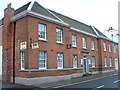
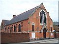
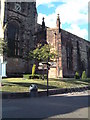
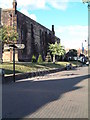
Photos of B79 7DS


Area Information
Living in B79 7DS means being part of a small, tightly knit residential cluster in England. With a population of 1,698, this area is compact but functional, catering to a community of adults aged 30–64, many of whom are likely to be in their prime working years. The area’s housing stock is dominated by flats, reflecting a mix of rental properties and owner-occupied homes. While the population is small, the presence of multiple rail stations and a bus interchange nearby suggests that the area is well-connected to surrounding towns. The demographic profile indicates a mature, stable community, with a median age of 47 and a predominantly White population. Daily life here is likely shaped by proximity to local amenities and the need to commute to nearby urban centres. The low flood risk and absence of environmental constraints mean residents can focus on practical concerns like transport and schools rather than natural hazards. B79 7DS is not a sprawling suburb but a defined postcode area where convenience and connectivity are key.
- Area Type
- Postcode
- Area Size
- Not available
- Population
- 1698
- Population Density
- 2051 people/km²
The property market in B79 7DS is characterised by a low home ownership rate of 24%, suggesting that the area is more rental-focused than owner-occupied. The accommodation type is predominantly flats, which may indicate a mix of older, purpose-built housing and newer developments. This configuration is typical of smaller postcode areas where land availability is limited, leading to high-density living. For buyers, this means the housing stock is unlikely to include large detached homes or high-end properties. Instead, the market is likely to feature flats in multi-unit buildings, often rented out to tenants rather than sold. The small size of the area also means that property choices are limited, and buyers may need to look beyond B79 7DS itself to find a wider range of options. The focus on rental properties suggests that the area is more suited to those seeking long-term tenancies than to investors looking for buy-to-let opportunities.
House Prices in B79 7DS
No properties found in this postcode.
Energy Efficiency in B79 7DS
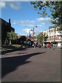
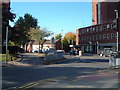
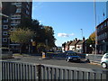
The lifestyle in B79 7DS is shaped by its proximity to retail, transport, and community hubs. Five local shops, including the Tamworth Co-operative Society and Spar, provide everyday convenience for groceries and essentials. The Victoria Road Bus Interchange serves as a central point for public transport, linking residents to nearby towns and services. Rail connectivity is particularly strong, with five stations offering access to Tamworth and surrounding areas, which is ideal for commuters. While the area lacks large parks or leisure facilities, its compact size ensures that amenities are within walking or short driving distance. The presence of multiple schools and transport links suggests a focus on practicality over luxury. For residents, daily life revolves around local services, efficient transport, and a community-oriented approach to living. The combination of retail options and transport infrastructure makes B79 7DS a functional, if modest, place to reside.
Amenities
Schools
Residents of B79 7DS have access to two notable schools. Tamworth Centre is listed as an “other” type of educational institution, though its specific focus is unclear from the data. Nearby is Mortimer House School, a special school with a good Ofsted rating. This mix of school types offers families a range of options, though the presence of a special school suggests the area may cater to students with specific educational needs. The absence of data on primary or secondary schools means it is unclear whether the local schools serve a broad age range or are specialised. For parents seeking a variety of educational environments, the combination of a special school and another institution could be a practical advantage. However, the lack of detailed information on school capacity, pupil numbers, or curriculum types means further research would be needed to fully assess the educational landscape.
| Rank | School | Type | Entry gender | Ages |
|---|
Explore more schools in this area
Go to Schools tabDemographics
The community in B79 7DS is predominantly composed of adults aged 30–64, with a median age of 47. This suggests a population that is largely in the workforce, with fewer young families or retirees compared to other areas. Home ownership is relatively low at 24%, indicating that the majority of residents rent their homes, which may reflect the prevalence of flats as the primary accommodation type. The area’s predominant ethnic group is White, though no specific data on diversity or deprivation is provided. The age profile implies a community with established careers and long-term residency, which could contribute to a sense of continuity. However, the lack of detailed information on household composition or income levels means the full picture of quality of life remains partially obscured. The data underscores a pragmatic, functional demographic profile, shaped by practical housing choices and a focus on stability.
Household Size
Accommodation Type
Tenure
Ethnic Group
Religion
Household Composition
Age
Household Deprivation
NS-SEC
Explore more demographic insights in this area
Go to Demographics tabPlanning
Planning Constraints
- Flood RiskPremium
- Ramsar Wetland SitesPremium
- Area of Outstanding Natural BeautyPremium
- Protected Nature ReservePremium
- Protected WoodlandPremium