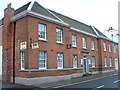
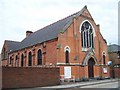
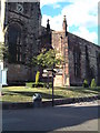
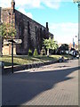
Area Overview for B79 7AD
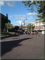
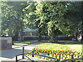
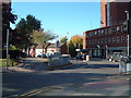
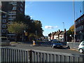
Photos of B79 7AD


Area Information
Living in B79 7AD offers a compact, residential experience with a population of 1,698, reflecting a small, tightly knit community. The area is characterised by its cluster of flats, catering to a demographic predominantly aged 30–64, with a median age of 47. This suggests a mature, stable population, likely drawn to the area’s practicality and proximity to local amenities. The postcode’s low flood risk and absence of protected natural sites like AONB or Ramsar wetlands indicate minimal environmental constraints for development. However, residents should note the area’s high crime risk, which is above average. Despite this, B79 7AD benefits from strong digital connectivity, with a broadband score of 100, ensuring seamless internet access. Nearby, the Victoria Road Bus Interchange and multiple railway stations, including Tamworth High Level, provide reliable transport links. For families, the presence of Mortimer House School, a special needs institution with a good Ofsted rating, adds to the area’s appeal, though options for mainstream education are limited to Tamworth Centre. The mix of retail outlets, from supermarkets to co-ops, supports daily living, making this a functional, if modest, place to reside.
- Area Type
- Postcode
- Area Size
- Not available
- Population
- 1698
- Population Density
- 2051 people/km²
The property market in B79 7AD is defined by its low home ownership rate of 24%, indicating that the majority of residents are renters rather than homeowners. The accommodation type is predominantly flats, which suggests a housing stock designed for smaller households or those seeking compact living spaces. This configuration points to a rental market rather than a buyer’s market, with limited opportunities for owner-occupation. The small size of the area further restricts the availability of diverse property types, making it a niche market for those seeking flats in a specific postcode cluster. For buyers, this means competition is likely to be low, but the range of properties available will be narrow. The focus on flats may appeal to individuals or couples prioritising affordability and convenience, though the lack of larger homes could be a drawback for growing families. The area’s proximity to transport links and amenities may offset its limited property diversity, but prospective buyers should consider the challenges of a small, homogeneous housing stock.
House Prices in B79 7AD
Showing 1 properties
| Address | Type | Beds | Baths | Last Sale Price | Last Sale Date | |
|---|---|---|---|---|---|---|
| Suite 4, 39-41 Lower Gungate, Tamworth, B79 7AD | Office | - | - | - | - |
Energy Efficiency in B79 7AD
The lifestyle in B79 7AD is shaped by its proximity to essential amenities, including five retail outlets such as Farmfoods Leyfields, Iceland Tamworth, and the Tamworth Co-operative Society. These stores provide access to groceries, household goods, and other daily necessities, reducing the need for long trips to larger towns. The Victoria Road Bus Interchange serves as a central hub for public transport, linking residents to broader networks. While the area lacks major parks or leisure facilities, its railway stations offer quick access to nearby towns with more extensive recreational options. The presence of multiple retail spots and transport links fosters a practical, convenience-driven lifestyle, ideal for those prioritising accessibility over expansive green spaces. However, the small size of B79 7AD means that social and cultural activities are limited to what is available within the immediate vicinity. For residents seeking a mix of retail, transport, and community amenities, the area delivers a functional, if modest, quality of life.
Amenities
Schools
The schools near B79 7AD include Tamworth Centre, which is categorised as an ‘other’ school, and Mortimer House School, a special needs institution with a good Ofsted rating. Mortimer House School’s designation as a special school suggests it caters to students with specific educational needs, providing a vital resource for families in the area. Tamworth Centre, while not classified as a mainstream school, may offer alternative education or vocational training. The absence of traditional primary or secondary schools in the immediate vicinity means families may need to look further afield for mainstream education. However, the presence of a special school indicates that B79 7AD is accessible to those requiring tailored support for their children. For parents seeking a range of educational options, the area’s limited school diversity may necessitate commuting to nearby towns for broader choices. The good Ofsted rating at Mortimer House School, however, offers reassurance about the quality of support available for students with special needs.
| Rank | School | Type | Entry gender | Ages |
|---|
Explore more schools in this area
Go to Schools tabDemographics
B79 7AD’s population of 1,698 is predominantly composed of adults aged 30–64, with a median age of 47. This suggests a community of middle-aged and older residents, likely settled in long-term housing. Home ownership in the area is low, at 24%, indicating that most residents rent their homes. The accommodation type is primarily flats, reflecting a housing stock suited to smaller households or those prioritising convenience over larger properties. The predominant ethnic group is White, with no specific data on other demographics provided. This homogeneity may influence the area’s social dynamics, though the absence of detailed diversity statistics means broader cultural perspectives remain unexplored. The low home ownership rate and older age profile suggest a rental market dominated by long-term tenants, with limited turnover. For buyers, this implies a niche market where property availability may be constrained by the area’s small size and limited housing stock. The demographic profile also aligns with a community that values stability, though the high crime risk may impact perceived safety and quality of life for some residents.
Household Size
Accommodation Type
Tenure
Ethnic Group
Religion
Household Composition
Age
Household Deprivation
NS-SEC
Explore more demographic insights in this area
Go to Demographics tabPlanning
Planning Constraints
- Flood RiskPremium
- Ramsar Wetland SitesPremium
- Area of Outstanding Natural BeautyPremium
- Protected Nature ReservePremium
- Protected WoodlandPremium