Area Overview for B79 7AA
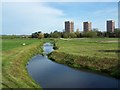
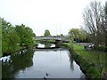
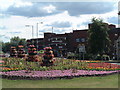
Photos of B79 7AA


Area Information
Living in B79 7AA means being part of a small, tightly knit residential cluster in England with a population of 1,698. The area is defined by its compact size and proximity to essential services, making it practical for daily life. The community is predominantly composed of adults aged 30–64, with a median age of 47, suggesting a mature, stable population. Most homes are flats, reflecting a rental-heavy market. Despite its small scale, the area offers access to key amenities, including retail outlets like Farmfoods Leyfields and Iceland Tamworth, as well as multiple railway stations. Schools such as Mortimer House School, rated ‘good’ by Ofsted, provide educational options for families. Digital connectivity is strong, with a broadband score of 100 and mobile coverage scoring 85, supporting remote work and online activities. However, crime risk is notably high, with a safety score of 2 out of 100, which prospective buyers should consider. The area’s character is shaped by its practicality, accessibility, and the balance between local convenience and broader transport links.
- Area Type
- Postcode
- Area Size
- Not available
- Population
- 1698
- Population Density
- 2051 people/km²
The property market in B79 7AA is characterised by a low home ownership rate of 24%, suggesting that the majority of the housing stock is rented rather than owner-occupied. The predominant accommodation type is flats, which is typical for smaller, residential clusters. This configuration may indicate a focus on affordable, practical living spaces rather than larger family homes. For buyers, the small area size and limited housing stock mean competition for available properties, particularly if seeking owner-occupied options. The flat-dominated market could appeal to those prioritising ease of maintenance or lower entry costs, but it may also limit choices for those seeking larger or more bespoke properties. The immediate surroundings likely offer similar housing patterns, reinforcing the area’s role as a rental-focused, compact residential zone.
House Prices in B79 7AA
No properties found in this postcode.
Energy Efficiency in B79 7AA
The lifestyle in B79 7AA is shaped by its proximity to practical amenities. Retail options include five local shops, such as Farmfoods Leyfields, Iceland Tamworth, and the Tamworth Co-operative Society, offering everyday essentials within reach. The Victoria Road Bus Interchange provides direct access to local and regional routes, while four railway stations—Tamworth High Level, Wilnecote, and Polesworth—connect residents to broader networks. These transport links ensure ease of movement for work, shopping, or leisure. The area’s compact nature means daily needs are met without long commutes, though the absence of parks or leisure facilities is notable. For residents, the balance of retail convenience, transport options, and nearby services creates a functional, if modest, lifestyle that prioritises accessibility over expansive recreational spaces.
Amenities
Schools
Residents of B79 7AA have access to two schools within practical reach: Tamworth Centre, which is listed as an ‘other’ type, and Mortimer House School, a special school with a ‘good’ Ofsted rating. The presence of a special school suggests the area caters to specific educational needs, while Tamworth Centre may provide broader or alternative learning options. For families, this mix offers flexibility, though the lack of mainstream primary or secondary schools may require additional travel for certain educational pathways. The ‘good’ rating at Mortimer House School indicates a reliable standard of education, which could be a key consideration for prospective buyers prioritising school quality. However, the absence of data on other local schools means the full range of educational provisions in the area remains unclear.
| Rank | School | Type | Entry gender | Ages |
|---|
Explore more schools in this area
Go to Schools tabDemographics
The population of B79 7AA is 1,698, with a median age of 47 and the majority of residents falling within the 30–64 age range. This suggests a community of established adults, likely with families or long-term tenure in the area. Home ownership is low, at 24%, indicating that most residents are renters rather than property owners. The predominant accommodation type is flats, which aligns with the area’s compact residential nature. The dominant ethnic group is White, though specific data on diversity or deprivation is not provided. The age profile implies a stable, mature demographic, which may influence local services and community dynamics. With no data on deprivation levels, it is unclear how economic factors might affect quality of life, but the high proportion of adults in the workforce could suggest a focus on practical living over transient populations.
Household Size
Accommodation Type
Tenure
Ethnic Group
Religion
Household Composition
Age
Household Deprivation
NS-SEC
Explore more demographic insights in this area
Go to Demographics tabPlanning
Planning Constraints
- Flood RiskPremium
- Ramsar Wetland SitesPremium
- Area of Outstanding Natural BeautyPremium
- Protected Nature ReservePremium
- Protected WoodlandPremium