Area Overview for B79 0LF
Photos of B79 0LF
Area Information
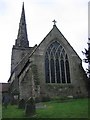
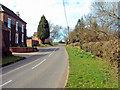
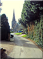
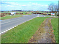
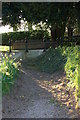
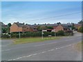
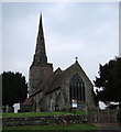
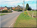
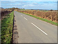
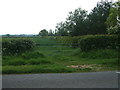
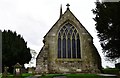
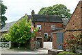
Living in B79 0LF means being part of a small, tightly knit residential cluster in England’s West Midlands. With a population of 1,728 and a density of 98 people per square kilometre, this area offers a quiet, low-density lifestyle. Situated near the Staffordshire border, it lies within the historic parish of Seckington, a village 4 miles northeast of Tamworth. The area’s character is shaped by its rural setting, with historical landmarks like Seckington Castle and the Church of All Saints adding to its heritage. Daily life here is defined by proximity to nature and a slower pace, with local amenities and transport links providing practical connectivity. The postcode covers a compact cluster of homes, predominantly owner-occupied, reflecting a community rooted in stability. For those seeking a balance between tranquillity and accessibility, B79 0LF offers a distinctive blend of historical charm and modern convenience, with nearby towns like Tamworth providing additional services.
- Area Type
- Postcode
- Area Size
- Not available
- Population
- 1728
- Population Density
- 98 people/km²
The property market in B79 0LF is characterised by high home ownership (82%) and a focus on houses, which dominate the accommodation type. This suggests a community of long-term residents rather than a transient rental market. The small residential cluster means property availability is limited, and the area is likely to be highly competitive for buyers. The emphasis on owner-occupied homes indicates a stable market, with potential for capital growth due to the area’s low density and historical appeal. However, the limited scale of the postcode means buyers should consider nearby areas for broader options. For those seeking a family home or a permanent residence, the mix of traditional housing and rural setting could be appealing, though the small size of the area may restrict choice.
House Prices in B79 0LF
No properties found in this postcode.
Energy Efficiency in B79 0LF
The lifestyle in B79 0LF is supported by a range of nearby amenities, including retail options such as Tesco Amington, Spar, and the Tamworth Co-operative Society. These shops provide essential goods, making daily errands convenient for residents. The area’s proximity to three railway stations—Polesworth, Tamworth High Level, and Wilnecote—connects it to broader transport networks, while the Victoria Road Bus Interchange offers local bus services. Though the area itself is small, the surrounding towns of Tamworth and nearby villages provide additional leisure and dining options. The mix of retail, transport, and historical sites creates a balanced lifestyle, blending practicality with the charm of a rural setting. For those who enjoy a mix of quiet living and accessible services, B79 0LF offers a functional, community-oriented environment.
Amenities
Schools
The schools nearest to B79 0LF include Austrey CofE Primary School and Newton Regis CofE Primary School, both of which are primary schools with Ofsted ratings of ‘good’. These institutions provide a solid foundation for young children, with a focus on community and faith-based education. The presence of two primary schools within the area ensures that families have options for their children’s early education, reducing the need for long commutes. While no secondary schools are listed, the proximity to Tamworth suggests access to larger educational institutions in nearby towns. The ‘good’ Ofsted ratings indicate that these schools meet national standards, offering a reliable and supportive learning environment for local students.
| Rank | School | Type | Entry gender | Ages |
|---|
Explore more schools in this area
Go to Schools tabDemographics
The community in B79 0LF is predominantly composed of adults aged 30–64, with a median age of 47. This suggests a mature, established population, likely with long-term ties to the area. Home ownership is high at 82%, indicating a stable housing market and a community of long-term residents. The accommodation type is largely houses, which aligns with the area’s low density and rural character. The predominant ethnic group is White, reflecting the broader demographic trends of the region. While no specific deprivation data is provided, the high home ownership and age profile suggest a community with relatively strong economic foundations. The absence of detailed diversity statistics means the area’s social composition remains largely homogeneous, which can foster a sense of familiarity but may limit cultural variety.
Household Size
Accommodation Type
Tenure
Ethnic Group
Religion
Household Composition
Age
Household Deprivation
NS-SEC
Explore more demographic insights in this area
Go to Demographics tabPlanning
Planning Constraints
- Flood RiskPremium
- Ramsar Wetland SitesPremium
- Area of Outstanding Natural BeautyPremium
- Protected Nature ReservePremium
- Protected WoodlandPremium