Area Overview for B79 0HN
Photos of B79 0HN
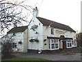
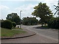
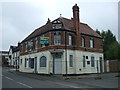
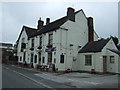

22 photos from this area
Area Information
Key information about the B79 0HN including its size, population, and administrative classification.
- Area Type
- Postcode
- Area Size
- 1.0 hectares
- Population
- 1975
- Population Density
- 144 people/km²
House Prices in B79 0HN
17
Properties
£290,875
Average Sold Price
£130,000
Lowest Price
£440,000
Highest Price
Showing 17 properties
| Address | Type | Beds | Baths | Last Sale Price | Last Sale Date | |
|---|---|---|---|---|---|---|
| 33 Austrey Road, Warton, B79 0HN | Detached | 3 | 2 | £375,000 | May 2023 | |
| 23 Austrey Road, Warton, B79 0HN | house | - | - | £300,000 | Dec 2021 | |
| 27 Austrey Road, Warton, B79 0HN | house | 4 | - | £440,000 | Oct 2020 | |
| 7 Austrey Road, Warton, B79 0HN | Semi-detached | 3 | - | £205,000 | Aug 2020 | |
| 19 Austrey Road, Warton, B79 0HN | Detached | 3 | 1 | £275,000 | Mar 2020 | |
| 37 Austrey Road, Warton, B79 0HN | Semi-detached | 4 | 1 | £335,000 | Nov 2018 | |
| 39 Austrey Road, Warton, B79 0HN | Semi-detached | 3 | 1 | £267,000 | Jul 2017 | |
| 21 Austrey Road, Warton, B79 0HN | Detached | - | - | £130,000 | Nov 2001 | |
| Shiralee, 25 Austrey Road, Warton, B79 0HN | Detached | 4 | 2 | - | - | |
| 5 Austrey Road, Warton, B79 0HN | Land | 4 | - | - | - |
Page 1 of 2
Energy Efficiency in B79 0HN
Amenities
Schools
| Rank | School | Type | Entry gender | Ages |
|---|
Explore more schools in this area
Go to Schools tabDemographics
Household Size
Two person
most common
Accommodation Type
Houses
most common
Tenure
80
majority
Ethnic Group
White
most common
Religion
N/A
most common
Household Composition
N/A
most common
Age
47
median
Adults (30-64 years)
most common
Household Deprivation
N/A
with no deprivation
NS-SEC
31
in Lower managerial occupations
Explore more demographic insights in this area
Go to Demographics tabPlanning
Planning Constraints
- Flood RiskPremium
- Ramsar Wetland SitesPremium
- Area of Outstanding Natural BeautyPremium
- Protected Nature ReservePremium
- Protected WoodlandPremium