Area Overview for B79 0ES
Photos of B79 0ES
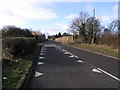
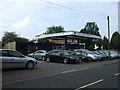
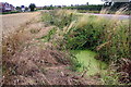
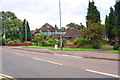
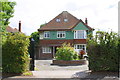

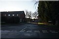
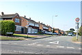
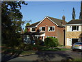
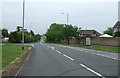
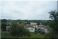

13 photos from this area
Area Information
Key information about the B79 0ES including its size, population, and administrative classification.
- Area Type
- Postcode
- Area Size
- 9703 m²
- Population
- 2488
- Population Density
- 735 people/km²
House Prices in B79 0ES
38
Properties
£345,116
Average Sold Price
£220,000
Lowest Price
£759,923
Highest Price
Showing 38 properties
| Address | Type | Beds | Baths | Last Sale Price | Last Sale Date | |
|---|---|---|---|---|---|---|
| 34 Oleander Close, Tamworth, B79 0ES | Semi-detached | 4 | 2 | £310,000 | Aug 2024 | |
| 37 Oleander Close, Tamworth, B79 0ES | Semi-detached | 2 | 1 | £220,000 | Apr 2024 | |
| 33 Oleander Close, Tamworth, B79 0ES | Semi-detached | 4 | - | £305,000 | Mar 2024 | |
| 36 Oleander Close, Tamworth, B79 0ES | house | - | - | £292,000 | Feb 2022 | |
| 35 Oleander Close, Tamworth, B79 0ES | house | - | - | £295,000 | Jan 2022 | |
| 38 Oleander Close, Tamworth, B79 0ES | house | - | - | £227,500 | Jan 2022 | |
| 39 Oleander Close, Tamworth, B79 0ES | house | 3 | 2 | £270,000 | Dec 2021 | |
| 1 Oleander Close, Tamworth, B79 0ES | house | - | - | £270,000 | Nov 2021 | |
| 2 Oleander Close, Tamworth, B79 0ES | Detached | 3 | 2 | £270,000 | Oct 2021 | |
| 31 Oleander Close, Tamworth, B79 0ES | house | - | - | £458,386 | Jan 2020 |
Page 1 of 4
Energy Efficiency in B79 0ES
Amenities
Schools
| Rank | School | Type | Entry gender | Ages |
|---|
Explore more schools in this area
Go to Schools tabDemographics
Household Size
Two person
most common
Accommodation Type
Houses
most common
Tenure
87
majority
Ethnic Group
White
most common
Religion
N/A
most common
Household Composition
N/A
most common
Age
47
median
Adults (30-64 years)
most common
Household Deprivation
N/A
with no deprivation
NS-SEC
38
in Lower managerial occupations
Explore more demographic insights in this area
Go to Demographics tabPlanning
Planning Constraints
- Flood RiskPremium
- Ramsar Wetland SitesPremium
- Area of Outstanding Natural BeautyPremium
- Protected Nature ReservePremium
- Protected WoodlandPremium