Area Overview for B78 3US
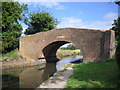
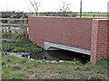
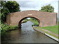
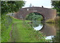
Photos of B78 3US
Area Information
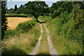
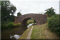
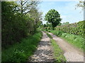
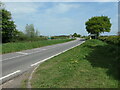
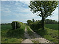
B78 3US is a small, tightly knit postcode area in England, encompassing a residential cluster with a population of 2322 people. Its low population density of 54 people per square kilometre suggests a quiet, perhaps rural or semi-rural character, though the area’s proximity to Tamworth—just three miles north—offers easy access to urban amenities. The region has deep historical roots, with Drayton Bassett, a village within the postcode, dating back to the Domesday Book. Designated a conservation area in 2018, the area preserves its historic core, including buildings from the 1882 Ordnance Survey and a school founded in 1830. This blend of heritage and modest modernity creates a distinct identity: a place where rural tranquillity meets practical connectivity. Residents benefit from nearby canals, rail links, and the Tame Valley’s natural setting, while the conservation status ensures the area’s architectural character remains intact. For those seeking a community with historical depth and a low-key lifestyle, B78 3US offers a compelling mix of tradition and accessibility.
- Area Type
- Postcode
- Area Size
- Not available
- Population
- 2322
- Population Density
- 54 people/km²
The property market in B78 3US is dominated by owner-occupied homes, with 76% of properties owned by residents rather than rented. The accommodation type is predominantly houses, suggesting a mix of detached and semi-detached properties typical of small villages or suburban clusters. This configuration implies a market where buyers are more likely to seek long-term investment than short-term rental opportunities. Given the area’s conservation status and historical character, properties may retain unique architectural features, appealing to buyers valuing heritage and low-density living. However, the small size of the postcode area means the housing stock is limited, potentially leading to competition for available homes. Buyers should consider the area’s rural charm and proximity to Tamworth when evaluating its appeal relative to nearby towns.
House Prices in B78 3US
No properties found in this postcode.
Energy Efficiency in B78 3US
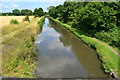
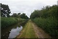
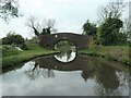
Living in B78 3US offers a blend of rural tranquillity and practical amenities. The nearby retail options include Tesco Fazeley, Tamworth Co-operative Society, and Tesco Dosthill, providing essential shopping within reach. Rail stations like Wilnecote and Tamworth High Level connect residents to broader networks, while the Victoria Road Bus Interchange offers local transport links. The area’s historic character is complemented by its natural surroundings, with access to canals and the Tame Valley. The conservation area status preserves the village’s heritage, including sites like St. Peter’s Parish Church and the former Drayton Manor. This mix of preserved history and modern convenience creates a lifestyle that balances community roots with accessible urban links, ideal for those seeking a peaceful yet connected existence.
Amenities
Schools
Residents of B78 3US have access to two primary schools: Manor Primary School and Manor Primary Academy. Both institutions cater to younger children, providing foundational education within the local community. While no Ofsted ratings are specified in the data, the presence of two primary schools suggests a focus on early education, which is critical for families with young children. The area’s historical connection to education is further reflected in the 1830 school founded by Lady Julia Peel, though this may no longer be operational. For families prioritising proximity to schools, the availability of two primary options reduces the need for long commutes. However, the absence of secondary schools or specialist provisions within the postcode means residents may need to look further afield for higher education or niche learning opportunities.
| Rank | School | Type | Entry gender | Ages |
|---|
Explore more schools in this area
Go to Schools tabDemographics
The population of B78 3US skews towards adults aged 30–64, with a median age of 47. This suggests a mature, stable community with a strong presence of middle-aged residents, likely tied to long-term homeownership. Home ownership is high at 76%, indicating a predominance of owner-occupied properties rather than rentals. The accommodation type is primarily houses, reflecting a suburban or semi-rural layout. The predominant ethnic group is White, though no specific data on diversity or deprivation is provided. The age profile implies a community focused on established families and professionals, with fewer young children or elderly residents compared to other areas. This demographic balance may influence local services and amenities, aligning with the area’s character as a settled, low-density residential zone.
Household Size
Accommodation Type
Tenure
Ethnic Group
Religion
Household Composition
Age
Household Deprivation
NS-SEC
Explore more demographic insights in this area
Go to Demographics tabPlanning
Planning Constraints
- Flood RiskPremium
- Ramsar Wetland SitesPremium
- Area of Outstanding Natural BeautyPremium
- Protected Nature ReservePremium
- Protected WoodlandPremium