Area Overview for B78 3TW
Photos of B78 3TW


Area Information
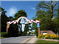
B78 3TW is a small, compact postcode area in England, encompassing the village of Drayton Bassett in Staffordshire. With a population of 1,663 spread across 6,393 square metres, it is a tightly knit community with a high population density of 1,077 people per square kilometre. The area’s character is shaped by its rural roots, with a historic core designated as a conservation area since 2018. Drayton Bassett, first recorded in the Domesday Survey, has evolved as an estate village linked to the former Drayton Manor, now a theme park and zoo. Its proximity to Tamworth—just three miles north—offers access to urban amenities while retaining a village atmosphere. Residents benefit from nearby transport links, including railway stations and the Fazeley Canal, and a mix of retail and leisure options. The area’s blend of historical significance and practical connectivity makes it appealing for those seeking a balance between rural tranquillity and accessible services.
- Area Type
- Postcode
- Area Size
- 6393 m²
- Population
- 1663
- Population Density
- 1077 people/km²
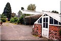
The property market in B78 3TW is characterised by a 53% home ownership rate, with houses forming the predominant accommodation type. This suggests a community where many residents live in their own homes, though the exact proportion of rental properties is not specified. Given the small area size and high population density, the housing stock is likely limited, with properties concentrated in the village core. The presence of a conservation area, designated in 2018, may influence property values and development constraints, preserving historic character at the expense of modern expansion. For buyers, this means a focus on existing homes rather than new builds, with potential for long-term value retention due to the area’s protected status. Proximity to Tamworth and transport links may also enhance appeal, though the small scale of the area means buyers must consider nearby regions for broader options.
House Prices in B78 3TW
Showing 84 properties
Energy Efficiency in B78 3TW
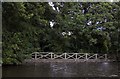
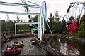
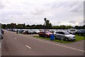
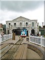
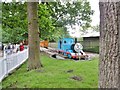
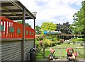
Daily life in B78 3TW is shaped by its small-scale amenities and rural setting. Retail options include nearby supermarkets such as Tesco Fazeley, Aldi Ventura, and Asda Tamworth, providing essential shopping within reach. The village’s historic character is complemented by leisure opportunities like the Fazeley Canal and Heart of England Way, ideal for walking or cycling. The nearby Drayton Manor Theme Park and Zoo, established on former estate land, offer family entertainment. Rail and bus services connect residents to Tamworth and beyond, while the conservation area’s historic buildings and Old School Row add cultural depth. The blend of practical retail, green spaces, and historical sites creates a lifestyle that balances convenience with a sense of place, appealing to those who value both community and accessibility.
Amenities
Schools
The nearest school to B78 3TW is Millfield Primary School, which serves the local community. While the data lists the school twice, it is the only educational institution explicitly named. As a primary school, it caters to younger children, though no Ofsted rating is provided, so its quality remains unspecified. Families in the area must rely on this single primary school for early education, with secondary schooling likely requiring travel to Tamworth or nearby towns. The absence of additional schools—such as secondary or special needs institutions—may pose challenges for households with children across multiple age groups. However, the presence of a primary school within practical reach offers convenience for younger families, aligning with the area’s focus on residential stability.
| Rank | School | Type | Entry gender | Ages |
|---|
Explore more schools in this area
Go to Schools tabDemographics
The population of B78 3TW skews towards adults aged 30–64, with a median age of 47. This suggests a mature, established community with a strong presence of middle-aged residents. Home ownership rates stand at 53%, indicating a mix of owner-occupied and rental properties, though the latter is not explicitly quantified. The predominant accommodation type is houses, reflecting a residential cluster with limited high-density development. The majority of residents identify as White, though specific data on other ethnic groups is not provided. The population density of 1,077 people per square kilometre implies a compact settlement, potentially influencing local infrastructure and community dynamics. For families, this profile suggests a stable environment with a focus on long-term residency, though the lack of detailed diversity metrics means the full demographic spectrum remains partially obscured.
Household Size
Accommodation Type
Tenure
Ethnic Group
Religion
Household Composition
Age
Household Deprivation
NS-SEC
Explore more demographic insights in this area
Go to Demographics tabPlanning
Planning Constraints
- Flood RiskPremium
- Ramsar Wetland SitesPremium
- Area of Outstanding Natural BeautyPremium
- Protected Nature ReservePremium
- Protected WoodlandPremium