Area Overview for B78 2JF
Photos of B78 2JF
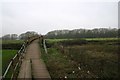
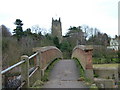
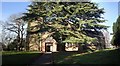
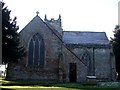
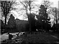
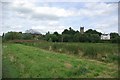
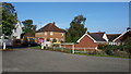
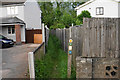
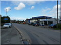
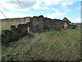
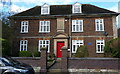
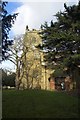
37 photos from this area
Area Information
Key information about the B78 2JF including its size, population, and administrative classification.
- Area Type
- Postcode
- Area Size
- 5246 m²
- Population
- 1762
- Population Density
- 715 people/km²
House Prices in B78 2JF
16
Properties
£164,175
Average Sold Price
£59,750
Lowest Price
£285,000
Highest Price
Showing 16 properties
| Address | Type | Beds | Baths | Last Sale Price | Last Sale Date | |
|---|---|---|---|---|---|---|
| 32 Oak Tree Close, Kingsbury, B78 2JF | Semi-detached | 3 | 1 | £260,000 | Dec 2023 | |
| 24 Oak Tree Close, Kingsbury, B78 2JF | Semi-detached | 2 | 1 | £200,000 | Sep 2023 | |
| 26 Oak Tree Close, Kingsbury, B78 2JF | Terraced | 2 | 1 | £197,000 | Aug 2023 | |
| 22 Oak Tree Close, Kingsbury, B78 2JF | house | 2 | 1 | £168,000 | Feb 2021 | |
| 2 Oak Tree Close, Kingsbury, B78 2JF | Detached | 4 | 2 | £285,000 | Oct 2017 | |
| 16 Oak Tree Close, Kingsbury, B78 2JF | Detached | 2 | - | £130,000 | Jun 2013 | |
| 12 Oak Tree Close, Kingsbury, B78 2JF | house | - | - | £122,000 | Mar 2013 | |
| 4 Oak Tree Close, Kingsbury, B78 2JF | Detached | 3 | 1 | £145,000 | Oct 2008 | |
| 14 Oak Tree Close, Kingsbury, B78 2JF | Semi-detached | - | - | £75,000 | May 2002 | |
| 28 Oak Tree Close, Kingsbury, B78 2JF | Semi-detached | - | - | £59,750 | May 2001 |
Page 1 of 2
Energy Efficiency in B78 2JF
Amenities
Schools
| Rank | School | Type | Entry gender | Ages |
|---|
Explore more schools in this area
Go to Schools tabDemographics
Household Size
Two person
most common
Accommodation Type
Houses
most common
Tenure
88
majority
Ethnic Group
White
most common
Religion
N/A
most common
Household Composition
N/A
most common
Age
47
median
Adults (30-64 years)
most common
Household Deprivation
N/A
with no deprivation
NS-SEC
34
in Lower managerial occupations
Explore more demographic insights in this area
Go to Demographics tabPlanning
Planning Constraints
- Flood RiskPremium
- Ramsar Wetland SitesPremium
- Area of Outstanding Natural BeautyPremium
- Protected Nature ReservePremium
- Protected WoodlandPremium