Area Overview for B78 2DB
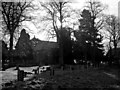
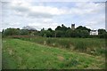
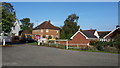
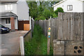
Photos of B78 2DB
Area Information
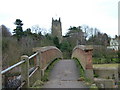
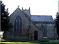
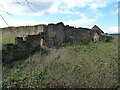
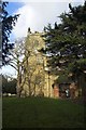
Living in B78 2DB means being part of a small, residential postcode area with a population of 1,789, nestled within the broader Kingsbury village in North Warwickshire. This area reflects a blend of semi-rural character and commuter functionality, shaped by its proximity to the M42 motorway and nearby towns. Historically, Kingsbury was a Saxon royal site, with its name deriving from *Chingesburie*, meaning “king’s fort.” Today, it retains traces of its past through landmarks like Kingsbury Hall, a medieval manor house, and the Church of St Peter & St Paul. The area’s modern identity is defined by its role as a commuter hub, with residents often working in nearby cities like Birmingham. Daily life here is influenced by its strategic location, offering access to transport networks while maintaining a quieter, village-like atmosphere. The mix of historic buildings and contemporary housing creates a unique setting for those seeking a balance between tradition and convenience.
- Area Type
- Postcode
- Area Size
- Not available
- Population
- 1789
- Population Density
- 1952 people/km²
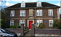
The property market in B78 2DB is characterised by high home ownership (71%) and a predominance of houses. This suggests a market skewed towards owner-occupied properties rather than rental units, which is typical of smaller, residential postcode areas. The focus on houses, rather than flats, indicates a preference for larger, more private living spaces, possibly catering to families or individuals seeking space. Given the area’s role as a commuter village, properties may be priced with proximity to transport networks in mind. However, the small size of the postcode means the housing stock is limited, and buyers should consider nearby areas for more options. The market likely appeals to those prioritising stability, with homes offering a blend of historic charm and modern convenience.
House Prices in B78 2DB
No properties found in this postcode.
Energy Efficiency in B78 2DB
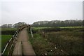
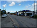
The lifestyle in B78 2DB is shaped by its proximity to retail, transport, and green spaces. Nearby amenities include three instances of Tamworth Co-operative Society Co, offering local shopping options. Rail services at Wilnecote, Coleshill Parkway, and Water Orton stations, along with Victoria Road Bus Interchange, provide connectivity to surrounding areas. The area’s semi-rural character is complemented by recreational spaces like Kingsbury Water Park, a former gravel pit now used for walking and birdwatching. These amenities contribute to a balanced lifestyle, blending practicality with leisure. The presence of multiple schools and transport links suggests a community focused on family needs and accessibility, though the broadband limitations may impact digital experiences.
Amenities
Schools
Residents of B78 2DB have access to several primary schools, including Kingsbury Infant School, Kingsbury Junior School, and Kingsbury School, a specialist science and mathematics academy. Kingsbury Primary School has an Ofsted rating of satisfactory, while others are listed as primary or academy schools. The variety of school types offers families options ranging from traditional primary education to specialist institutions focused on science and maths. This mix may appeal to parents seeking tailored educational environments for their children. The presence of multiple schools within the area suggests a strong local education infrastructure, though specific secondary school options are not detailed in the data.
| Rank | School | Type | Entry gender | Ages |
|---|
Explore more schools in this area
Go to Schools tabDemographics
The community in B78 2DB is predominantly composed of adults aged 30–64, with a median age of 47. This suggests a mature population, likely with established careers and families. Home ownership is high, at 71%, indicating a stable, long-term resident base. The accommodation type is primarily houses, reflecting a preference for detached or semi-detached properties over flats. The predominant ethnic group is White, though specific diversity statistics are not provided. The age profile and ownership rates suggest a community focused on stability and long-term investment. With no data on deprivation levels, it is reasonable to infer that the area’s safety and infrastructure support a quality of life aligned with its demographic makeup.
Household Size
Accommodation Type
Tenure
Ethnic Group
Religion
Household Composition
Age
Household Deprivation
NS-SEC
Explore more demographic insights in this area
Go to Demographics tabPlanning
Planning Constraints
- Flood RiskPremium
- Ramsar Wetland SitesPremium
- Area of Outstanding Natural BeautyPremium
- Protected Nature ReservePremium
- Protected WoodlandPremium