Area Overview for B78 1QS
Photos of B78 1QS
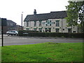
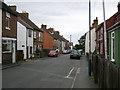
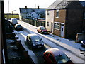
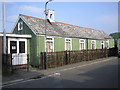
6 photos from this area
Area Information
Key information about the B78 1QS including its size, population, and administrative classification.
- Area Type
- Postcode
- Area Size
- 7457 m²
- Population
- 1552
- Population Density
- 2294 people/km²
House Prices in B78 1QS
14
Properties
£163,717
Average Sold Price
£67,950
Lowest Price
£282,500
Highest Price
Showing 14 properties
| Address | Type | Beds | Baths | Last Sale Price | Last Sale Date | |
|---|---|---|---|---|---|---|
| 82 Whitehouse Road, Dordon, B78 1QS | Bungalow | 2 | 1 | £282,500 | Sep 2021 | |
| 88 Whitehouse Road, Dordon, B78 1QS | Bungalow | 2 | - | £245,000 | Mar 2021 | |
| 84 Whitehouse Road, Dordon, B78 1QS | Bungalow | 3 | 2 | £222,500 | Mar 2019 | |
| 68 Whitehouse Road, Dordon, B78 1QS | Semi-detached | 3 | - | £122,500 | Nov 2013 | |
| 74 Whitehouse Road, Dordon, B78 1QS | house | 3 | - | £148,000 | Nov 2011 | |
| 78 Whitehouse Road, Dordon, B78 1QS | house | - | - | £137,000 | Dec 2009 | |
| 76 Whitehouse Road, Dordon, B78 1QS | Semi-detached | - | - | £146,500 | May 2004 | |
| 86 Whitehouse Road, Dordon, B78 1QS | Detached | - | - | £101,500 | Oct 1999 | |
| 72 Whitehouse Road, Dordon, B78 1QS | Semi-detached | - | - | £67,950 | Feb 1999 | |
| 90 Whitehouse Road, Dordon, B78 1QS | Bungalow | 3 | 1 | - | - |
Page 1 of 2
Energy Efficiency in B78 1QS
Amenities
Schools
| Rank | School | Type | Entry gender | Ages |
|---|
Explore more schools in this area
Go to Schools tabDemographics
Household Size
Family (3-5 people)
most common
Accommodation Type
Houses
most common
Tenure
55
majority
Ethnic Group
White
most common
Religion
N/A
most common
Household Composition
N/A
most common
Age
47
median
Adults (30-64 years)
most common
Household Deprivation
N/A
with no deprivation
NS-SEC
17
in Lower managerial occupations
Explore more demographic insights in this area
Go to Demographics tabPlanning
Planning Constraints
- Flood RiskPremium
- Ramsar Wetland SitesPremium
- Area of Outstanding Natural BeautyPremium
- Protected Nature ReservePremium
- Protected WoodlandPremium