Area Overview for B77 4HN
Photos of B77 4HN
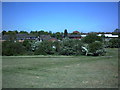

27 photos from this area
Area Information
Key information about the B77 4HN including its size, population, and administrative classification.
- Area Type
- Postcode
- Area Size
- 2.5 hectares
- Population
- 1472
- Population Density
- 2893 people/km²
House Prices in B77 4HN
8
Properties
£151,688
Average Sold Price
£117,500
Lowest Price
£212,500
Highest Price
Showing 8 properties
| Address | Type | Beds | Baths | Last Sale Price | Last Sale Date | |
|---|---|---|---|---|---|---|
| 46 Fossdale Road, Stonydelph, Tamworth, B77 4HN | Bungalow | - | - | £188,000 | May 2022 | |
| 42 Fossdale Road, Stonydelph, Tamworth, B77 4HN | Bungalow | - | - | £212,500 | Aug 2021 | |
| 40 Fossdale Road, Stonydelph, Tamworth, B77 4HN | Bungalow | 2 | - | £187,500 | Mar 2021 | |
| 50 Fossdale Road, Stonydelph, Tamworth, B77 4HN | Bungalow | 2 | - | £133,000 | Nov 2014 | |
| 52 Fossdale Road, Stonydelph, Tamworth, B77 4HN | Semi-detached | 2 | 1 | £117,500 | Nov 2011 | |
| 48 Fossdale Road, Stonydelph, Tamworth, B77 4HN | Bungalow | 2 | - | £120,000 | Aug 2011 | |
| 44 Fossdale Road, Stonydelph, Tamworth, B77 4HN | Semi-detached | - | - | £125,000 | Aug 2008 | |
| 54 Fossdale Road, Stonydelph, Tamworth, B77 4HN | Semi-detached | - | - | £130,000 | Aug 2007 |
Energy Efficiency in B77 4HN
Amenities
Schools
| Rank | School | Type | Entry gender | Ages |
|---|
Explore more schools in this area
Go to Schools tabDemographics
Household Size
Family (3-5 people)
most common
Accommodation Type
Houses
most common
Tenure
63
majority
Ethnic Group
White
most common
Religion
N/A
most common
Household Composition
N/A
most common
Age
47
median
Adults (30-64 years)
most common
Household Deprivation
N/A
with no deprivation
NS-SEC
23
in Lower managerial occupations
Explore more demographic insights in this area
Go to Demographics tabPlanning
Planning Constraints
- Flood RiskPremium
- Ramsar Wetland SitesPremium
- Area of Outstanding Natural BeautyPremium
- Protected Nature ReservePremium
- Protected WoodlandPremium