Area Overview for B77 4FR
Photos of B77 4FR

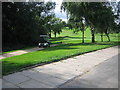
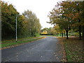

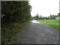
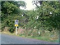

8 photos from this area
Area Information
Key information about the B77 4FR including its size, population, and administrative classification.
- Area Type
- Postcode
- Area Size
- 2.5 hectares
- Population
- 1975
- Population Density
- 144 people/km²
House Prices in B77 4FR
38
Properties
£221,975
Average Sold Price
£80,500
Lowest Price
£606,272
Highest Price
Showing 38 properties
| Address | Type | Beds | Baths | Last Sale Price | Last Sale Date | |
|---|---|---|---|---|---|---|
| 35 Cheddleton Close, Amington, Tamworth, B77 4FR | Semi-detached | 3 | 2 | £285,000 | Oct 2025 | |
| 20 Cheddleton Close, Amington, Tamworth, B77 4FR | Semi-detached | 3 | 1 | £275,000 | Jun 2025 | |
| 3 Cheddleton Close, Amington, Tamworth, B77 4FR | Terraced | 3 | 2 | £270,000 | Apr 2025 | |
| 24 Cheddleton Close, Amington, Tamworth, B77 4FR | Terraced | 2 | 1 | £122,500 | May 2024 | |
| 23 Cheddleton Close, Amington, Tamworth, B77 4FR | Terraced | 2 | 1 | £99,000 | Feb 2024 | |
| 12 Cheddleton Close, Amington, Tamworth, B77 4FR | Retail | 3 | 2 | £276,000 | Aug 2022 | |
| 15 Cheddleton Close, Amington, Tamworth, B77 4FR | house | - | - | £199,995 | Jan 2021 | |
| 16 Cheddleton Close, Amington, Tamworth, B77 4FR | house | - | - | £232,995 | Jul 2020 | |
| 33 Cheddleton Close, Amington, Tamworth, B77 4FR | Detached | 2 | 1 | £199,995 | Apr 2020 | |
| 19 Cheddleton Close, Amington, Tamworth, B77 4FR | house | 3 | 2 | £199,995 | Mar 2020 |
Page 1 of 4
Energy Efficiency in B77 4FR
Amenities
Schools
| Rank | School | Type | Entry gender | Ages |
|---|
Explore more schools in this area
Go to Schools tabDemographics
Household Size
Two person
most common
Accommodation Type
Houses
most common
Tenure
80
majority
Ethnic Group
White
most common
Religion
N/A
most common
Household Composition
N/A
most common
Age
47
median
Adults (30-64 years)
most common
Household Deprivation
N/A
with no deprivation
NS-SEC
31
in Lower managerial occupations
Explore more demographic insights in this area
Go to Demographics tabPlanning
Planning Constraints
- Flood RiskPremium
- Ramsar Wetland SitesPremium
- Area of Outstanding Natural BeautyPremium
- Protected Nature ReservePremium
- Protected WoodlandPremium