Area Overview for B77 4DF
Photos of B77 4DF

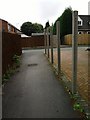
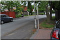
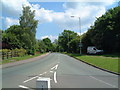
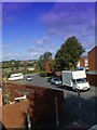

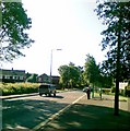
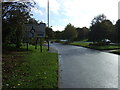
20 photos from this area
Area Information
Key information about the B77 4DF including its size, population, and administrative classification.
- Area Type
- Postcode
- Area Size
- 2.0 hectares
- Population
- 1430
- Population Density
- 3266 people/km²
House Prices in B77 4DF
51
Properties
£121,532
Average Sold Price
£40,000
Lowest Price
£290,000
Highest Price
Showing 51 properties
| Address | Type | Beds | Baths | Last Sale Price | Last Sale Date | |
|---|---|---|---|---|---|---|
| 106 Goldsborough, Stonydelph, Tamworth, B77 4DF | Semi-detached | 5 | 2 | £290,000 | Aug 2024 | |
| 90 Goldsborough, Stonydelph, Tamworth, B77 4DF | house | - | - | £150,000 | May 2023 | |
| 80 Goldsborough, Stonydelph, Tamworth, B77 4DF | house | 2 | - | £187,000 | Jul 2022 | |
| 56 Goldsborough, Stonydelph, Tamworth, B77 4DF | house | - | - | £198,000 | Apr 2022 | |
| 93 Goldsborough, Stonydelph, Tamworth, B77 4DF | Retail | 3 | 1 | £229,950 | Dec 2021 | |
| 58 Goldsborough, Stonydelph, Tamworth, B77 4DF | Semi-detached | 2 | 1 | £175,000 | Oct 2021 | |
| 91 Goldsborough, Stonydelph, Tamworth, B77 4DF | house | - | - | £250,000 | Sep 2020 | |
| 62 Goldsborough, Stonydelph, Tamworth, B77 4DF | Semi-detached | 4 | 2 | £210,000 | Nov 2019 | |
| 101 Goldsborough, Stonydelph, Tamworth, B77 4DF | Semi-detached | 3 | 1 | £185,000 | Jan 2019 | |
| 59 Goldsborough, Stonydelph, Tamworth, B77 4DF | Semi-detached | 2 | 1 | £152,000 | Sep 2017 |
Page 1 of 6
Energy Efficiency in B77 4DF
Amenities
Schools
| Rank | School | Type | Entry gender | Ages |
|---|
Explore more schools in this area
Go to Schools tabDemographics
Household Size
Two person
most common
Accommodation Type
Houses
most common
Tenure
81
majority
Ethnic Group
White
most common
Religion
N/A
most common
Household Composition
N/A
most common
Age
47
median
Adults (30-64 years)
most common
Household Deprivation
N/A
with no deprivation
NS-SEC
27
in Lower managerial occupations
Explore more demographic insights in this area
Go to Demographics tabPlanning
Planning Constraints
- Flood RiskPremium
- Ramsar Wetland SitesPremium
- Area of Outstanding Natural BeautyPremium
- Protected Nature ReservePremium
- Protected WoodlandPremium