Area Overview for B77 2PF
Photos of B77 2PF


Area Information
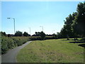
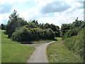
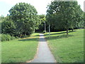
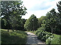
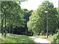
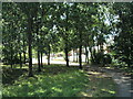
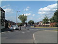
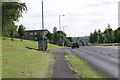
Living in B77 2PF, part of the village of Bolehall in Staffordshire, means being part of a small, tightly knit community within the Tamworth Conurbation. With a population of just 1,598, this postcode area is a quiet residential cluster on the south bank of the River Anker. Its character is shaped by historical roots, including the Grade II listed Bolehall Viaduct and the remnants of Bole Hall, a 17th-century manor. Daily life here is defined by proximity to nature, with Warwickshire Moor nearby, and access to local amenities that cater to both practical needs and leisure. The area’s compact size means residents can easily walk or cycle to shops, schools, and transport links. While it sits near the motorway network, B77 2PF retains a village feel, blending historic charm with modern convenience. For those seeking a balance between tranquillity and connectivity, this area offers a distinct blend of low-density housing, low crime rates, and proximity to Tamworth’s urban offerings.
- Area Type
- Postcode
- Area Size
- Not available
- Population
- 1598
- Population Density
- 4718 people/km²
The property market in B77 2PF is dominated by owner-occupied homes, with 74% of residents living in properties they own. This high home ownership rate suggests a stable market where long-term residency is the norm, rather than a transient rental scene. The accommodation type is primarily houses, which is unusual for areas of this size, indicating a preference for larger, private properties. This dynamic may appeal to buyers seeking family homes or those looking to invest in a low-density, low-risk area. The small postcode area’s limited size means the housing stock is relatively uniform, with little variation in property types. For buyers, this could mean fewer choices but potentially higher demand for available homes. The absence of flats or high-rise buildings also aligns with the area’s village character, making it distinct from more urbanised parts of Tamworth.
House Prices in B77 2PF
No properties found in this postcode.
Energy Efficiency in B77 2PF
The lifestyle in B77 2PF is shaped by its proximity to practical amenities. Within walking distance are five retail outlets, including Aldi Amington, Tamworth Co-operative Society, and Spar, offering everyday shopping needs. The area’s rail links, such as Tamworth High Level Railway Station, provide easy access to urban centres, while the Victoria Road Bus Interchange connects residents to local routes. Though the data does not mention parks or leisure facilities, the presence of Warwickshire Moor nearby suggests opportunities for outdoor activities. The village character, combined with retail and transport options, creates a balance between convenience and tranquillity. Residents can enjoy a self-contained lifestyle with minimal need to travel far for essentials, while still being within reach of larger towns for more specialised services.
Amenities
Schools
The nearest school to B77 2PF is The Woodlands Community Primary School, which serves the local area. As a primary school, it is likely the main educational provision for children aged 4–11, though no secondary schools are listed in the data. The repetition of the school’s name suggests it may be the only primary school nearby, which could be a consideration for families requiring multiple educational options. The absence of secondary schools or specialist provision means parents may need to look beyond B77 2PF for secondary education, potentially increasing travel time. However, the presence of a primary school within the area supports daily routines and reduces the need for long commutes. The school’s role as a community hub may also contribute to the area’s social fabric.
| Rank | School | Type | Entry gender | Ages |
|---|
Explore more schools in this area
Go to Schools tabDemographics
The community in B77 2PF is predominantly composed of adults aged 30–64, with a median age of 47. This suggests a mature, stable population, likely with established careers and families. Home ownership is high, with 74% of residents owning their homes, reflecting a strong preference for long-term residency. The area is characterised by houses rather than flats, indicating a focus on single-family dwellings. The predominant ethnic group is White, though specific data on diversity or deprivation is not provided. The age profile and ownership rates imply a community that values stability and property investment. With no data on income distribution or deprivation levels, it is reasonable to infer that the area’s demographics align with broader trends in the West Midlands, where older populations and owner-occupied housing are common. This profile may appeal to those seeking a settled, family-oriented environment.
Household Size
Accommodation Type
Tenure
Ethnic Group
Religion
Household Composition
Age
Household Deprivation
NS-SEC
Explore more demographic insights in this area
Go to Demographics tabPlanning
Planning Constraints
- Flood RiskPremium
- Ramsar Wetland SitesPremium
- Area of Outstanding Natural BeautyPremium
- Protected Nature ReservePremium
- Protected WoodlandPremium