Area Overview for B77 2NZ
Photos of B77 2NZ
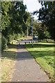
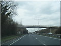
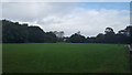
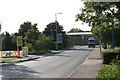
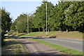
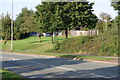
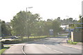

59 photos from this area
Area Information
Key information about the B77 2NZ including its size, population, and administrative classification.
- Area Type
- Postcode
- Area Size
- 10.8 hectares
- Population
- 1603
- Population Density
- 2085 people/km²
House Prices in B77 2NZ
34
Properties
£288,294
Average Sold Price
£117,000
Lowest Price
£468,000
Highest Price
Showing 34 properties
| Address | Type | Beds | Baths | Last Sale Price | Last Sale Date | |
|---|---|---|---|---|---|---|
| 39 Shannon, Belgrave, Tamworth, B77 2NZ | Detached | 4 | 2 | £425,000 | Nov 2023 | |
| 24 Shannon, Belgrave, Tamworth, B77 2NZ | Detached | 4 | 2 | £468,000 | Aug 2023 | |
| 20 Shannon, Belgrave, Tamworth, B77 2NZ | house | - | - | £435,000 | Dec 2021 | |
| 4 Shannon, Belgrave, Tamworth, B77 2NZ | house | - | - | £355,000 | Jan 2021 | |
| 22 Shannon, Belgrave, Tamworth, B77 2NZ | house | - | - | £415,000 | Mar 2019 | |
| 43 Shannon, Belgrave, Tamworth, B77 2NZ | Detached | 5 | 2 | £399,000 | Feb 2019 | |
| 18 Shannon, Belgrave, Tamworth, B77 2NZ | Detached | 5 | 3 | £400,000 | Jan 2018 | |
| 33 Shannon, Belgrave, Tamworth, B77 2NZ | Detached | 5 | 2 | £365,000 | Aug 2017 | |
| 8 Shannon, Belgrave, Tamworth, B77 2NZ | Detached | 4 | 2 | £315,000 | May 2017 | |
| 2 Shannon, Belgrave, Tamworth, B77 2NZ | Detached | 4 | 2 | £350,000 | Jan 2017 |
Page 1 of 4
Energy Efficiency in B77 2NZ
Amenities
Schools
| Rank | School | Type | Entry gender | Ages |
|---|
Explore more schools in this area
Go to Schools tabDemographics
Household Size
Family (3-5 people)
most common
Accommodation Type
Houses
most common
Tenure
89
majority
Ethnic Group
White
most common
Religion
N/A
most common
Household Composition
N/A
most common
Age
47
median
Adults (30-64 years)
most common
Household Deprivation
N/A
with no deprivation
NS-SEC
38
in Lower managerial occupations
Explore more demographic insights in this area
Go to Demographics tabPlanning
Planning Constraints
- Flood RiskPremium
- Ramsar Wetland SitesPremium
- Area of Outstanding Natural BeautyPremium
- Protected Nature ReservePremium
- Protected WoodlandPremium