Area Overview for B77 2NX
Photos of B77 2NX
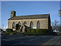
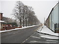
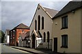
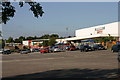


59 photos from this area
Area Information
Key information about the B77 2NX including its size, population, and administrative classification.
- Area Type
- Postcode
- Area Size
- 9459 m²
- Population
- 2167
- Population Density
- 2794 people/km²
House Prices in B77 2NX
18
Properties
£147,804
Average Sold Price
£52,750
Lowest Price
£260,000
Highest Price
Showing 18 properties
| Address | Type | Beds | Baths | Last Sale Price | Last Sale Date | |
|---|---|---|---|---|---|---|
| 11 Nymet, Belgrave, Tamworth, B77 2NX | house | - | - | £260,000 | Mar 2021 | |
| 19 Nymet, Belgrave, Tamworth, B77 2NX | Detached | 3 | 1 | £193,000 | Oct 2020 | |
| 14 Nymet, Belgrave, Tamworth, B77 2NX | house | - | - | £208,000 | Dec 2016 | |
| 6 Nymet, Belgrave, Tamworth, B77 2NX | Detached | 4 | - | £177,000 | May 2011 | |
| 18 Nymet, Belgrave, Tamworth, B77 2NX | Detached | 4 | 2 | £173,000 | Dec 2009 | |
| 5 Nymet, Belgrave, Tamworth, B77 2NX | Detached | - | - | £139,950 | Jul 2005 | |
| 10 Nymet, Belgrave, Tamworth, B77 2NX | Detached | - | - | £150,000 | Apr 2004 | |
| 12 Nymet, Belgrave, Tamworth, B77 2NX | Detached | - | - | £152,950 | Sep 2002 | |
| 1 Nymet, Belgrave, Tamworth, B77 2NX | Detached | - | - | £105,000 | Aug 2001 | |
| 4 Nymet, Belgrave, Tamworth, B77 2NX | Semi-detached | - | - | £102,000 | Jun 2001 |
Page 1 of 2
Energy Efficiency in B77 2NX
Amenities
Schools
| Rank | School | Type | Entry gender | Ages |
|---|
Explore more schools in this area
Go to Schools tabDemographics
Household Size
Family (3-5 people)
most common
Accommodation Type
Houses
most common
Tenure
70
majority
Ethnic Group
White
most common
Religion
N/A
most common
Household Composition
N/A
most common
Age
47
median
Adults (30-64 years)
most common
Household Deprivation
N/A
with no deprivation
NS-SEC
27
in Lower managerial occupations
Explore more demographic insights in this area
Go to Demographics tabPlanning
Planning Constraints
- Flood RiskPremium
- Ramsar Wetland SitesPremium
- Area of Outstanding Natural BeautyPremium
- Protected Nature ReservePremium
- Protected WoodlandPremium