Area Overview for B77 2GB
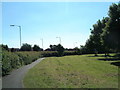
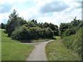
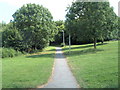
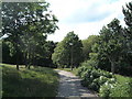
Photos of B77 2GB


Area Information
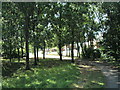
B77 2GB is a small residential postcode area in Staffordshire, England, part of the Tamworth Conurbation. It lies on the south bank of the River Anker, within the Tamworth Borough Council ward. With a population of approximately 1,598, this area is characterised by a quiet, close-knit community. Historically, the manor of Bole Hall dates back to 1390, though the original structure was in ruins by 1515. Today, the area retains a rural charm, with landmarks like the Grade II-listed Bolehall Viaduct and Warwickshire Moor, a local nature reserve. The postcode covers a compact cluster of homes, predominantly houses, reflecting a stable, family-oriented demographic. Residents benefit from proximity to Tamworth’s amenities while maintaining a sense of seclusion. The area’s low crime rate and excellent broadband connectivity make it appealing for those seeking a balanced lifestyle between rural tranquillity and accessible urban services. Living in B77 2GB means being part of a community with a rich historical backdrop and practical modern conveniences.
- Area Type
- Postcode
- Area Size
- Not available
- Population
- 1598
- Population Density
- 4718 people/km²
The property market in B77 2GB is dominated by owner-occupied homes, with 74% of properties owned by residents rather than rented. The accommodation type is exclusively houses, indicating a lack of flats or apartments. This suggests a market tailored to families or individuals seeking single-family homes. Given the small population and compact postcode area, the housing stock is likely limited in scale, with properties concentrated in a tight cluster. The absence of rental data means it is unclear whether the area attracts investors or is primarily a buyer’s market. For prospective buyers, the focus on owner-occupation implies a stable, low-turnover environment, potentially offering long-term value. However, the limited size of the area may restrict options for those seeking larger properties or developments.
House Prices in B77 2GB
No properties found in this postcode.
Energy Efficiency in B77 2GB
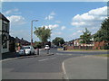
Daily life in B77 2GB is shaped by its proximity to essential amenities. Retail options include five shops, such as Aldi Amington and Spar, offering convenience for local shopping. The area’s rail network, with four stations, connects residents to Tamworth and beyond, while the Victoria Road Bus Interchange provides local transport links. Though the data does not mention parks or leisure facilities, the presence of Warwickshire Moor nearby suggests access to green spaces. The community’s character is defined by its blend of historical sites, such as Bolehall Viaduct, and practical modern amenities. The compact nature of the area means residents can access shops, transport, and services without long commutes, fostering a self-contained lifestyle.
Amenities
Schools
The nearest school to B77 2GB is The Woodlands Community Primary School, a primary school listed twice in the data. No secondary schools or other educational institutions are mentioned, suggesting a focus on primary education within the area. The duplication of the school’s name in the data may indicate an error, but it underscores the prominence of this single primary school in the local education landscape. For families, the availability of a primary school nearby is a key consideration, though the absence of secondary schools means students may need to travel to neighbouring areas for further education. The lack of additional schools or Ofsted ratings in the data means the quality of education cannot be assessed beyond the presence of this one primary institution.
| Rank | School | Type | Entry gender | Ages |
|---|
Explore more schools in this area
Go to Schools tabDemographics
The population of B77 2GB is 1,598, with a median age of 47. The most common age range is adults aged 30–64, indicating a mature, established community. Home ownership is high at 74%, suggesting a strong presence of long-term residents. The area is predominantly composed of houses, with no mention of flats or other accommodation types. The predominant ethnic group is White, reflecting a homogenous demographic profile. This age group and ownership rate imply a stable, low-turnover neighbourhood, likely with a focus on family living. The absence of data on deprivation or diversity means the area’s socio-economic profile remains unexplored in the provided information. However, the high home ownership and mature age profile suggest a community prioritising security and continuity over transient lifestyles.
Household Size
Accommodation Type
Tenure
Ethnic Group
Religion
Household Composition
Age
Household Deprivation
NS-SEC
Explore more demographic insights in this area
Go to Demographics tabPlanning
Planning Constraints
- Flood RiskPremium
- Ramsar Wetland SitesPremium
- Area of Outstanding Natural BeautyPremium
- Protected Nature ReservePremium
- Protected WoodlandPremium