Area Overview for B77 2ED
Photos of B77 2ED


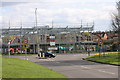
16 photos from this area
Area Information
Key information about the B77 2ED including its size, population, and administrative classification.
- Area Type
- Postcode
- Area Size
- 8855 m²
- Population
- 1355
- Population Density
- 4741 people/km²
House Prices in B77 2ED
14
Properties
£73,000
Average Sold Price
£73,000
Lowest Price
£73,000
Highest Price
Showing 14 properties
| Address | Type | Beds | Baths | Last Sale Price | Last Sale Date | |
|---|---|---|---|---|---|---|
| 70 Caledonian, Glascote, Tamworth, B77 2ED | Flat | - | - | £73,000 | Jun 2016 | |
| Tamworth Borough Council, Glascote Arch, Glascote Heath Library, 80 Caledonian, Glascote, Tamworth, B77 2ED | Office | - | - | - | - | |
| Heathview Medical Practice, Heath View Medical Practice, Glascote Health Centre, 60 Caledonian, Glascote, Tamworth, B77 2ED | hospital_care_home | - | - | - | - | |
| Recycling Centre, St George Public House, 81 Caledonian, Glascote, Tamworth, B77 2ED | commercial | - | - | - | - | |
| 75 Caledonian, Glascote, Tamworth, B77 2ED | Flat | - | - | - | - | |
| 72 Caledonian, Glascote, Tamworth, B77 2ED | Maisonette | - | - | - | - | |
| 77 Caledonian, Glascote, Tamworth, B77 2ED | Maisonette | - | - | - | - | |
| 73 Caledonian, Glascote, Tamworth, B77 2ED | Flat | - | - | - | - | |
| 74 Caledonian, Glascote, Tamworth, B77 2ED | Maisonette | - | - | - | - | |
| 78 Caledonian, Glascote, Tamworth, B77 2ED | Flat | - | - | - | - |
Page 1 of 2
Energy Efficiency in B77 2ED
Amenities
Schools
| Rank | School | Type | Entry gender | Ages |
|---|
Explore more schools in this area
Go to Schools tabDemographics
Household Size
Family (3-5 people)
most common
Accommodation Type
Houses
most common
Tenure
42
majority
Ethnic Group
White
most common
Religion
N/A
most common
Household Composition
N/A
most common
Age
47
median
Adults (30-64 years)
most common
Household Deprivation
N/A
with no deprivation
NS-SEC
12
in Lower managerial occupations
Explore more demographic insights in this area
Go to Demographics tabPlanning
Planning Constraints
- Flood RiskPremium
- Ramsar Wetland SitesPremium
- Area of Outstanding Natural BeautyPremium
- Protected Nature ReservePremium
- Protected WoodlandPremium