Area Overview for B77 1WB
Photos of B77 1WB


Area Information
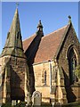
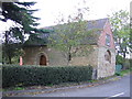
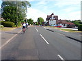
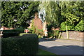
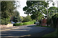
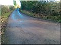
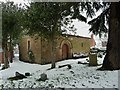
Living in B77 1WB, a small residential cluster in England’s West Midlands, means being part of a semi-rural village with a distinct historical character. The area, home to 2,592 residents spread across 17 km², sits on a bluff above the River Tame valley, a site once central to Saxon royalty. Today, it blends commuter convenience with a quiet, semi-rural atmosphere. Its proximity to the M42 motorway ensures easy access to nearby towns like Tamworth and Birmingham, while its low population density fosters a sense of space. The village’s history as a Saxon fort and later industrial hub—marked by former collieries and gravel pits—shapes its modern identity as a commuter community. Residents benefit from a mix of historical landmarks, such as Kingsbury Hall, and practical amenities. The area’s small size means a tight-knit feel, with local shops, schools, and transport links within practical reach. For those seeking a balance between rural tranquillity and urban connectivity, B77 1WB offers a unique blend of heritage and modernity.
- Area Type
- Postcode
- Area Size
- Not available
- Population
- 2592
- Population Density
- 148 people/km²
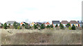
The property market in B77 1WB is dominated by owner-occupied homes, with 72% of households owning their properties. This suggests a stable, long-term resident base rather than a rental market. The accommodation type is primarily houses, which aligns with the semi-rural character of the area and the presence of larger properties typical of villages. Given the small size of the postcode and its focus on houses, the housing stock is limited, making the area competitive for buyers. The lack of flats or apartments indicates a lack of high-density development, which may appeal to those seeking space and privacy. For buyers, this means properties are likely to be family homes, with limited scope for new builds or conversions. The proximity to the M42 motorway adds value for commuters, though the small size of the area means buyers should consider nearby towns for additional options.
House Prices in B77 1WB
No properties found in this postcode.
Energy Efficiency in B77 1WB
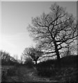
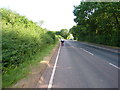
The lifestyle in B77 1WB is supported by a range of nearby amenities, from retail to transport. Local shops include Tesco Dosthill, Lidl Tamworth, and Tamworth Co-operative Society Co, offering everyday essentials within reach. These stores cater to daily needs, reducing the necessity for long trips to larger towns. The area’s transport links, including rail stations and a bus interchange, ensure easy access to nearby cities and towns, enhancing convenience for commuters and shoppers. For leisure, the Kingsbury Water Park—a former gravel pit—provides a space for walking and birdwatching, reflecting the semi-rural character of the village. The mix of practical amenities and green spaces creates a balanced lifestyle, combining modern convenience with natural surroundings. Residents benefit from a compact, functional environment where shopping, commuting, and recreation are all within practical distance.
Amenities
Schools
The nearest school to B77 1WB is Wood End Primary School, a primary school with a good Ofsted rating. This school serves the local community, providing education for younger children in a setting that aligns with the area’s semi-rural character. The presence of a primary school is crucial for families, offering convenience and reducing the need for long commutes to larger towns. While no secondary schools are listed in the data, the proximity to nearby towns like Tamworth suggests access to broader educational options. The good rating at Wood End Primary School indicates a commitment to quality education, which is a key consideration for homebuyers prioritising schools. Families in B77 1WB benefit from a local primary school that supports the community’s needs without requiring extensive travel.
| Rank | School | Type | Entry gender | Ages |
|---|
Explore more schools in this area
Go to Schools tabDemographics
The population of B77 1WB is predominantly adults aged 30–64, with a median age of 47, reflecting a mature, stable community. Home ownership is high at 72%, indicating a strong presence of long-term residents and families. The area is characterised by houses rather than flats, suggesting a focus on traditional family homes. The predominant ethnic group is White, which aligns with the broader demographic patterns of the region. This age profile and ownership structure imply a community prioritising stability over transient lifestyles. The absence of specific deprivation data means the area’s quality of life is likely shaped by its infrastructure and amenities. With no indication of high deprivation, residents benefit from services such as nearby schools and transport links. The demographic makeup supports a local economy centred on commuting and semi-rural living, with limited reliance on rental properties.
Household Size
Accommodation Type
Tenure
Ethnic Group
Religion
Household Composition
Age
Household Deprivation
NS-SEC
Explore more demographic insights in this area
Go to Demographics tabPlanning
Planning Constraints
- Flood RiskPremium
- Ramsar Wetland SitesPremium
- Area of Outstanding Natural BeautyPremium
- Protected Nature ReservePremium
- Protected WoodlandPremium