Area Overview for B77 1PB
Photos of B77 1PB
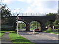
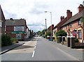
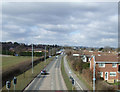

4 photos from this area
Area Information
Key information about the B77 1PB including its size, population, and administrative classification.
- Area Type
- Postcode
- Area Size
- 1.3 hectares
- Population
- 1331
- Population Density
- 1885 people/km²
House Prices in B77 1PB
27
Properties
£179,272
Average Sold Price
£59,950
Lowest Price
£316,000
Highest Price
Showing 27 properties
| Address | Type | Beds | Baths | Last Sale Price | Last Sale Date | |
|---|---|---|---|---|---|---|
| 79 Houting, Dosthill, Tamworth, B77 1PB | house | - | - | £300,000 | Jun 2021 | |
| 80 Houting, Dosthill, Tamworth, B77 1PB | house | - | - | £316,000 | Feb 2019 | |
| 97 Houting, Dosthill, Tamworth, B77 1PB | Detached | 3 | 1 | £209,000 | Oct 2018 | |
| 87 Houting, Dosthill, Tamworth, B77 1PB | Bungalow | 2 | - | £220,000 | Feb 2018 | |
| 88 Houting, Dosthill, Tamworth, B77 1PB | Bungalow | 2 | 1 | £205,000 | Jan 2018 | |
| 98 Houting, Dosthill, Tamworth, B77 1PB | Detached | 5 | 1 | £240,000 | Nov 2017 | |
| 95 Houting, Dosthill, Tamworth, B77 1PB | Detached | 3 | 1 | £209,950 | Mar 2017 | |
| 78 Houting, Dosthill, Tamworth, B77 1PB | Detached | - | - | £170,000 | Jan 2009 | |
| 74 Houting, Dosthill, Tamworth, B77 1PB | Detached | - | - | £197,500 | Dec 2006 | |
| 85 Houting, Dosthill, Tamworth, B77 1PB | house | - | - | £196,000 | Sep 2005 |
Page 1 of 3
Energy Efficiency in B77 1PB
Amenities
Schools
| Rank | School | Type | Entry gender | Ages |
|---|
Explore more schools in this area
Go to Schools tabDemographics
Household Size
Two person
most common
Accommodation Type
Houses
most common
Tenure
72
majority
Ethnic Group
White
most common
Religion
N/A
most common
Household Composition
N/A
most common
Age
47
median
Adults (30-64 years)
most common
Household Deprivation
N/A
with no deprivation
NS-SEC
29
in Lower managerial occupations
Explore more demographic insights in this area
Go to Demographics tabPlanning
Planning Constraints
- Flood RiskPremium
- Ramsar Wetland SitesPremium
- Area of Outstanding Natural BeautyPremium
- Protected Nature ReservePremium
- Protected WoodlandPremium