Area Overview for B77 1LA
Photos of B77 1LA
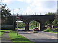
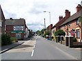
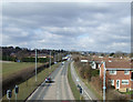

4 photos from this area
Area Information
Key information about the B77 1LA including its size, population, and administrative classification.
- Area Type
- Postcode
- Area Size
- 1.2 hectares
- Population
- 1319
- Population Density
- 5587 people/km²
House Prices in B77 1LA
14
Properties
£281,550
Average Sold Price
£140,000
Lowest Price
£450,000
Highest Price
Showing 14 properties
| Address | Type | Beds | Baths | Last Sale Price | Last Sale Date | |
|---|---|---|---|---|---|---|
| 68 Tamworth Road, Dosthill, Tamworth, B77 1LA | Detached | 3 | - | £450,000 | Sep 2025 | |
| 58 Tamworth Road, Dosthill, Tamworth, B77 1LA | Detached | - | - | £300,000 | Feb 2025 | |
| 56 Tamworth Road, Dosthill, Tamworth, B77 1LA | Bungalow | 2 | - | £315,000 | Mar 2021 | |
| 52 Tamworth Road, Dosthill, Tamworth, B77 1LA | house | - | - | £324,000 | Dec 2020 | |
| 62 Tamworth Road, Dosthill, Tamworth, B77 1LA | house | - | - | £249,950 | Apr 2017 | |
| 72 Tamworth Road, Dosthill, Tamworth, B77 1LA | house | - | - | £235,000 | Oct 2013 | |
| 66 Tamworth Road, Dosthill, Tamworth, B77 1LA | Bungalow | 3 | - | £295,000 | Apr 2012 | |
| 54 Tamworth Road, Dosthill, Tamworth, B77 1LA | house | 3 | - | £140,000 | Jun 2011 | |
| 70 Tamworth Road, Dosthill, Tamworth, B77 1LA | Detached | 4 | 2 | £225,000 | Mar 2004 | |
| 64 Tamworth Road, Dosthill, Tamworth, B77 1LA | Detached | - | - | - | - |
Page 1 of 2
Energy Efficiency in B77 1LA
Amenities
Schools
| Rank | School | Type | Entry gender | Ages |
|---|
Explore more schools in this area
Go to Schools tabDemographics
Household Size
Two person
most common
Accommodation Type
Houses
most common
Tenure
90
majority
Ethnic Group
White
most common
Religion
N/A
most common
Household Composition
N/A
most common
Age
47
median
Adults (30-64 years)
most common
Household Deprivation
N/A
with no deprivation
NS-SEC
32
in Lower managerial occupations
Explore more demographic insights in this area
Go to Demographics tabPlanning
Planning Constraints
- Flood RiskPremium
- Ramsar Wetland SitesPremium
- Area of Outstanding Natural BeautyPremium
- Protected Nature ReservePremium
- Protected WoodlandPremium