Area Overview for B77 1HD
Photos of B77 1HD
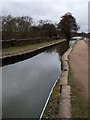


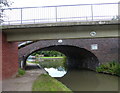
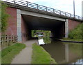
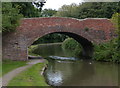


52 photos from this area
Area Information
Key information about the B77 1HD including its size, population, and administrative classification.
- Area Type
- Postcode
- Area Size
- 7070 m²
- Population
- 1810
- Population Density
- 4931 people/km²
House Prices in B77 1HD
25
Properties
£151,938
Average Sold Price
£35,500
Lowest Price
£260,000
Highest Price
Showing 25 properties
| Address | Type | Beds | Baths | Last Sale Price | Last Sale Date | |
|---|---|---|---|---|---|---|
| 14 New Street, Two Gates, Tamworth, B77 1HD | Semi-detached | 2 | 1 | £185,000 | Aug 2025 | |
| 12 New Street, Two Gates, Tamworth, B77 1HD | Terraced | 2 | 1 | £125,000 | Jun 2025 | |
| 24 New Street, Two Gates, Tamworth, B77 1HD | Bungalow | 2 | 1 | £260,000 | Aug 2023 | |
| 7 New Street, Two Gates, Tamworth, B77 1HD | house | 2 | 1 | £198,000 | Jul 2023 | |
| 15 New Street, Two Gates, Tamworth, B77 1HD | Terraced | 2 | 1 | £198,500 | Apr 2022 | |
| 6 New Street, Two Gates, Tamworth, B77 1HD | Terraced | 2 | 1 | £157,000 | Mar 2022 | |
| 17 New Street, Two Gates, Tamworth, B77 1HD | Semi-detached | 3 | 2 | £200,000 | Sep 2021 | |
| New World, 20 New Street, Two Gates, Tamworth, B77 1HD | Detached | 3 | 2 | £242,500 | Jun 2021 | |
| 3 New Street, Two Gates, Tamworth, B77 1HD | Terraced | 2 | 2 | £150,000 | Feb 2019 | |
| The Bungalow, 22 New Street, Two Gates, Tamworth, B77 1HD | Bungalow | 2 | 1 | £194,950 | Jul 2016 |
Page 1 of 3
Energy Efficiency in B77 1HD
Amenities
Schools
| Rank | School | Type | Entry gender | Ages |
|---|
Explore more schools in this area
Go to Schools tabDemographics
Household Size
Two person
most common
Accommodation Type
Houses
most common
Tenure
81
majority
Ethnic Group
White
most common
Religion
N/A
most common
Household Composition
N/A
most common
Age
47
median
Adults (30-64 years)
most common
Household Deprivation
N/A
with no deprivation
NS-SEC
29
in Lower managerial occupations
Explore more demographic insights in this area
Go to Demographics tabPlanning
Planning Constraints
- Flood RiskPremium
- Ramsar Wetland SitesPremium
- Area of Outstanding Natural BeautyPremium
- Protected Nature ReservePremium
- Protected WoodlandPremium