Area Overview for B77 1AP
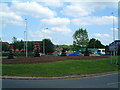
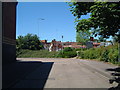
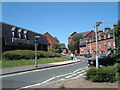
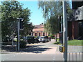
Photos of B77 1AP

Area Information
Living in B77 1AP means residing within a tightly defined residential cluster that covers just 5,664 square metres. This compact postcode serves a small but concentrated community of 1,539 people, resulting in a very high population density of 271,726 per square kilometre. You will find that life here is characterised by proximity, with every resident situated extremely close to their neighbours and local services. The area functions as a specific residential pocket rather than a broad neighbourhood, offering a sense of immediacy to daily routines. Because the land area is so limited, the built environment is intense, and the distance to key amenities like shops, stations, and schools is measured in metres rather than miles. This density ensures that nothing is far away, creating a community where practical convenience is the defining feature of daily life. You do not need to drive for short trips, making the B77 1AP location ideal for those who prefer a high-intensity living environment where walkability is naturally supported by the sheer closeness of residences to one another.
- Area Type
- Postcode
- Area Size
- 5664 m²
- Population
- 1539
- Population Density
- 2453 people/km²
The housing market in B77 1AP is defined by a strong preference for freehold living. With 61% home ownership, the area is significantly more occupied by owners than by tenants, suggesting a neighbourhood where families have chosen to settle permanently rather than rent temporarily. The predominant accommodation type is houses, meaning you will find a landscape of detached or semi-detached properties rather than flats or apartments. This indicates a market geared towards those seeking traditional family homes with private grounds rather than communal living arrangements. For buyers looking at this small area, the high ownership figure suggests that the estate agents and local market often deal with sales of established family residences. The limited size of the postcode area, at just 5,664 square metres, means the supply of properties is finite. You are looking at a market where availability is dictated by the number of existing houses within this tiny cluster, making specific listings particularly valuable when they come up for sale.
House Prices in B77 1AP
Showing 16 properties
| Address | Type | Beds | Baths | Last Sale Price | Last Sale Date | |
|---|---|---|---|---|---|---|
| 7 Castle View, Tamworth, B77 1AP | Semi-detached | 3 | 2 | £258,000 | Jun 2024 | |
| 10 Castle View, Tamworth, B77 1AP | Retail | 3 | 1 | £207,000 | Nov 2022 | |
| 12 Castle View, Tamworth, B77 1AP | Semi-detached | 3 | 1 | £250,000 | Sep 2022 | |
| 14 Castle View, Tamworth, B77 1AP | house | - | - | £195,000 | Oct 2021 | |
| 3 Castle View, Tamworth, B77 1AP | Semi-detached | 3 | 1 | £185,000 | May 2020 | |
| 4 Castle View, Tamworth, B77 1AP | Semi-detached | 4 | 1 | £146,000 | Aug 2015 | |
| 6 Castle View, Tamworth, B77 1AP | house | 3 | - | £125,000 | Nov 2011 | |
| 11 Castle View, Tamworth, B77 1AP | house | 3 | - | £120,000 | May 2010 | |
| 16 Castle View, Tamworth, B77 1AP | house | 3 | - | £116,500 | Jan 2004 | |
| 9 Castle View, Tamworth, B77 1AP | Semi-detached | - | - | £72,000 | Mar 2002 |
Energy Efficiency in B77 1AP
Residents of B77 1AP enjoy immediate access to a selection of retail outlets and transport hubs within practical reach. Five distinct retail venues serve the local population, including Lidl Leyfields, Budgens Tamworth, and Iceland Tamworth. These supermarkets provide essential groceries and daily necessities just a short distance from the homes. Public transport links are established for those needing to travel beyond the immediate vicinity. Three railway stations—Tamworth High Level, Wilnecote, and Polesworth—are available for rail travel, while a single bus service routes through the Victoria Road Bus Interchange. This combination of retail and transport options means you can manage your daily shopping and commuting without leaving the local authority area. The concentration of these amenities within the neighbourhood enhances convenience, allowing residents to run errands quickly before returning to their houses in the dense cluster.
Amenities
Schools
Families living in B77 1AP have access to two specific educational institutions located nearest to their homes. Kettlebrook Infant School serves as the local primary option for younger children within the catchment area. Parents also have access to Kettlebrook Short Stay School, which offers an alternative provision for students with special educational needs. The presence of both a primary school and a short-stay option suggests that the local education landscape caters to a range of student requirements, from standard primary education to specialist care. While the area does not host secondary schools within the immediate vicinity, the proximity of these two institutions supports the local community's need for early childhood and primary education. For those considering homes in B77 1AP, the availability of Kettlebrook Infant School means children can access schooling locally without travelling far. The mix of school types indicates a community approach to education, ensuring that specialist needs are met alongside standard primary curricula right near the residential cluster.
| Rank | School | Type | Entry gender | Ages |
|---|
Explore more schools in this area
Go to Schools tabDemographics
The community in B77 1AP is dominated by adults between the ages of 30 and 64 years, who form the most common age range. The median age for residents stands at 47, indicating a mature population where young families and empty nesters likely influence the character of the streets. With 61% of residents reporting home ownership, a significant majority of people in this postcode have a long-term stake in their property rather than being租户. This high rate of ownership contrasts with areas where renting is prevalent, suggesting a stable community with established roots in specific homes. The predominant ethnic group is White, which defines the cultural make-up of the local streets. Accommodation in B77 1AP consists primarily of houses, confirming that detached or semi-detached family properties are the standard housing stock. You can expect a settled demographic where long-term residents form the social fabric of the small geographical area defined by the postcode.
Household Size
Accommodation Type
Tenure
Ethnic Group
Religion
Household Composition
Age
Household Deprivation
NS-SEC
Explore more demographic insights in this area
Go to Demographics tabPlanning
Planning Constraints
- Flood RiskPremium
- Ramsar Wetland SitesPremium
- Area of Outstanding Natural BeautyPremium
- Protected Nature ReservePremium
- Protected WoodlandPremium