Area Overview for B76 9QW
Photos of B76 9QW
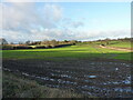
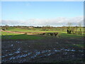

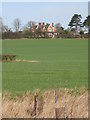
25 photos from this area
Area Information
Key information about the B76 9QW including its size, population, and administrative classification.
- Area Type
- Postcode
- Area Size
- 73.0 hectares
- Population
- 1605
- Population Density
- 184 people/km²
House Prices in B76 9QW
17
Properties
£666,667
Average Sold Price
£450,000
Lowest Price
£850,000
Highest Price
Showing 17 properties
| Address | Type | Beds | Baths | Last Sale Price | Last Sale Date | |
|---|---|---|---|---|---|---|
| Ramshurst Farm, Bulls Lane, Sutton Coldfield, B76 9QW | Detached | 4 | 2 | £850,000 | Dec 2019 | |
| Oakwood House, Bulls Lane, Sutton Coldfield, B76 9QW | Detached | - | - | £700,000 | Aug 2008 | |
| Site Of Fair View Cottage, Bulls Lane, Sutton Coldfield, B76 9QW | house | - | - | £450,000 | Jan 2007 | |
| Smokestack Cottage, 100 Bulls Lane, Sutton Coldfield, B76 9QW | Detached | 2 | 1 | - | - | |
| Fair View Farm, Bulls Lane, Sutton Coldfield, B76 9QW | Detached | 7 | 2 | - | - | |
| Smokestack, Fair View Farm, Bulls Lane, Sutton Coldfield, B76 9QW | Detached | 5 | 3 | - | - | |
| Fair View Farm Caravan, Bulls Lane, Sutton Coldfield, B76 9QW | Mobile Home | - | - | - | - | |
| Pritams, Fair View Farm, Bulls Lane, Sutton Coldfield, B76 9QW | Detached | - | - | - | - | |
| Grooms House Wishaw School Of Riding, Bulls Lane, Sutton Coldfield, B76 9QW | Detached | - | - | - | - | |
| Oak Tree Farm, Bulls Lane, Sutton Coldfield, B76 9QW | Farm | - | - | - | - |
Page 1 of 2
Energy Efficiency in B76 9QW
Amenities
Schools
| Rank | School | Type | Entry gender | Ages |
|---|
Explore more schools in this area
Go to Schools tabDemographics
Household Size
Family (3-5 people)
most common
Accommodation Type
Houses
most common
Tenure
85
majority
Ethnic Group
White
most common
Religion
N/A
most common
Household Composition
N/A
most common
Age
47
median
Adults (30-64 years)
most common
Household Deprivation
N/A
with no deprivation
NS-SEC
39
in Lower managerial occupations
Explore more demographic insights in this area
Go to Demographics tabPlanning
Planning Constraints
- Flood RiskPremium
- Ramsar Wetland SitesPremium
- Area of Outstanding Natural BeautyPremium
- Protected Nature ReservePremium
- Protected WoodlandPremium