Area Overview for B76 9PN
Photos of B76 9PN


Area Information
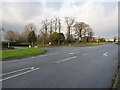
Living in B76 9PN means inhabiting a small, tightly knit residential cluster in England, where the population of 1,476 people is spread across 283 individuals per square kilometre. This compact area suggests a close-knit community, with homes predominantly in the form of houses rather than flats, reflecting a traditional, family-oriented character. The median age of 47 and the prevalence of adults aged 30–64 indicate a mature demographic, likely with established careers and long-term residency. Daily life here is shaped by proximity to essential amenities, from retail outlets to rail connections, while the low flood risk and absence of environmental constraints suggest a stable, practical living environment. Though modest in size, B76 9PN offers a blend of residential comfort and accessibility, with nearby schools, transport hubs, and shops within practical reach. The area’s small scale means it is unlikely to have sprawling developments, instead maintaining a cohesive, localised feel. For those seeking a quieter, less congested environment with direct access to services, B76 9PN presents a straightforward option. Its charm lies in its simplicity: not a bustling city centre, but a functional, well-served residential enclave.
- Area Type
- Postcode
- Area Size
- Not available
- Population
- 1476
- Population Density
- 283 people/km²
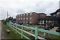
The property market in B76 9PN is characterised by a high rate of home ownership (64%) and a focus on houses rather than flats or apartments. This suggests a housing stock that is largely family-oriented, with properties likely built to accommodate multi-generational households or larger families. The absence of rental data means it is unclear whether the area has a significant buy-to-let or rental market, but the high ownership rate implies that most properties are owner-occupied. As a small, compact postcode area, the housing stock is limited, which may mean that buyers have fewer options and may need to consider nearby areas for additional choices. The predominance of houses also means that the market may cater more to those seeking space and privacy rather than urban convenience. For buyers, this could mean higher competition for available properties, but also the potential for long-term stability in a low-risk, low-density environment.
House Prices in B76 9PN
No properties found in this postcode.
Energy Efficiency in B76 9PN
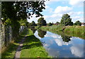
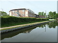
Daily life in B76 9PN is supported by a network of practical amenities, including five retail outlets such as Tesco Water and Asda Minworth, which provide access to groceries, clothing, and household goods. The rail network, with stations like Water Orton and Chester Road, offers convenient links to nearby towns and cities, while the proximity to Birmingham International Airport and railway stations expands travel options. For leisure, the area’s small size means that parks and open spaces are likely limited, but the nearby Sutton Park (though not explicitly named in the data) may be accessible for walking or recreation. The mix of retail, transport, and digital connectivity suggests a lifestyle that balances convenience with a modest, community-focused environment. While not a hub for cultural or entertainment amenities, B76 9PN caters to those prioritising functional living over urban vibrancy.
Amenities
Schools
The nearest school to B76 9PN is Minworth Junior and Infant School, a primary school with an Ofsted rating of ‘good’. This provides families with a reliable option for early education, though no secondary schools are listed in the data. The presence of a primary school with a positive rating suggests that the area is suitable for families with young children, offering access to quality education without the need to travel far. However, the absence of secondary schools means that students may need to commute to nearby towns for further education. The single school listed indicates a limited range of educational options, which could be a consideration for families planning long-term residency. Overall, the school infrastructure in B76 9PN is functional but not extensive, catering primarily to the needs of younger children.
| Rank | School | Type | Entry gender | Ages |
|---|
Explore more schools in this area
Go to Schools tabDemographics
The community in B76 9PN is predominantly composed of adults aged 30–64, with a median age of 47, reflecting a mature, settled population. Home ownership is high, at 64%, indicating a strong presence of long-term residents rather than transient renters. The accommodation type is exclusively houses, which aligns with the area’s low population density and traditional housing stock. The predominant ethnic group is White, though no specific data on diversity or minority representation is provided. This demographic profile suggests a community focused on stability, with fewer young families or students compared to areas with higher proportions of younger age groups. The absence of detailed data on deprivation or income levels means that quality of life indicators such as access to services and safety must be inferred from available metrics. For instance, the medium crime risk score of 58 (out of 100) implies that while not exceptional, standard security measures are advisable. Overall, B76 9PN appears to cater to individuals and families prioritising established, low-risk living over dynamic, rapidly evolving environments.
Household Size
Accommodation Type
Tenure
Ethnic Group
Religion
Household Composition
Age
Household Deprivation
NS-SEC
Explore more demographic insights in this area
Go to Demographics tabPlanning
Planning Constraints
- Flood RiskPremium
- Ramsar Wetland SitesPremium
- Area of Outstanding Natural BeautyPremium
- Protected Nature ReservePremium
- Protected WoodlandPremium