Area Overview for B76 2SR
Photos of B76 2SR
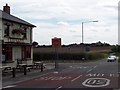
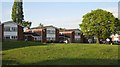
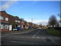
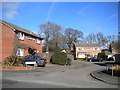

Area Information
B76 2SR represents a specific residential cluster within the broader Royal Town of Sutton Coldfield in the West Midlands. You are looking at a locality defined by its distinct identity as part of the municipality that joined Birmingham in 1974. The total area spans 3,586 square metres, hosting a population of 1,605 residents. This concentration creates a neighbourhood scale where community life remains intimate yet connected to the wider town's history and infrastructure. The character of the area is rooted in its long settlement, which dates back to the Bronze Age, featuring Medieval deer parks that now form the surrounding green spaces. While the specific postcode covers a small cluster, it benefits from the extensive heritage of Sutton Coldfield, including the Royal Charter granted in 1528 and the historic Sutton Park. Living here means residing in a place where the past continues to shape the present, with conservation areas and historic landmarks like Holy Trinity Church defining the local landscape. The environment is stable and safe, with no protected conservation constraints affecting planning potential in this specific zone. This makes B76 2SR a practical choice for those seeking a foothold in a historic town with modern commuter links.
- Area Type
- Postcode
- Area Size
- 3586 m²
- Population
- 1605
- Population Density
- 184 people/km²
Housing in B76 2SR is characterised by a predominance of houses, supporting the high home ownership rate of 85 per cent. You are entering a market where owner-occupiers form the vast majority of the resident base. This suggests that properties here are often sold through traditional estate agencies rather than the high-turnover rental sector common in towns with large student populations. The accommodation stock consists primarily of standalone houses, fitting the profile of a suburb designed for families or couples seeking space. With an area size of only 3,586 square metres, the housing supply is finite, and new development is likely constrained by the existing character and planning constraints. Buyers should expect a mix of established homes, potentially reflecting the historical development since the 19th century. The low population density of 184 people per square kilometre means properties are not tightly packed in high-rise blocks. This setting aligns with the Royal town status of Sutton Coldfield, where property values often reflect the prestige of the locale and the scarcity of independent houses in such compact postcode areas.
House Prices in B76 2SR
Showing 8 properties
| Address | Type | Beds | Baths | Last Sale Price | Last Sale Date | |
|---|---|---|---|---|---|---|
| 163 Springfield Road, Sutton New Hall, Sutton Coldfield, B76 2SR | Semi-detached | 4 | 1 | £428,000 | Oct 2025 | |
| 159 Springfield Road, Sutton New Hall, Sutton Coldfield, B76 2SR | Semi-detached | 3 | 1 | £362,500 | Feb 2024 | |
| 147 Springfield Road, Sutton New Hall, Sutton Coldfield, B76 2SR | Retail | 3 | 1 | £286,000 | Mar 2022 | |
| 143 Springfield Road, Sutton New Hall, Sutton Coldfield, B76 2SR | Semi-detached | 3 | 1 | £267,000 | May 2018 | |
| 149 Springfield Road, Sutton New Hall, Sutton Coldfield, B76 2SR | Semi-detached | 3 | - | £265,000 | Oct 2016 | |
| 161 Springfield Road, Sutton New Hall, Sutton Coldfield, B76 2SR | Semi-detached | - | - | £202,000 | Apr 2006 | |
| 145 Springfield Road, Sutton New Hall, Sutton Coldfield, B76 2SR | Semi-detached | - | - | £118,000 | Jul 2001 | |
| 157 Springfield Road, Sutton New Hall, Sutton Coldfield, B76 2SR | Semi-detached | - | - | £90,000 | Sep 1995 |
Energy Efficiency in B76 2SR
Residents of B76 2SR enjoy convenient access to retail and transport hubs located within practical reach. You can shop at Asda Sutton, Co-op Hollyfield, and Co-op Rectory, ensuring everyday necessities are available without a long drive. These supermarkets and stores form the backbone of the local retail offer. For travel, Sutton Coldfield Railway Station, Wylde Green Railway Station, and Chester Road Railway Station are nearby, providing efficient links beyond the local green lanes. The area is also defined by its green spaces, particularly Sutton Park, which hosts the remaining medieval deer park established for Mercian leaders. This park is a prominent feature of the Laurie's landscape, offering outdoor recreation and historical interest. The conservation area on High Street protects the architectural character of the town, visible in sandstone walls and heritage buildings. While specific dining options or leisure centres are not itemised in the immediate amenity list, the proximity to Sutton Coldfield's main High Street means you are minutes from a wider range of cafes, restaurants, and shops. The blend of commercial convenience and historic green space creates a balanced lifestyle.
Amenities
Schools
Families in B76 2SR have access to local education provision through Holy Cross Catholic Primary School. This institution serves as a primary option for children living in the immediate vicinity. The area does not list secondary schools within the provided data, meaning older children likely travel to other parts of Sutton Coldfield or Birmingham for their secondary education. The presence of two instances of Holy Cross Catholic Primary School in the data points to a strong Catholic educational provision for young learners. Residents must plan carefully regarding secondary school catchment areas, as the local infrastructure focuses on early years and primary education. This concentration of primary provision suggests the immediate neighbourhood is well-suited for families with young children or those planning to spend their school years locally. The lack of listed secondary options highlights that B76 2SR functions as a residential community that feeds into the wider educational network of the Royal Town rather than hosting a full spectrum of local schools.
| Rank | School | Type | Entry gender | Ages |
|---|
Explore more schools in this area
Go to Schools tabDemographics
The community profile of B76 2SR reveals a settled population with a median age of 47 years. The most common age range comprises adults between 30 and 64 years, indicating a neighbourhood dominated by established households. Home ownership stands at 85 per cent, which defines the social fabric of the area as one where residents typically own their properties. Accommodation types predominantly consist of houses, reflecting a preference for detached or semi-detached living rather than flats or shared housing. The predominant ethnic group in this postcode area is White, aligning with the broader demographic trends of the West Midlands. This demographic structure suggests a family-oriented environment where long-term stability is common. The high home ownership rate implies a community invested in the local area, with residents likely involved in local governance and decision-making processes. The age profile indicates fewer young children born in the area compared to family hubs, but the presence of working-age adults supports a quiet, stable daily rhythm.
Household Size
Accommodation Type
Tenure
Ethnic Group
Religion
Household Composition
Age
Household Deprivation
NS-SEC
Explore more demographic insights in this area
Go to Demographics tabPlanning
Planning Constraints
- Flood RiskPremium
- Ramsar Wetland SitesPremium
- Area of Outstanding Natural BeautyPremium
- Protected Nature ReservePremium
- Protected WoodlandPremium