Area Overview for B76 1NY
Photos of B76 1NY
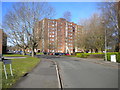
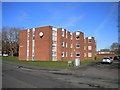
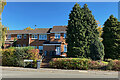
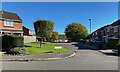
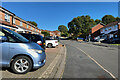
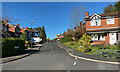
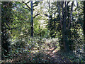
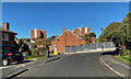
36 photos from this area
Area Information
Key information about the B76 1NY including its size, population, and administrative classification.
- Area Type
- Postcode
- Area Size
- 7076 m²
- Population
- 1424
- Population Density
- 3386 people/km²
House Prices in B76 1NY
10
Properties
£231,750
Average Sold Price
£82,000
Lowest Price
£360,000
Highest Price
Showing 10 properties
| Address | Type | Beds | Baths | Last Sale Price | Last Sale Date | |
|---|---|---|---|---|---|---|
| 1 Hollyfield Road South, Sutton Coldfield, B76 1NY | house | - | - | £360,000 | Apr 2023 | |
| 9 Hollyfield Road South, Sutton Coldfield, B76 1NY | Semi-detached | 4 | 1 | £245,000 | Mar 2016 | |
| 5 Hollyfield Road South, Sutton Coldfield, B76 1NY | house | - | - | £240,000 | Aug 2010 | |
| 3 Hollyfield Road South, Sutton Coldfield, B76 1NY | Semi-detached | - | - | £82,000 | Feb 1997 | |
| Therapia Beauty Clinic, 23A Hollyfield Road South, Sutton Coldfield, B76 1NY | retail_financial | - | - | - | - | |
| Post Office, 21-25 Hollyfield Road South, Sutton Coldfield, B76 1NY | Retail | - | - | - | - | |
| 7 Hollyfield Road South, Sutton Coldfield, B76 1NY | Semi-detached | - | - | - | - | |
| Flat, 17 Hollyfield Road South, Sutton Coldfield, B76 1NY | Flat | - | - | - | - | |
| Flat, 15 Hollyfield Road South, Sutton Coldfield, B76 1NY | retail_financial | - | - | - | - | |
| Flat Over, 25 Hollyfield Road South, Sutton Coldfield, B76 1NY | Flat | - | - | - | - |
Energy Efficiency in B76 1NY
Amenities
Schools
| Rank | School | Type | Entry gender | Ages |
|---|
Explore more schools in this area
Go to Schools tabDemographics
Household Size
One person
most common
Accommodation Type
Houses
most common
Tenure
80
majority
Ethnic Group
White
most common
Religion
N/A
most common
Household Composition
N/A
most common
Age
47
median
Adults (30-64 years)
most common
Household Deprivation
N/A
with no deprivation
NS-SEC
45
in Lower managerial occupations
Explore more demographic insights in this area
Go to Demographics tabPlanning
Planning Constraints
- Flood RiskPremium
- Ramsar Wetland SitesPremium
- Area of Outstanding Natural BeautyPremium
- Protected Nature ReservePremium
- Protected WoodlandPremium