Area Overview for B76 1FD
Photos of B76 1FD
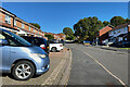
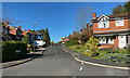
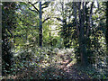
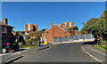
36 photos from this area
Area Information
Key information about the B76 1FD including its size, population, and administrative classification.
- Area Type
- Postcode
- Area Size
- 1.2 hectares
- Population
- 1718
- Population Density
- 2841 people/km²
House Prices in B76 1FD
10
Properties
£369,970
Average Sold Price
£151,000
Lowest Price
£822,809
Highest Price
Showing 10 properties
| Address | Type | Beds | Baths | Last Sale Price | Last Sale Date | |
|---|---|---|---|---|---|---|
| 2 Forest Park, Sutton Coldfield, B76 1FD | Detached | 7 | 5 | £822,809 | Aug 2023 | |
| 16 Forest Park, Sutton Coldfield, B76 1FD | Retail | 4 | 3 | £617,500 | May 2022 | |
| 14 Forest Park, Sutton Coldfield, B76 1FD | house | - | - | £475,000 | Apr 2014 | |
| 4 Forest Park, Sutton Coldfield, B76 1FD | Detached | - | - | £249,950 | Aug 2000 | |
| 18 Forest Park, Sutton Coldfield, B76 1FD | Detached | - | - | £225,000 | Aug 1999 | |
| 10 Forest Park, Sutton Coldfield, B76 1FD | Detached | - | - | £225,000 | Apr 1999 | |
| 20 Forest Park, Sutton Coldfield, B76 1FD | Detached | - | - | £151,000 | May 1998 | |
| 6 Forest Park, Sutton Coldfield, B76 1FD | Detached | - | - | £193,500 | Oct 1996 | |
| 8 Forest Park, Sutton Coldfield, B76 1FD | Detached | - | - | - | - | |
| 12 Forest Park, Sutton Coldfield, B76 1FD | Detached | - | - | - | - |
Energy Efficiency in B76 1FD
Amenities
Schools
| Rank | School | Type | Entry gender | Ages |
|---|
Explore more schools in this area
Go to Schools tabDemographics
Household Size
Family (3-5 people)
most common
Accommodation Type
Houses
most common
Tenure
84
majority
Ethnic Group
White
most common
Religion
N/A
most common
Household Composition
N/A
most common
Age
47
median
Adults (30-64 years)
most common
Household Deprivation
N/A
with no deprivation
NS-SEC
50
in Lower managerial occupations
Explore more demographic insights in this area
Go to Demographics tabPlanning
Planning Constraints
- Flood RiskPremium
- Ramsar Wetland SitesPremium
- Area of Outstanding Natural BeautyPremium
- Protected Nature ReservePremium
- Protected WoodlandPremium