Area Overview for B76 0BH
Photos of B76 0BH


Area Information
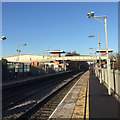
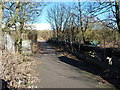
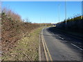
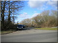
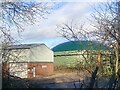
B76 0BH is a small residential postcode area nestled in North Warwickshire, close to Birmingham’s eastern fringes. With a population of 1,619 and a density of 93 people per square kilometre, it reflects a compact, tight-knit community. The area’s historical roots run deep: Curdworth, the village it borders, dates back to the 6th or 7th centuries and was the first Anglo-Saxon settlement in the Midlands. Its strategic position between the M42 and M6 Toll motorways, alongside the A4097 Kingsbury Road, makes it a gateway to nearby towns like Sutton Coldfield. Daily life here blends rural charm with modern connectivity. Residents benefit from proximity to Birmingham International Airport and railway stations such as Coleshill Parkway, offering easy access to the city. The village itself, with its award-winning upkeep and historic sites like the Church of St Nicholas and Peter ad Vincula, retains a distinct character. This is a place where history meets practicality, appealing to those seeking a quieter lifestyle without sacrificing accessibility.
- Area Type
- Postcode
- Area Size
- Not available
- Population
- 1619
- Population Density
- 93 people/km²
B76 0BH is a predominantly owner-occupied area, with 87% of properties owned by residents rather than rented. The accommodation type is largely houses, which is unusual for a small postcode area but suggests a focus on family homes or single-occupancy properties. This composition indicates a market where property values are likely to be stable, with fewer rental options available. The limited size of the area means the housing stock is constrained, potentially making it challenging for buyers seeking a wide selection. However, the high home ownership rate implies a community that prioritises long-term residency, which can be an advantage for those looking for a settled environment. Buyers should note that the market is not driven by short-term rentals or speculative investment, but by residents seeking durable, family-friendly homes.
House Prices in B76 0BH
No properties found in this postcode.
Energy Efficiency in B76 0BH
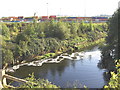
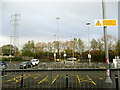
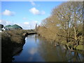
Living in B76 0BH offers a blend of rural tranquillity and accessible amenities. Nearby, residents can shop at Tesco Water, Aldi Station, and Morrisons Coleshill, while the King George V Playing Field provides open space for recreation. The Birmingham and Fazeley Canal runs through the area, offering leisure opportunities. The village’s historical sites, including the Church of St Nicholas and Peter ad Vincula, add cultural depth. Proximity to Birmingham International Airport and railway stations ensures easy travel, though the area’s small size means most amenities are concentrated within a short drive. The village’s recognition as Best Kept in Warwickshire underscores its maintained appearance, appealing to those who value aesthetics and community pride.
Amenities
Schools
The nearest school to B76 0BH is Curdworth Primary School, a primary education institution serving the local community. The presence of a primary school is critical for families with young children, though no secondary schools are listed in the data. The repetition of Curdworth Primary School in the dataset may indicate its prominence as the sole primary option for the area. For families requiring secondary education, residents would need to look beyond B76 0BH, potentially commuting to nearby towns like Coleshill or Birmingham. The absence of secondary schools highlights a potential limitation for households with older children, though the primary school’s availability ensures early education needs are met.
| Rank | School | Type | Entry gender | Ages |
|---|
Explore more schools in this area
Go to Schools tabDemographics
The population of B76 0BH is predominantly middle-aged, with a median age of 47 and most residents falling within the 30-64 age range. Home ownership is high at 87%, indicating a stable, long-term community. The accommodation type is primarily houses, suggesting a mix of family homes and single-occupancy properties. The predominant ethnic group is White, though specific diversity metrics are not provided. The age profile and ownership rates point to a community that values stability and long-term investment. With 93 people per square kilometre, the area is neither densely packed nor overly sparse, offering a balance between privacy and proximity to amenities. The lack of explicit data on deprivation means quality of life factors like healthcare access or public services remain unquantified, but the high home ownership rate implies a generally affluent or secure demographic.
Household Size
Accommodation Type
Tenure
Ethnic Group
Religion
Household Composition
Age
Household Deprivation
NS-SEC
Explore more demographic insights in this area
Go to Demographics tabPlanning
Planning Constraints
- Flood RiskPremium
- Ramsar Wetland SitesPremium
- Area of Outstanding Natural BeautyPremium
- Protected Nature ReservePremium
- Protected WoodlandPremium