Area Overview for B75 7LE
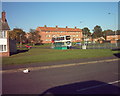
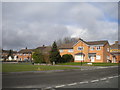
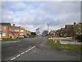
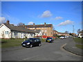
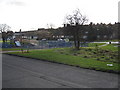
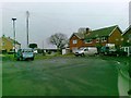
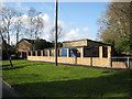
Photos of B75 7LE

Area Information
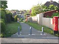
Living in B75 7LE means being part of a small, tightly knit residential cluster in England’s West Midlands. With a population of 1,651, this postcode area reflects a mature community, where the median age of 47 suggests a stable demographic profile. The area’s character is shaped by its history as a royal town, with roots tracing back to the medieval period and a legacy of royal charters granted by Henry VIII. Residents benefit from proximity to Sutton Coldfield’s amenities, including retail hubs like Asda Sutton and Tesco Coldfield, as well as rail links to Sutton Coldfield Railway Station and Wylde Green. The area’s digital connectivity is robust, with a broadband score of 94 and mobile coverage rated 85, ensuring seamless online access for work or leisure. While the community is predominantly White and home ownership stands at 61%, the area’s small size fosters a sense of familiarity. For those seeking a balance between historical charm and modern convenience, B75 7LE offers a quiet yet connected lifestyle.
- Area Type
- Postcode
- Area Size
- Not available
- Population
- 1651
- Population Density
- 2097 people/km²
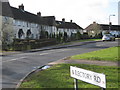
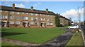
The property market in B75 7LE is characterised by a 61% home ownership rate, with houses forming the majority of the accommodation stock. This suggests a community where many residents are long-term homeowners, rather than renters. The predominance of houses over flats indicates a focus on family-friendly, spacious living, which may appeal to those seeking traditional homes rather than modern apartments. Given the area’s small size, the housing stock is likely limited, making it a niche market for buyers prioritising proximity to local amenities and historical features. The high home ownership rate also implies that rental properties are less common, potentially reducing competition for buyers. However, the area’s compact nature means that property values may be influenced more by local factors, such as proximity to schools and transport links, than by broader regional trends.
House Prices in B75 7LE
No properties found in this postcode.
Energy Efficiency in B75 7LE
The lifestyle in B75 7LE is shaped by its proximity to essential amenities, including five retail venues such as Asda Sutton and Tesco Coldfield, which provide everyday shopping convenience. The area’s rail stations, including Sutton Coldfield Railway Station and Wylde Green, offer practical access to commuting routes and regional travel. While the data does not explicitly mention parks or leisure facilities, the historical context of Sutton Coldfield suggests nearby green spaces, such as Sutton Park, which may be accessible to residents. The presence of retail and rail options contributes to a lifestyle that balances local convenience with connectivity to broader networks. For those valuing ease of access to shops and transport, B75 7LE offers a practical base, though the absence of detailed information on leisure facilities means their extent remains unconfirmed.
Amenities
Schools
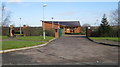
Residents of B75 7LE have access to a mix of primary and special schools, including New Hall Primary School, which holds a good Ofsted rating, and Lindridge Junior School, both of which cater to younger children. Trinity Specialist College provides education for students with specific needs, offering a tailored approach to learning. This combination of school types ensures that families have options for both mainstream and specialist education. The presence of a special school highlights the area’s commitment to inclusive education, while the good Ofsted rating at New Hall Primary suggests a reliable foundation for early years’ learning. For parents, the availability of these schools within practical reach reduces the need for long commutes, supporting a balanced lifestyle. However, the absence of secondary schools in the data means that older students may need to travel further for secondary education.
| Rank | School | Type | Entry gender | Ages |
|---|
Explore more schools in this area
Go to Schools tabDemographics
The population of B75 7LE is 1,651, with a median age of 47, indicating a community skewed toward middle-aged and older residents. The most common age range is 30–64 years, suggesting a stable, family-oriented demographic. Home ownership is strong, at 61%, with houses being the predominant accommodation type. The area is predominantly White, reflecting a homogenous ethnic profile. This demographic structure implies a mature, settled population with established routines and long-term residency. The absence of specific deprivation data means the quality of life is not explicitly tied to socioeconomic factors, but the high home ownership rate suggests a degree of financial stability. The area’s small size and low population density likely contribute to a close-knit community feel, where residents may know their neighbours personally.
Household Size
Accommodation Type
Tenure
Ethnic Group
Religion
Household Composition
Age
Household Deprivation
NS-SEC
Explore more demographic insights in this area
Go to Demographics tabPlanning
Planning Constraints
- Flood RiskPremium
- Ramsar Wetland SitesPremium
- Area of Outstanding Natural BeautyPremium
- Protected Nature ReservePremium
- Protected WoodlandPremium