Area Overview for B75 7DA
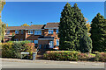
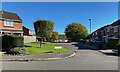
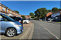
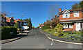
Photos of B75 7DA


Area Information
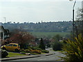
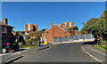
The postcode area B75 7DA covers a specific residential cluster within the broader historic town of Sutton Coldfield. This settlement falls under the royal town's jurisdiction and lies approximately at coordinates 52.534747, -1.833367, situated just south of the boundary with Tamworth. The area consists of roughly 1,500 residents living in a tight-knit community characterised by low density housing and established character. Sutton Coldfield operates as part of Birmingham since 1974, yet it retains its distinct identity dating back to the Anglo-Saxon period when the name meant "south town". Living in B75 7DA offers a quiet residential experience with a median age of 47, suggesting a demographic skewed towards established families and mature adults. The housing stock is predominantly houses rather than flats, aligning with the town's traditional architectural heritage. You will find yourself in an environment where the modern world connects seamlessly through excellent digital infrastructure, while the local landscape avoids significant planning constraints such as flood risks or designated nature reserves. The area supports a population of 1,499 people, creating a neighbourhood that feels intimate yet benefits from the wider resources of a historic market town.
- Area Type
- Postcode
- Area Size
- Not available
- Population
- 1499
- Population Density
- 1725 people/km²
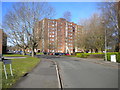
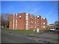
The property market in B75 7DA is driven by owner-occupiers rather than private renters or landlords. With home ownership sitting at 65%, the area functions as a traditional family borough where residents purchase to stay rather than invest for short-term gain. Houses dominate the accommodation type, meaning you will not find large blocks of flats or high-density conversions. This housing stock is typical of Sutton Coldfield's evolution from a Mercian hunting lodge to a coaching town, preserving a consistent architectural narrative. The majority of residents buy direct from the open market or second-hand exchanges, creating a seller's market where properties change hands slowly. This dynamic ensures that buyers entering the market in B75 7DA are committing to a long-term home. The specific nature of the postcode cluster means that supply is limited, often requiring purchasers to look at the wider Sutton Coldfield stock if their requirements are not met by this small residential node. The absence of rental pressure helps maintain property values relative to the median age of the residents. Families looking for homes in B75 7DA can expect a stable, predictable transaction environment.
House Prices in B75 7DA
No properties found in this postcode.
Energy Efficiency in B75 7DA
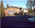
Your daily life in B75 7DA benefits from a practical selection of amenities clustered just beyond the residential boundary. Retail options include Co-op Hollyfield and Co-op Rectory, which provide essential grocery and daily essentials without requiring a long drive. You can also visit Aldi Sutton for budget-friendly shopping, placing five key retail outlets within easy walking or short driving distance. For rail-dependent residents, the network encompasses Sutton Coldfield Railway Station, Wylde Green Railway Station, and Four Oaks Railway Station, giving you five stations to choose from depending on your destination. The character of the area reflects its history as a former hunting lodge and royal residence, with Sutton Park standing as a nearby landmark. The narrative of the area stretches back to the Bronze Age and includes the operation of 15 watermills historically. Today, you enjoy a modern convenience that blends with this historical depth. The presence of these shops and stations means you do not need to travel far for basic needs, maintaining the quiet integrity of the neighbourhood while ensuring you are not isolated from commercial services.
Amenities
Schools
Families living in B75 7DA have direct access to local education provision within the area. Whitehouse Common Infant School caters to the younger years of primary education, serving as the first port of call for children entering the system. Adjacent to this is the Whitehouse Common Junior School, which picks up pupils at the transition point to teenage years. For families requiring a broader curriculum or a single-nickname institution, the Whitehouse Common Primary School is also available in the vicinity. All three educational institutions listed fall under the primary education umbrella, meaning secondary school attendance requires travelling further afield. The Whitehouse Common Primary School holds a 'good' Ofsted rating, a specific designation confirming its quality and performance standards despite the name variations in the area. This rating is crucial for parents assessing the environment for their children. The proximity of these schools to the residential cluster suggests that local families are served by a cohesive educational package within the commune.
| Rank | School | Type | Entry gender | Ages |
|---|
Explore more schools in this area
Go to Schools tabDemographics
Residents of B75 7DA form a community defined by stability and maturity. The median age here is 47 years, with the most common age range consisting of adults between 30 and 64 years old. This demographic profile indicates a population that has settled permanently rather than_FLOW transit through temporary accommodation. Home ownership stands at 65%, a figure that significantly outpaces national rental averages and suggests a deep-rooted connection to the place. This level of ownership typically correlates with higher job security and long-term investment in local improvements. You will find that the predominant ethnic group is White, reflecting the town's traditional character established over centuries. This socio-economic stability is reinforced by the accommodation type; the area consists almost entirely of houses. This mix creates a suburban feel where noise levels remain low and community events centre around street and group interactions rather than high-density developments. The age distribution means that local shops and services often cater to families without young children alongside retirees and working professionals. There is no data on specific deprivation metrics, but the high ownership rate suggests financial resilience within the household structure.
Household Size
Accommodation Type
Tenure
Ethnic Group
Religion
Household Composition
Age
Household Deprivation
NS-SEC
Explore more demographic insights in this area
Go to Demographics tabPlanning
Planning Constraints
- Flood RiskPremium
- Ramsar Wetland SitesPremium
- Area of Outstanding Natural BeautyPremium
- Protected Nature ReservePremium
- Protected WoodlandPremium