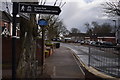
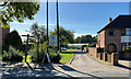
Area Overview for B75 7BS
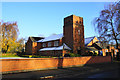
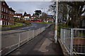
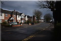
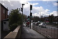
Photos of B75 7BS


Area Information
This postcode area represents a specific residential cluster covering approximately 5115 square metres. You will find a resident population of 1499 people living within this compact boundary. The location sits within the broader royal town of Sutton Coldfield, historically significant for its medieval deer park origins and industrial milling past. Although human settlement dates back to the Bronze Age and the area surpassed the status of a market town under Edward I, the modern character focuses on stable housing. The geographical size suggests a tight-knit neighbourhood where residents know one another. Daily life here revolves around immediate access to local services rather than extensive urban sprawl. The area maintains a population density of 293040 people per square kilometre, indicating very concentrated living arrangements within this specific postcode boundary. For those seeking a home in this smaller cluster, the environment feels distinct from the wider town while benefiting from Sutton Coldfield's historic infrastructure. The location continues to attract buyers who value proximity to local amenities within the broader Sutton Coldfield framework.
- Area Type
- Postcode
- Area Size
- 5115 m²
- Population
- 1499
- Population Density
- 1725 people/km²
Looking at the property market in this specific postcode, you encounter a landscape defined by stability. Sixty-five percent of residents own their homes, meaning the local stock is overwhelmingly occupied rather than rented out. The accommodation type categories to houses indicate that buyers in this area seek detached or semi-detached properties typical of a royal town setting. This high ownership rate suggests that the housing here is frequently bought and sold on the open market rather than passed down solely within families or leased long-term. For those searching for homes in this cluster, the stock likely offers space and gardens common to Buckingham detached styles found in Sutton Coldfield. The limited square metreage of the postcode means inventory is finite, requiring quick decision-making. With such a high percentage of owner-occupiers, competition for suitable properties may be intense. Buyers should note that the market here mirrors the broader trend of the West Midlands, where established households dominate the sales figures.
House Prices in B75 7BS
No properties found in this postcode.
Energy Efficiency in B75 7BS
Residents of this postcode enjoy practical access to specific retail and transport hubs. Within practical reach, you can visit Co-op Rectory or Co-op Hollyfield for weekly groceries and household essentials. Aldi Sutton provides another major shopping option for those seeking value and large supermarket availability. For rail commuters, five stations lie within reach, including Sutton Coldfield Railway Station, Wylde Green Railway Station, and Four Oaks Railway Station. These stations provide direct links to the wider Birmingham network and beyond. The concentration of five retail venues ensures you can run most errands without leaving the immediate vicinity. Travel by train remains a viable daily option because of the proximity to multiple termini. This blend of local convenience and wider rail connectivity defines the lifestyle for anyone choosing to live in this area. You have the freedom to shop locally or travel further without compromise.
Amenities
Schools
Families moving to this postcode will find several educational institutions nearby. Whitehouse Common Infant School serves as a primary option for younger children. Whitehouse Common Junior School caters to older primary-age pupils. Whitehouse Common Primary School, which holds an Ofsted rating of good, combines both infant and education for a continuous primary experience. This mix of single-phase and two-phase schools offers flexibility for parents depending on their child's specific needs. The presence of a school with a good rating directly impacts the desirability of homes in the immediate vicinity. Every school listed operates within the local education framework to serve the catchment area of Sutton Coldfield. Parents seeking living in this area should review which schools fall under their child's specific catchment boundaries. The availability of primary education options means you do not need to commute far during the school run.
| Rank | School | Type | Entry gender | Ages |
|---|
Explore more schools in this area
Go to Schools tabDemographics
The community in this postcode area is dominated by adults between the ages of 30 and 64 years. The median age stands at 47, confirming that the neighbourhood attracts a mature demographic. Seventy-five percent of residents own their homes outright, creating a sense of stability within the cluster. Accommodation in B75 7BS consists primarily of houses rather than flats or apartments. The predominant ethnic group among residents is White, reflecting the composition of the wider royal town. This demographic profile suggests a settled family environment where long-term residents exert significant influence over local character. The high home ownership rate means property prices tend to reflect owner-occupier demand rather than a volatile rental market. Older age groups holding properties may shape the availability of family-sized homes. The concentration of adults in their working years supports local demand for services catering to established households.
Household Size
Accommodation Type
Tenure
Ethnic Group
Religion
Household Composition
Age
Household Deprivation
NS-SEC
Explore more demographic insights in this area
Go to Demographics tabPlanning
Planning Constraints
- Flood RiskPremium
- Ramsar Wetland SitesPremium
- Area of Outstanding Natural BeautyPremium
- Protected Nature ReservePremium
- Protected WoodlandPremium