Area Overview for B75 7BH
Photos of B75 7BH
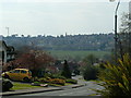
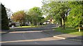
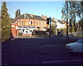
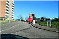
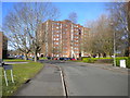
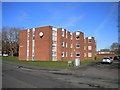
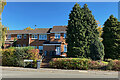
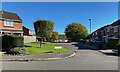
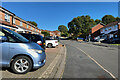
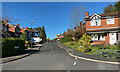
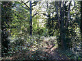
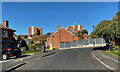
36 photos from this area
Area Information
Key information about the B75 7BH including its size, population, and administrative classification.
- Area Type
- Postcode
- Area Size
- 8765 m²
- Population
- 1424
- Population Density
- 3386 people/km²
House Prices in B75 7BH
13
Properties
£302,250
Average Sold Price
£135,000
Lowest Price
£600,000
Highest Price
Showing 13 properties
| Address | Type | Beds | Baths | Last Sale Price | Last Sale Date | |
|---|---|---|---|---|---|---|
| 15 Reddicap Hill, Sutton Coldfield, B75 7BH | Detached | 3 | 1 | £520,000 | Mar 2025 | |
| 4 Reddicap Hill, Sutton Coldfield, B75 7BH | Semi-detached | 3 | 1 | £358,000 | Aug 2022 | |
| 1 Reddicap Hill, Sutton Coldfield, B75 7BH | house | - | - | £600,000 | Oct 2020 | |
| 2 Reddicap Hill, Sutton Coldfield, B75 7BH | Semi-detached | 3 | 1 | £190,000 | Aug 2015 | |
| 6 Reddicap Hill, Sutton Coldfield, B75 7BH | house | 3 | - | £189,000 | May 2011 | |
| 9 Reddicap Hill, Sutton Coldfield, B75 7BH | Detached | 4 | 2 | £230,000 | May 2011 | |
| 8 Reddicap Hill, Sutton Coldfield, B75 7BH | Semi-detached | - | - | £196,000 | Mar 2007 | |
| 7 Reddicap Hill, Sutton Coldfield, B75 7BH | house | 4 | - | £135,000 | Oct 2001 | |
| 1A Reddicap Hill, Sutton Coldfield, B75 7BH | Detached | 5 | 4 | - | - | |
| 3A Reddicap Hill, Sutton Coldfield, B75 7BH | house | - | - | - | - |
Page 1 of 2
Energy Efficiency in B75 7BH
Amenities
Schools
| Rank | School | Type | Entry gender | Ages |
|---|
Explore more schools in this area
Go to Schools tabDemographics
Household Size
One person
most common
Accommodation Type
Houses
most common
Tenure
80
majority
Ethnic Group
White
most common
Religion
N/A
most common
Household Composition
N/A
most common
Age
47
median
Adults (30-64 years)
most common
Household Deprivation
N/A
with no deprivation
NS-SEC
45
in Lower managerial occupations
Explore more demographic insights in this area
Go to Demographics tabPlanning
Planning Constraints
- Flood RiskPremium
- Ramsar Wetland SitesPremium
- Area of Outstanding Natural BeautyPremium
- Protected Nature ReservePremium
- Protected WoodlandPremium