Area Overview for B75 6TR
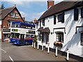
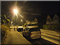
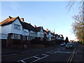
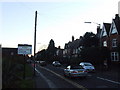
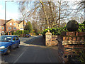
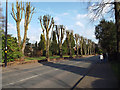
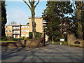
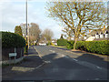
Photos of B75 6TR

Area Information
Living in postcode area B75 6TR means residing within a specific residential cluster defined by its proximity to the historic royal town of Sutton Coldfield. This area covers 5370 m² and forms a tight-knit community with a population of 1689 people. The location benefits from a rich local heritage, situated near landmarks such as Holy Trinity Church and Sutton Park, which retains its medieval character as a former deer park established for Mercian leaders. While the specific street layout of B75 6TR is small, it is embedded in a region that transformed significantly with the arrival of railways in the mid-19th century, originally opening on 2 June 1862. Daily life here is influenced by the town's long history, stretching back to Bronze Age settlements and Anglo-Saxon periods. The area lies just south of Tamworth, historically the capital of Mercia, and carries the name "Sutton Coldfield" which denotes either a cold field or a place of charcoal burning. Modern residents enjoy living in an environment that balances historical significance with contemporary convenience. The high level of home ownership suggests a stable environment where families and retirees have put down roots over generations. You are buying into a setting where the past informs the present, offering a distinct sense of place within the broader West Midlands region without the overwhelming scale of neighbouring Birmingham.
- Area Type
- Postcode
- Area Size
- 5370 m²
- Population
- 1689
- Population Density
- 3862 people/km²
The property market in B75 6TR is characterised by stability and ownership. Eighty-eight per cent of homes in this postcode are owner-occupied, creating a neighbourhood where residents have a long-term stake in their properties. The accommodation type is primarily houses, which fits the profile of the wider Sutton Coldfield area known for its substantial family homes. This high ownership rate suggests that the local housing stock is not dominated by short-term rentals or student accommodations. Instead, you are looking at an area where families have purchased homes to stay for years. When searching for homes in B75 6TR, expectations should be set around established properties within a specific residential cluster. The size of the area, covering just 5370 m², implies that individual plots and gardens are likely well-managed with little vacant land between dwellings. Buying here offers the opportunity to join a community where most neighbours have decided they do not wish to move. The lack of rental pressure and the prevalence of owner-occupied stock often lead to lower turnover rates compared to city centre locations. Potential buyers can expect a market driven by first-time movers to the outskirts and upgraders seeking space in the royal town's environs.
House Prices in B75 6TR
Showing 11 properties
| Address | Type | Beds | Baths | Last Sale Price | Last Sale Date | |
|---|---|---|---|---|---|---|
| 5 Ridgewood Drive, Sutton Coldfield, B75 6TR | Detached | 4 | 1 | £470,000 | Dec 2023 | |
| 4 Ridgewood Drive, Sutton Coldfield, B75 6TR | house | - | - | £420,000 | Apr 2021 | |
| 6 Ridgewood Drive, Sutton Coldfield, B75 6TR | Detached | 4 | 2 | £390,000 | Oct 2019 | |
| 7 Ridgewood Drive, Sutton Coldfield, B75 6TR | Detached | 4 | 2 | £412,500 | Jun 2017 | |
| 9 Ridgewood Drive, Sutton Coldfield, B75 6TR | house | - | - | £330,000 | Jun 2017 | |
| 1 Ridgewood Drive, Sutton Coldfield, B75 6TR | house | - | - | £290,000 | Apr 2017 | |
| 2 Ridgewood Drive, Sutton Coldfield, B75 6TR | house | 4 | - | £266,000 | Aug 2010 | |
| 12 Ridgewood Drive, Sutton Coldfield, B75 6TR | Detached | 5 | 2 | £225,000 | Jun 2010 | |
| 8 Ridgewood Drive, Sutton Coldfield, B75 6TR | Detached | - | - | £179,950 | Jan 2001 | |
| 10 Ridgewood Drive, Sutton Coldfield, B75 6TR | house | - | - | - | - |
Energy Efficiency in B75 6TR
Daily life in B75 6TR benefits from convenient access to practical amenities that require only short trips. Within walking reach or a brief drive, you will find five retail locations and five rail-connected spots that serve daily needs. Specific supermarkets such as Cook Mere, Sainsburys Mere, and Aldi Belwell Lane provide readily available groceries and household essentials. These stores are located near the doorstep, meaning you do not need to plan long journeys for routine shopping. The presence of these familiar high-street brands adds convenience and stability to the local high street environment. Additionally, five railway stations are accessible from this postcode, offering quick connections to Greater Sutton Coldfield and beyond. The area's layout supports a lifestyle where local everything is prioritised, from daily food shops to community transit hubs. While the postcode covers a small footprint of 5370 m², its connection to the wider Sutton Coldfield infrastructure ensures you are never isolated. You can expect a functional lifestyle without the need for excessive car dependency, supported by a compact network of shops and transport links designed to serve residents efficiently.
Amenities
Schools
Families living in B75 6TR have immediate access to a range of educational facilities, each serving different needs within the local system. Coppice Infant School is a primary school located nearby, providing education for younger children. Just beyond that, Coppice Junior School caters to older primary-age pupils. The educational journey continues at Langley School, which operates as a special school, offering tailored support for specific educational needs. Furthermore, Coppice Primary School serves the community, holding an Ofsted rating of "good", which indicates a standard of education that meets required criteria. This mix of primary and special education provisions means the local area caters to diverse learning requirements. Residents do not need to travel far to ensure their children receive quality schooling. The presence of a primary school with a "good" rating provides reassurance to parents regarding the educational standards available at a local level. These institutions are situated within practical reach of the 1689 residents, ensuring that daily school runs are manageable. The combination of infant, junior, and special schools reflects a comprehensive approach to local education that serves the community's specific demographic composition.
| Rank | School | Type | Entry gender | Ages |
|---|
Explore more schools in this area
Go to Schools tabDemographics
The community within postcode B75 6TR reflects a mature and established population. The median age stands at 47 years, with adults aged between 30 and 64 years comprising the most common age range. This demographic profile indicates that the area is not dominated by children or the very elderly, suggesting a mix of mid-life families, older adults, and perhaps some young professionals settling earlier than usual. A defining feature of this community is the exceptionally high rate of home ownership, which sits at 88%. This figure demonstrates that the vast majority of residents own their properties outright or have significant equity, fostering a stable neighbourhood environment. Accommodation types are predominantly houses, aligning with the suburban feel of Sutton Coldfield and its surrounding boroughs. The area is overwhelmingly White, matching the predominant ethnic group across much of the West Midlands. With a population of 1689 people, B75 6TR is a small but concentrated community. The high density figure of 314496 people per km² reflects the specific measurement of this small postcode area rather than the vast sparseness of the wider countryside. Residents here likely enjoy a quieter, more private lifestyle compared to larger urban centres, with the social fabric built around established homes and local facilities rather than transient populations.
Household Size
Accommodation Type
Tenure
Ethnic Group
Religion
Household Composition
Age
Household Deprivation
NS-SEC
Explore more demographic insights in this area
Go to Demographics tabPlanning
Planning Constraints
- Flood RiskPremium
- Ramsar Wetland SitesPremium
- Area of Outstanding Natural BeautyPremium
- Protected Nature ReservePremium
- Protected WoodlandPremium