Area Overview for B75 6SD
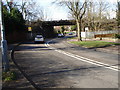
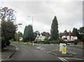
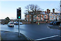
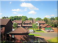
Photos of B75 6SD


Area Information
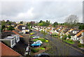
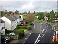
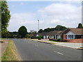
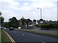
B75 6SD is a small, tightly knit residential postcode area in England, home to 1,689 people. Nestled within the broader Sutton Coldfield region, this area reflects the town’s historic character as a royal settlement, with roots tracing back to the medieval period. Sutton Coldfield, once a hunting ground for Mercian kings, became part of Birmingham in 1974, yet retains its distinct identity. The area’s compact size means residents live in close proximity to amenities, schools, and transport links. Daily life here is shaped by a mature demographic, with a median age of 47 and a strong presence of adults aged 30–64. Home ownership is high at 88%, suggesting a stable, long-term community. The area’s small footprint and residential focus make it ideal for those seeking a quieter, family-oriented environment. With no major industrial or commercial hubs nearby, B75 6SD prioritises residential comfort, supported by good digital connectivity and low crime rates. Its proximity to Sutton Park and historic sites like Holy Trinity Church adds a layer of cultural and recreational value. For buyers, this area offers a blend of practicality and heritage, with homes predominantly in traditional house styles.
- Area Type
- Postcode
- Area Size
- Not available
- Population
- 1689
- Population Density
- 3862 people/km²
B75 6SD is a small, residential postcode area where 88% of properties are owner-occupied, indicating a strong preference for long-term residency over rental living. The accommodation type is predominantly houses, which suggests a suburban or semi-rural character with limited high-rise or apartment developments. This makes the area appealing to families or individuals seeking traditional, spacious homes. The small size of the postcode means the housing stock is likely limited to a cluster of properties, possibly with a mix of older and newer builds. For buyers, this presents both opportunities and constraints: the area’s compact nature may limit availability, but the high home ownership rate suggests a stable market with little turnover. Proximity to Sutton Coldfield’s amenities, including schools and transport links, adds to its appeal. However, the lack of commercial or industrial development means property values are unlikely to be driven by speculative investment. Buyers should consider the area’s small footprint when evaluating its long-term viability.
House Prices in B75 6SD
No properties found in this postcode.
Energy Efficiency in B75 6SD
Living in B75 6SD offers access to essential amenities within walking or short driving distance. Retail options include M&S Sutton Coldfield, Morrisons Daily Sutton, and Cook Mere, providing grocery, clothing, and general shopping needs. The area’s rail stations, such as Four Oaks and Sutton Coldfield Town, connect residents to broader networks, enhancing access to employment, leisure, and services beyond the immediate postcode. While the data does not specify dining or leisure venues, the proximity to Sutton Coldfield’s historic and natural sites—such as Sutton Park—suggests opportunities for outdoor recreation. The town’s heritage, including Holy Trinity Church and Bishop Vesey’s Grammar School, adds cultural value. However, the absence of detailed information on local pubs, cafes, or parks means the full lifestyle picture remains partial. Nonetheless, the combination of retail, transport, and nearby green spaces indicates a functional, community-oriented environment.
Amenities
Schools
Residents of B75 6SD have access to a range of schools, including three primary schools and one special school. Coppice Primary School, Coppice Junior School, and Coppice Infant School all hold a ‘good’ Ofsted rating, indicating strong educational provision for younger children. Langley School, a special school, serves students with specific educational needs. The mix of school types ensures families can find appropriate education for children of all ages, from early years to specialist support. The presence of multiple primary schools in close proximity suggests a focus on local, community-based education. However, no secondary schools are listed in the data, so families may need to look beyond the immediate area for comprehensive schooling. The high quality of primary education here, combined with the availability of a special school, makes B75 6SD an attractive option for families prioritising educational standards.
| Rank | School | Type | Entry gender | Ages |
|---|
Explore more schools in this area
Go to Schools tabDemographics
The population of B75 6SD is 1,689, with a median age of 47. The majority of residents fall within the 30–64 age range, indicating a community skewed towards middle-aged adults. Home ownership is exceptionally high at 88%, suggesting a stable, long-term resident base with limited rental activity. The predominant accommodation type is houses, reflecting a suburban or semi-rural character rather than high-density living. The predominant ethnic group is White, though no further breakdown of diversity is provided. This demographic profile implies a mature, established community with strong family ties. The absence of specific data on deprivation or income levels means the area’s socioeconomic challenges cannot be assessed here, but the high home ownership rate and median age suggest a relatively affluent, settled population. The age distribution also indicates a low proportion of young children or elderly residents, which may influence local service provision and school demand.
Household Size
Accommodation Type
Tenure
Ethnic Group
Religion
Household Composition
Age
Household Deprivation
NS-SEC
Explore more demographic insights in this area
Go to Demographics tabPlanning
Planning Constraints
- Flood RiskPremium
- Ramsar Wetland SitesPremium
- Area of Outstanding Natural BeautyPremium
- Protected Nature ReservePremium
- Protected WoodlandPremium