Area Overview for B75 6EU
Photos of B75 6EU


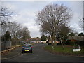


15 photos from this area
Area Information
Key information about the B75 6EU including its size, population, and administrative classification.
- Area Type
- Postcode
- Area Size
- 9236 m²
- Population
- 1499
- Population Density
- 3700 people/km²
House Prices in B75 6EU
13
Properties
£425,661
Average Sold Price
£266,000
Lowest Price
£750,000
Highest Price
Showing 13 properties
| Address | Type | Beds | Baths | Last Sale Price | Last Sale Date | |
|---|---|---|---|---|---|---|
| 187 Whitehouse Common Road, Sutton Coldfield, B75 6EU | Semi-detached | 4 | 2 | £500,000 | Jun 2023 | |
| 185 Whitehouse Common Road, Sutton Coldfield, B75 6EU | Detached | 4 | 3 | £750,000 | Jun 2023 | |
| 201 Whitehouse Common Road, Sutton Coldfield, B75 6EU | Detached | 3 | 1 | £430,000 | Oct 2020 | |
| 193 Whitehouse Common Road, Sutton Coldfield, B75 6EU | Semi-detached | 3 | 1 | £330,000 | Nov 2018 | |
| 197 Whitehouse Common Road, Sutton Coldfield, B75 6EU | Detached | 4 | 1 | £495,000 | Oct 2018 | |
| 181 Whitehouse Common Road, Sutton Coldfield, B75 6EU | Detached | 5 | - | £465,000 | Dec 2014 | |
| 189 Whitehouse Common Road, Sutton Coldfield, B75 6EU | Semi-detached | 4 | 2 | £325,000 | Oct 2014 | |
| 199 Whitehouse Common Road, Sutton Coldfield, B75 6EU | Detached | - | - | £266,000 | May 2004 | |
| 203 Whitehouse Common Road, Sutton Coldfield, B75 6EU | Detached | 7 | - | £269,950 | Feb 2003 | |
| 183 Whitehouse Common Road, Sutton Coldfield, B75 6EU | Detached | - | - | - | - |
Page 1 of 2
Energy Efficiency in B75 6EU
Amenities
Schools
| Rank | School | Type | Entry gender | Ages |
|---|
Explore more schools in this area
Go to Schools tabDemographics
Household Size
Family (3-5 people)
most common
Accommodation Type
Houses
most common
Tenure
94
majority
Ethnic Group
White
most common
Religion
N/A
most common
Household Composition
N/A
most common
Age
47
median
Adults (30-64 years)
most common
Household Deprivation
N/A
with no deprivation
NS-SEC
50
in Lower managerial occupations
Explore more demographic insights in this area
Go to Demographics tabPlanning
Planning Constraints
- Flood RiskPremium
- Ramsar Wetland SitesPremium
- Area of Outstanding Natural BeautyPremium
- Protected Nature ReservePremium
- Protected WoodlandPremium