Area Overview for B75 6AN
Photos of B75 6AN

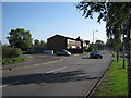
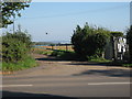

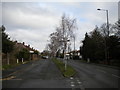
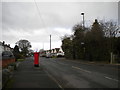
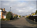
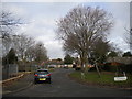


15 photos from this area
Area Information
Key information about the B75 6AN including its size, population, and administrative classification.
- Area Type
- Postcode
- Area Size
- 1.1 hectares
- Population
- 1499
- Population Density
- 3700 people/km²
House Prices in B75 6AN
27
Properties
£262,684
Average Sold Price
£108,000
Lowest Price
£383,000
Highest Price
Showing 27 properties
| Address | Type | Beds | Baths | Last Sale Price | Last Sale Date | |
|---|---|---|---|---|---|---|
| 27 Vincent Road, Sutton Coldfield, B75 6AN | Bungalow | - | - | £289,950 | Apr 2025 | |
| 23 Vincent Road, Sutton Coldfield, B75 6AN | Semi-detached | 2 | 1 | £300,000 | Dec 2024 | |
| 39 Vincent Road, Sutton Coldfield, B75 6AN | house | - | - | £340,000 | Aug 2023 | |
| 36 Vincent Road, Sutton Coldfield, B75 6AN | Semi-detached | 3 | 1 | £300,000 | Mar 2023 | |
| 28 Vincent Road, Sutton Coldfield, B75 6AN | house | 3 | 1 | £383,000 | Nov 2022 | |
| 25 Vincent Road, Sutton Coldfield, B75 6AN | Bungalow | - | - | £315,000 | Mar 2022 | |
| 16 Vincent Road, Sutton Coldfield, B75 6AN | house | - | - | £355,000 | Mar 2021 | |
| 29 Vincent Road, Sutton Coldfield, B75 6AN | Semi-detached | 2 | 1 | £273,000 | Nov 2019 | |
| 14 Vincent Road, Sutton Coldfield, B75 6AN | Semi-detached | 3 | 1 | £180,000 | Jun 2019 | |
| 41 Vincent Road, Sutton Coldfield, B75 6AN | Semi-detached | 3 | - | £250,000 | Dec 2014 |
Page 1 of 3
Energy Efficiency in B75 6AN
Amenities
Schools
| Rank | School | Type | Entry gender | Ages |
|---|
Explore more schools in this area
Go to Schools tabDemographics
Household Size
Family (3-5 people)
most common
Accommodation Type
Houses
most common
Tenure
94
majority
Ethnic Group
White
most common
Religion
N/A
most common
Household Composition
N/A
most common
Age
47
median
Adults (30-64 years)
most common
Household Deprivation
N/A
with no deprivation
NS-SEC
50
in Lower managerial occupations
Explore more demographic insights in this area
Go to Demographics tabPlanning
Planning Constraints
- Flood RiskPremium
- Ramsar Wetland SitesPremium
- Area of Outstanding Natural BeautyPremium
- Protected Nature ReservePremium
- Protected WoodlandPremium