Area Overview for B75 5NB
Photos of B75 5NB
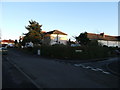
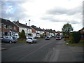
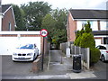
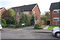
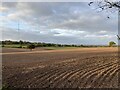
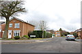
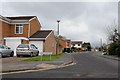
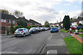
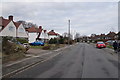
9 photos from this area
Area Information
Key information about the B75 5NB including its size, population, and administrative classification.
- Area Type
- Postcode
- Area Size
- 1.8 hectares
- Population
- 1702
- Population Density
- 5634 people/km²
House Prices in B75 5NB
34
Properties
£278,639
Average Sold Price
£116,500
Lowest Price
£450,000
Highest Price
Showing 34 properties
| Address | Type | Beds | Baths | Last Sale Price | Last Sale Date | |
|---|---|---|---|---|---|---|
| 49 Worcester Lane, Sutton Coldfield, B75 5NB | Semi-detached | 3 | 1 | £435,000 | Jun 2023 | |
| 70 Worcester Lane, Sutton Coldfield, B75 5NB | Retail | 4 | 2 | £407,300 | Oct 2022 | |
| 57 Worcester Lane, Sutton Coldfield, B75 5NB | Semi-detached | 3 | 2 | £450,000 | Oct 2022 | |
| 76 Worcester Lane, Sutton Coldfield, B75 5NB | house | - | - | £435,000 | Dec 2021 | |
| 64 Worcester Lane, Sutton Coldfield, B75 5NB | house | - | - | £380,000 | Apr 2021 | |
| 74 Worcester Lane, Sutton Coldfield, B75 5NB | Semi-detached | 3 | - | £325,000 | May 2019 | |
| 78 Worcester Lane, Sutton Coldfield, B75 5NB | house | - | - | £305,000 | Jul 2017 | |
| 63 Worcester Lane, Sutton Coldfield, B75 5NB | house | - | - | £370,000 | Jul 2016 | |
| 41 Worcester Lane, Sutton Coldfield, B75 5NB | house | - | - | £310,000 | Mar 2016 | |
| 43 Worcester Lane, Sutton Coldfield, B75 5NB | Semi-detached | 3 | 1 | £360,361 | Mar 2016 |
Page 1 of 4
Energy Efficiency in B75 5NB
Amenities
Schools
| Rank | School | Type | Entry gender | Ages |
|---|
Explore more schools in this area
Go to Schools tabDemographics
Household Size
Family (3-5 people)
most common
Accommodation Type
Houses
most common
Tenure
85
majority
Ethnic Group
White
most common
Religion
N/A
most common
Household Composition
N/A
most common
Age
47
median
Adults (30-64 years)
most common
Household Deprivation
N/A
with no deprivation
NS-SEC
46
in Lower managerial occupations
Explore more demographic insights in this area
Go to Demographics tabPlanning
Planning Constraints
- Flood RiskPremium
- Ramsar Wetland SitesPremium
- Area of Outstanding Natural BeautyPremium
- Protected Nature ReservePremium
- Protected WoodlandPremium