Area Overview for B75 5JW
Photos of B75 5JW


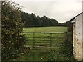

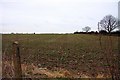
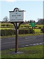
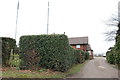
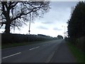

13 photos from this area
Area Information
Key information about the B75 5JW including its size, population, and administrative classification.
- Area Type
- Postcode
- Area Size
- 1.4 hectares
- Population
- 1586
- Population Density
- 1503 people/km²
House Prices in B75 5JW
13
Properties
£470,000
Average Sold Price
£240,000
Lowest Price
£725,000
Highest Price
Showing 13 properties
| Address | Type | Beds | Baths | Last Sale Price | Last Sale Date | |
|---|---|---|---|---|---|---|
| 225 Hill Village Road, Sutton Coldfield, B75 5JW | Detached | 4 | 5 | £725,000 | Dec 2024 | |
| 215 Hill Village Road, Sutton Coldfield, B75 5JW | house | 4 | 1 | £630,000 | Nov 2024 | |
| 219 Hill Village Road, Sutton Coldfield, B75 5JW | Bungalow | 4 | 2 | £595,000 | May 2024 | |
| 213 Hill Village Road, Sutton Coldfield, B75 5JW | Detached | 4 | 4 | £500,000 | Apr 2023 | |
| 217 Hill Village Road, Sutton Coldfield, B75 5JW | Detached | - | - | £300,000 | Apr 2018 | |
| 231 Hill Village Road, Sutton Coldfield, B75 5JW | Bungalow | 3 | - | £345,000 | Feb 2015 | |
| 229 Hill Village Road, Sutton Coldfield, B75 5JW | Bungalow | - | - | £425,000 | Nov 2008 | |
| 221 Hill Village Road, Sutton Coldfield, B75 5JW | Detached | 5 | 5 | £240,000 | May 2005 | |
| 213A Hill Village Road, Sutton Coldfield, B75 5JW | Detached | 4 | 4 | - | - | |
| 215A Hill Village Road, Sutton Coldfield, B75 5JW | Detached | 5 | 2 | - | - |
Page 1 of 2
Energy Efficiency in B75 5JW
Amenities
Schools
| Rank | School | Type | Entry gender | Ages |
|---|
Explore more schools in this area
Go to Schools tabDemographics
Household Size
Two person
most common
Accommodation Type
Houses
most common
Tenure
69
majority
Ethnic Group
White
most common
Religion
N/A
most common
Household Composition
N/A
most common
Age
47
median
Adults (30-64 years)
most common
Household Deprivation
N/A
with no deprivation
NS-SEC
39
in Lower managerial occupations
Explore more demographic insights in this area
Go to Demographics tabPlanning
Planning Constraints
- Flood RiskPremium
- Ramsar Wetland SitesPremium
- Area of Outstanding Natural BeautyPremium
- Protected Nature ReservePremium
- Protected WoodlandPremium